- Usage in publication:
-
- Mount Blue Member
- Modifications:
-
- Named
- Dominant lithology:
-
- Siltstone
- Shale
- AAPG geologic province:
-
- New England province
Summary:
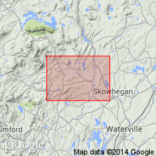
Mount Blue Member, lowest of three members of Seboomook Formation, here named in west-central Maine. Replaces Saddleback Mountain Formation of Warner and Pankiwskyj (1965). Described as rhythmically bedded, rusty-weathering, light gray metasiltstone and gray metapelite, mineralogically similar to Carrabassett Formation. 450 to 500 m thick in map area. Overlies Hildreths Formation; gradationally underlies Temple Stream Member. Age is Early Devonian.
Source: GNU records (USGS DDS-6; Reston GNULEX).

- Usage in publication:
-
- Mount Blue Formation
- Modifications:
-
- Revised
- AAPG geologic province:
-
- New England province
Summary:
Mount Blue Formation is here raised in rank and assigned to Seboomook Group, also raised in rank. Rocks at Boucot's (1961) type section of the Seboomook are designated Northeast Carry Formation, uppermost unit of the Seboomook. Also included in the Seboomook Group are Carrabassett and Hildreths Formations, Ironbound Mountain Formation (of Marvinney, in prep), and Day Mountain and Temple Stream Formations, also raised in rank.
Source: GNU records (USGS DDS-6; Reston GNULEX).

- Usage in publication:
-
- Mount Blue Formation*
- Modifications:
-
- Revised
- Overview
- AAPG geologic province:
-
- New England province
Summary:
Rank raised to formation of the Seboomook Group following usage of Pollock (1987). Occurs in central Maine trough in western ME and consists of cyclically interbedded pelitic schist and graded metasiltstone and metasandstone. Similar to Day Mountain and Carrabassett Formations, also of Seboomook Group, but contains smaller proportion of arenaceous rocks than Day Mountain and a larger proportion than Carrabassett. In areas of migmatitic gneiss, lower part may contain abundant remnants of underlying Hildreths Formation of Seboomook Group. Age is Early Devonian.
Source: GNU records (USGS DDS-6; Reston GNULEX).
For more information, please contact Nancy Stamm, Geologic Names Committee Secretary.
Asterisk (*) indicates published by U.S. Geological Survey authors.
"No current usage" (†) implies that a name has been abandoned or has fallen into disuse. Former usage and, if known, replacement name given in parentheses ( ).
Slash (/) indicates name conflicts with nomenclatural guidelines (CSN, 1933; ACSN, 1961, 1970; NACSN, 1983, 2005, 2021). May be explained within brackets ([ ]).

