

- Usage in publication:
-
- Mossy Creek Sand
- Modifications:
-
- Named
- Dominant lithology:
-
- Sand
- AAPG geologic province:
-
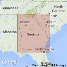
- South Georgia sedimentary province
Summary:
Name Mossy Creek Sand of Fort Valley Group (new) is proposed here for a dominantly sand formation with minor thin beds or lenses of clay (smectite or kaolin) of coastal marine/lagoon origin. The Fort Valley includes sandy, kaolinitic units of marine origin in the Fort Valley plateau region, while the Oconee Group includes lithologically similar deposits of fluvial origin in this region. In addition to the type section, three reference sections are designated. The lower boundary stratotype is designated as the roadcut, 0.8 mi northwest of the type locality, on the eastern valley wall of Mossy Creek, approximately 0.2 mi east of the county hwy bridge over the Creek, and approximately 0.7 mi west-southwest of the intersection with Taylors Mill Road. Here the Mossy Creek disconformably overlies the Marshallville Formation. A second reference section is designated as the sand pit 0.6 mi south of the Mossy Creek type locality, located on the southern valley wall of Mossy Creek, on the east side of Taylors Mill Road in Peach Co. A third section is designated as the roadcut along a paved county road 1.3 mi north of the center of Byron, Peach Co., GA. This section represents the cross-bedded, channeled, coarse, bioturbated and burrowed lithofacies. Thickness at the type locality is only 15 ft (4.6 m), but a maximum of 83 ft (25 m) is reached at the lower boundary stratotype. The Mossy Creek underlies high river terrace deposits. Unit occurs in only one area east of the Ocmulgee River, in Huber Pit 36, Twiggs Co., where it disconformably overlies the Huber Formation. Occurs west of the Flint River only near Butler in Taylor Co., GA. Grades laterally eastward into the Jeffersonville member of the Huber and grades laterally seaward into the Perry Sand. A late middle Eocene (Claibornian, Bartonian) age for the Mossy Creek is based on its equivalence with the Perry Sand and the Lisbon Formation.
Source: GNU records (USGS DDS-6; Reston GNULEX).
- Usage in publication:
-
- Mossy Creek Sand
- Modifications:
-
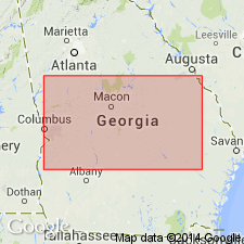
- Areal extent
- Overview
- AAPG geologic province:
-
- South Georgia sedimentary province
Summary:
Mossy Creek Sand of west-central GA is lithologically more variable than the downdip Perry Sand. Resembles the Perry in its finer grained lithofacies, but is coarser grained, is less well sorted, and the bedding is larger in scale and more crude. Where coarsest, the Mossy Creek occurs as coarse-grained, poorly sorted, bioturbated tidal channel deposits with large-scale cross-bedding and common clay rip-up clasts. This coarser facies resembles the Tobacco Road Sand. Areal extent is broader than the Perry Sand and it is described as a blanket sand. Grades laterally eastward across the Ocmulgee River into the informal Jeffersonville member of the Huber Formation. An upper sand overlying the Cretaceous kaolin at the Bell kaolin pit in western Aiken Co., SC, is indistinguishable from the finer grained lithofacies of the Mossy Creek, but there appears to be little or no Mossy Creek-type sands in eastern GA.
Source: GNU records (USGS DDS-6; Reston GNULEX).
For more information, please contact Nancy Stamm, Geologic Names Committee Secretary.
Asterisk (*) indicates published by U.S. Geological Survey authors.
"No current usage" (†) implies that a name has been abandoned or has fallen into disuse. Former usage and, if known, replacement name given in parentheses ( ).
Slash (/) indicates name conflicts with nomenclatural guidelines (CSN, 1933; ACSN, 1961, 1970; NACSN, 1983, 2005, 2021). May be explained within brackets ([ ]).