


- Usage in publication:
-
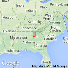
- Mosheim limestone*
- Modifications:
-
- Named
- Dominant lithology:
-
- Limestone
- AAPG geologic province:
-
- Appalachian basin
Summary:
Named the Mosheim limestone for Mosheim Station, Greene Co., eastern TN. Consists of fine-grained limestone that overlies the Knox dolomite or Jonesboro limestone and underlies the Lenoir limestone in the Knoxville and Athens troughs and unconformably underlies the Holston limestone in the Pearisburg trough. Unit is considered part of Stones River Group and is of Early Ordovician age.
Source: GNU records (USGS DDS-6; Reston GNULEX).
- Usage in publication:
-
- Mosheim limestone
- Modifications:
-
- Areal extent
- AAPG geologic province:
-
- Appalachian basin
Summary:
Geographically extended the Mosheim limestone of the Stones River group into northwestern GA. Thickness varies from a few feet to 100 feet. Unit is not extensively exposed. Overlies the Murfreesboro limestone and underlies the Lenoir limestone.
Source: GNU records (USGS DDS-6; Reston GNULEX).
- Usage in publication:
-
- Mosheim member
- Modifications:
-
- Revised
- AAPG geologic province:
-
- Appalachian basin
Summary:
The Mosheim is revised to a member of the Lenoir limestone and locally replaces the lower part of the formation. The Lenoir overlies the Knox group and underlies the Holston formation. The Lenoir limestone and Athens shale grade into each other in vague belt near Monroe-McMinn Co. line.
Source: GNU records (USGS DDS-6; Reston GNULEX).
- Usage in publication:
-
- Mosheim
- Modifications:
-
- Overview
- AAPG geologic province:
-
- Appalachian basin
Summary:
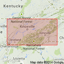
The Mosheim limestone is considered a facies rather than a formation and has been widely misidentified. Name should be used only for calcilutites associated with restricted Lenoir formation in southwestern belts and their equivalents. At type section, formation overlies the Knox dolomite but underlies the Lenoir lithology. Northeast of Friendsville, TN, typical Mosheim appears between beds with typical Lenoir lithology. In town of Friendsville the Mosheim is underlain by calcarenites with abundant typical Lenoir species. Thus, the Mosheim is a part of the Lenoir, but is discontinuous and appears at different levels in the Lenoir.
Source: GNU records (USGS DDS-6; Reston GNULEX).
- Usage in publication:
-
- Mosheim Member
- Modifications:
-
- Overview
- AAPG geologic province:
-
- Appalachian basin
Summary:
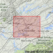
The Mosheim Member of the Lenoir Formation in eastern TN is a relatively pure aphanitic, thick-bedded, gray limestone that generally occurs near the base of the formation. In places, the Mosheim grades into coarser grained rock which in a few places is coarse enough to be "marble." In other places the Mosheim grades or interfingers into the main body of the Lenoir with an increase in terrigenous clays and silts. Typically, the Mosheim contains an abundance of calcite-filled openings called birdseyes; although some are small calcite-filled fossils, many structures are fillings of voids formed from gas bubbles generated by decomposition of organic matter and have been interpreted by some to be indicative of supratidal deposition. The Mosheim Member ranges up to 60 feet in thickness in Knox Co., but is 150 feet thick in the Forks of the River. The Mosheim Member of the Lenoir overlies the Mascot Dolomite and underlies the remainder of the Lenoir Limestone.
Source: GNU records (USGS DDS-6; Reston GNULEX).
- Usage in publication:
-
- Mosheim Member*
- Modifications:
-
- Overview
- AAPG geologic province:
-
- Appalachian basin
Summary:
Mosheim Member of Lenoir Limestone unconformably overlies newly named Cottingham Creek Member of Lenoir at Pratt Ferry, AL. Contact between the two members is sharp and irregular and may represent an erosional surface. The magnitude of the hiatus, however, is less than a single conodont zone. Age of the Lenoir is middle to late Whiterockian.
Source: GNU records (USGS DDS-6; Reston GNULEX).
For more information, please contact Nancy Stamm, Geologic Names Committee Secretary.
Asterisk (*) indicates published by U.S. Geological Survey authors.
"No current usage" (†) implies that a name has been abandoned or has fallen into disuse. Former usage and, if known, replacement name given in parentheses ( ).
Slash (/) indicates name conflicts with nomenclatural guidelines (CSN, 1933; ACSN, 1961, 1970; NACSN, 1983, 2005, 2021). May be explained within brackets ([ ]).