The National Geologic Map Database is migrating to a new infrastructure. We apologize for any service disruptions during this process.
|
|---|


- Usage in publication:
-
- Moose Formation*
- Modifications:
-
- Named
- Dominant lithology:
-
- Argillite
- Siltite
- AAPG geologic province:
-
- Northern Rocky Mountain region
Summary:
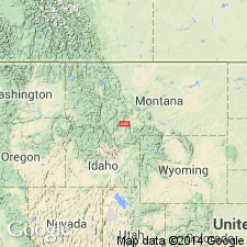
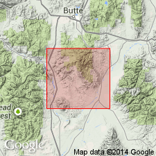
Named as formation in lower Belt of Belt Supergroup. Type locality designated along north side of Moose Creek, for which unit is named, in Highland Mountains, Silver Bow Co, MT, Northern Rocky Mountain region. Rocks previously assigned to Prichard Formation or Chamberlain Shale by earlier workers. Nearest outcrops of definite Prichard are 150 km west-northwest of Highland Mountains. Chamberlain is lithologically distinct and restricted to Little Belt Mountains, 150 km northeast of Highland Mountains. Units of lower Belt and Greyson Shale of Ravalli Group of Belt are laterally gradational and were deposited simultaneously. At type, lower 9 m is even to wavy, parallel-laminated, argillaceous siltite with 1-cm-thick silty channels locally filled by cross-bedded quartzite; upper 39 m is mainly even- to wavy-bedded, medium-gray, platy, argillaceous siltite and dark-gray silty argillite enclosing very fine grained, thin quartzite lenses. Thickens eastward from type across Soap Gulch fault block; at Camp Creek, 11 km from type, Moose is 85 m thick; thin sliver recognized to east in Table Mountain fault block where Moose and part of Newland Formation of lower Belt interval is occupied by newly named Table Mountain Quartzite. Schematic cross section (fig. 2); correlation diagram (fig. 3). At type, overlies LaHood Formation of lower Belt with contact by small fault; gradationally underlies Newland. Middle Proterozoic age.
Source: GNU records (USGS DDS-6; Denver GNULEX).
- Usage in publication:
-
- Moose Formation*
- Modifications:
-
- Mapped 1:50k
- Dominant lithology:
-
- Argillite
- Siltite
- Quartzite
- AAPG geologic province:
-
- Northern Rocky Mountain region
Summary:
Mapped in west-central to western part of study area in central and southern Highland Mountains, southwestern MT, Northern Rocky Mountain region. Is within lower part of Belt Supergroup. Consists of medium-gray to tan argillite, siltite, and minor quartzite that lacks both tabular, blocky beds of overlying Newland Formation of Belt and argillaceous quartzite grit of underlying LaHood Formation of Belt. In western part of study area, interfingers with Newland and LaHood. Also correlates in part with Table Mountain Quartzite and Greyson Formation of Belt. Thickness ranges from 40 m on west to near 80 m at Camp Creek. Middle Proterozoic age.
Source: GNU records (USGS DDS-6; Denver GNULEX).
For more information, please contact Nancy Stamm, Geologic Names Committee Secretary.
Asterisk (*) indicates published by U.S. Geological Survey authors.
"No current usage" (†) implies that a name has been abandoned or has fallen into disuse. Former usage and, if known, replacement name given in parentheses ( ).
Slash (/) indicates name conflicts with nomenclatural guidelines (CSN, 1933; ACSN, 1961, 1970; NACSN, 1983, 2005, 2021). May be explained within brackets ([ ]).