

- Usage in publication:
-
- Moody's Branch
- Modifications:
-
- Overview
- AAPG geologic province:
-
- Mid-Gulf Coast basin
Summary:
Pg. 435. [Moody's Branch used in Mississippi column of table in parentheses after Jackson and opposite Jacksonian. No definition.]
Source: US geologic names lexicon (USGS Bull. 896, p. 1415).
- Usage in publication:
-
- Moody's Branch Beds (substage)
- Modifications:
-
- Revised
- AAPG geologic province:
-
- Mid-Gulf Coast basin
Summary:
Pg. 303-304. [Moody's Branch Beds (substage) used in table for upper part of Jackson stage, Mark's Mills Red Beds (substage) being used to cover lower part of Jackson stage.]
Source: US geologic names lexicon (USGS Bull. 896, p. 1415).
- Usage in publication:
-
- Moodys Branch green marls
- Modifications:
-
- Revised
- AAPG geologic province:
-
- Mid-Gulf Coast basin
Summary:
Described Moodys Branch green marls as a formation of Jackson group and as overlying Yazoo clay marl. [Age is late Eocene.]
Source: US geologic names lexicon (USGS Bull. 896, p. 1415).
- Usage in publication:
-
- Moodys calcareous marl member*
- Modifications:
-
- Areal extent
- Dominant lithology:
-
- Marl
- Limestone
- AAPG geologic province:
-
- Mid-Gulf Coast basin
Summary:
Pg. 186-198. Moodys calcareous marl member. Basal member of Jackson formation. [Name shortened.] Thickness 35 or 40 feet in central and western Mississippi; 90 feet in western Alabama, a few miles across Mississippi line. At base is bed of shells enclosed in quartz, sand, and glauconite. Toward top becomes less sandy and much more calcareous and in many places contains thin strata of indurated marl or impure limestone. In eastern Mississippi and western Alabama a deposit of fine incoherent yellow sand intervenes between the indurated ledges at top and the more argillaceous marl below. Although the individual indurated ledges are discontinuous, the zone in which they occur is quite persistent and has been traced from western Alabama across Mississippi to Yazoo River. In Alabama it constitutes the principal horizon at which ZEUGLODON occurs, and has therefore been called "ZEUGLODON bed." The Moodys member rests conformably on Yegua formation [=Gosport sand of Alabama] and is overlain by Yazoo clay member of the Jackson. [Later reports give thicknesses up to 220 feet.] [Age is late Eocene.]
Source: US geologic names lexicon (USGS Bull. 896, p. 1415).

- Usage in publication:
-
- Moodys marl member
- Modifications:
-
- Overview
- AAPG geologic province:
-
- Mid-Gulf Coast basin
Summary:
Moodys marl member of Jackson formation. Later work [post-1918] led Cooke to transfer the ZEUGLODON-bearing bed to Yazoo clay member. (See AAPG Bull., v. 17, no. 11, 1933, p. 1387-1388.) He also applied Cocoa sand member to sandy beds in Alabama that represent lower part of Yazoo clay of Mississippi and overlie Moodys marl member. These are present approved definitions of Moodys marl member, Yazoo clay member, and Cocoa sand member. The USGS does not now use calcareous in connection with marl. Age is late Eocene. Recognized in Mississippi and southwestern Alabama.
Named from exposures along Moodys Branch of Pearl River, in city of Jackson, MS.
Source: US geologic names lexicon (USGS Bull. 896, p. 1415).
- Usage in publication:
-
- Moody's Branch marl
- Modifications:
-
- Areal extent
- AAPG geologic province:
-
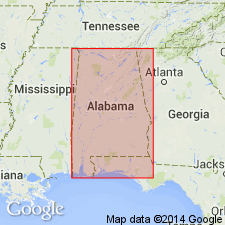
- Arkla basin
Summary:
Pg. 94-98. Moodys Branch marl of Jackson group. Extended into Grant and La Salle Parishes, Louisiana, where it is most fossiliferous unit zone in state. Consists of glauconitic sands transitional with [underlying] lignitic silty clays of Cockfield formation and with overlying Yazoo clays. [Age is late Eocene.]
Section at Montgomery Landing, in SE/4 sec. 25, T. 8 N., R. 5 W., Grant Parish, LA, measured and described; subsurface section described.
Source: US geologic names lexicon (USGS Bull. 1200, p. 2577-2578); supplemental information from GNU records (USGS DDS-6; Denver GNULEX).
- Usage in publication:
-
- Moodys marl
- Modifications:
-
- Revised
- AAPG geologic province:
-
- Mid-Gulf Coast basin
Summary:
Pg. 337-339. Gosport sand of Alabama, heretofore classified as topmost formation of Claiborne group (Eocene), and the only known formation of "upper Claiborne" age, proves to be nearly equivalent to Moodys marl of Jackson group. It is recommended that name Gosport be replaced by Moodys and that Claiborne group be restricted to formations heretofore classified as lower Claiborne. [Age is late Eocene.]
Source: US geologic names lexicon (USGS Bull. 1200, p. 2577-2578).
- Usage in publication:
-
- Moodys Branch member
- Modifications:
-
- Areal extent
- AAPG geologic province:
-
- Mid-Gulf Coast basin
Summary:
Pg. 12 (table), 16-18, 19 (fig. 4). Moodys Branch, basal member of Jackson formation. Underlies Yazoo member; overlies Yegua silt (Lisbon). Thickness 30 to 45 feet. [Age is late Eocene.]
Source: US geologic names lexicon (USGS Bull. 1200, p. 2577-2578).

- Usage in publication:
-
- [Moodys Branch marl]
- Modifications:
-
- Areal extent
- AAPG geologic province:
-
- Mid-Gulf Coast basin
Summary:
Pg. 56-59. [Moodys Branch marl] is calcareous fossiliferous green sand ranging in thickness from about 10 to 50 feet. Author of this report is convinced that at least uper part and perhaps all of so-called "Gosport" of Hatchetigbee anticline [Washington Co., western Alabama] is Moodys Branch. Political boundary separating Mississippi and Alabama was apparently given weight in not only changing name of Moodys Branch, but also the age. There is possibility that Jackson-Claiborne contact is located in approximate middle of "Gosport" of Hatchetigbee anticline. Jackson group includes Moodys Branch at base and Yazoo clay at top. [Age is late Eocene.]
Source: US geologic names lexicon (USGS Bull. 1200, p. 2577-2578).
- Usage in publication:
-
- Moodys Branch formation
- Modifications:
-
- Mapped
- AAPG geologic province:
-
- Mid-Gulf Coast basin
Summary:
Jackson group, as mapped, includes Moodys Branch formation at base and Yazoo clay above. [Age is late Eocene.]
Source: US geologic names lexicon (USGS Bull. 1200, p. 2577-2578).
- Usage in publication:
-
- Moodys Branch formation
- Modifications:
-
- Areal extent
- AAPG geologic province:
-
- Mid-Gulf Coast basin
Summary:
Pg. 33-42. Term Moodys Branch formation replaces term Moodys marl. Although not rigidly defined, name Moodys marl apparently was used in this area [southeastern Alabama] for "SCUTELLA bed" and beds here referred to Gosport sand.
Gosport sand and Claiborne-Jackson contact discussed. Writer has determined equivalence of lower part of Gosport, as originally defined, with uppermost part of Cockfield formation (Yegua), and upper part of Gosport with lower part of Moodys Branch, to his own satisfaction but acknowledges that there are others who would place base of Moodys Branch at both higher and lower levels. Main problem is not whether lower part of Gosport is equivalent to Moodys Branch, but whether or not lower part of Gosport, and at least upper part of Cockfield, are Jackson rather than Claiborne. Practice of USGS in classifying Gosport as Jackson was based on supposed equivalence of Gosport and Moodys Branch. [Age is late Eocene.]
Source: US geologic names lexicon (USGS Bull. 1200, p. 2577-2578).
- Usage in publication:
-
- Moodys Branch formation
- Modifications:
-
- Areal extent
- AAPG geologic province:
-
- Mid-Gulf Coast basin
Summary:
Correlation chart shows Moodys Branch formation comprises lower sand member and upper limestone member; lower sand member interfingers with "SCUTELLA bed" which extends into Georgia. Formation underlies Yazoo clay and overlies Cockfield formation in Mississippi; hence, in Alabama and Georgia, underlies Ocala limestone. [Age is late Eocene.]
Source: US geologic names lexicon (USGS Bull. 1200, p. 2577-2578).
- Usage in publication:
-
- Moodys Branch formation
- Modifications:
-
- Areal extent
- AAPG geologic province:
-
- Mid-Gulf Coast basin
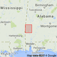
Summary:
Pg. 120-121. Moodys Branch formation described in Choctaw County, Alabama, where it maintains thickness of 10 to 18 feet. Basal formation in Jackson group; underlies Yazoo clay; overlies Gosport sand. [Age is late Eocene.]
Source: US geologic names lexicon (USGS Bull. 1200, p. 2577-2578).
- Usage in publication:
-
- Moodys Branch formation
- Modifications:
-
- Revised
- AAPG geologic province:
-
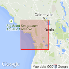
- Florida platform
Summary:
Pg. 112 (table 9), 115-156. Moodys Branch formation in Florida is cream to white fragmental marine highly fossiliferous limestone composed of camerinid-rich limestone member, Williston (new) at top and echinoid-rich limestone member, Inglis (new), at base. It is approximately basal 80 feet of Ocala limestone of Cooke (1945). Underlies Ocala limestone (restricted); disconformably overlies Avon Park limestone. [Age is late Eocene.]
Source: US geologic names lexicon (USGS Bull. 1200, p. 2577-2578).

- Usage in publication:
-
- [Moodys Branch formation]
- Modifications:
-
- Revised
- AAPG geologic province:
-
- Mid-Gulf Coast basin
Summary:
Pg. 41. In Alabama, [Moodys Branch formation] includes Dellett sand member (new). [Age is late Eocene.]
Source: US geologic names lexicon (USGS Bull. 1200, p. 2577-2578).
- Usage in publication:
-
- Moodys Branch formation
- Modifications:
-
- Revised
- Areal extent
- AAPG geologic province:
-
- Florida platform
Summary:
Pg. 29-30. Williston and Inglis, originally defined as members of Moodys Branch, are herein raised to formational rank. [This apparently abandons use of Moodys Branch formation in Florida.]
Source: US geologic names lexicon (USGS Bull. 1200, p. 2577-2578).
- Usage in publication:
-
- Moodys Branch formation
- Modifications:
-
- Principal reference
- AAPG geologic province:
-
- Mid-Gulf Coast basin
Andersen, H.V., 1960, Type localities project Unit 1: Society of Economic Paleontologists and Mineralogists, Gulf Coast Section, Baton Rouge, LA
Summary:
Note on type locality. Reference section designated. Thickness 16 feet at reference section.
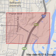
Type locality: at intersection of Peachtree Street and Poplar Blvd. in city of Jackson, Hinds Co., MS.
Reference section: in Riverside Park, in city of Jackson, MS.
Source: US geologic names lexicon (USGS Bull. 896, p. 1415).

- Usage in publication:
-
- Moodys Branch Formation
- Modifications:
-
- Overview
- AAPG geologic province:
-
- Mid-Gulf Coast basin
Summary:
Pg. 61-62. Moodys Branch Formation of Jackson Group. Greenish-gray to pale-yellowish-orange glauconitic, calcareous, fossiliferous sand and sandy marl. The upper part is generally less glauconitic and more calcareous than the lower part. Contains the guide fossil PERIARCHUS LYELLI (Conrad). Present in south Alabama. Thickness ranges from 10 to 48 feet. Age is late Eocene, Jackson (early Priabonian).
See also Toulmin, L.D., 1977, Alabama Geol. Survey Mon., no. 13, v. 1.
Source: Publication.

- Usage in publication:
-
- Moodys Branch Formation
- Modifications:
-
- Areal extent
- Dominant lithology:
-
- Sand
- Marl
- AAPG geologic province:
-
- Mid-Gulf Coast basin
Summary:
The upper Eocene Jackson Group in the study area consists of the basal Moodys Branch Formation, the Yazoo Clay, and the Crystal River Formation. The Moodys Branch Formation disconformably overlies strata of the middle Eocene Claiborne Group. At the reference locality at Riverside Park, Moodys Branch is 17 ft thick and can be divided into a lower greenish-gray glauconitic, fossiliferous calcareous, argillaceous, fine-grained sand (13 feet) and an upper light-bluish-gray glauconitic fossiliferous sandy marl (4 feet). In southwestern Alabama, unit generally consists of 10 to 20 feet of greenish-gray glauconitic, fossiliferous, calcareous sand and sandy marl. Unit has been assigned to the planktonic foraminiferal P14 zone by Barker (1979) and to the nannofossil NP17 zone by Siesser (1983).
Source: GNU records (USGS DDS-6; Reston GNULEX).

- Usage in publication:
-
- Moodys Branch Formation
- Modifications:
-
- Revised
- AAPG geologic province:
-
- Mid-Gulf Coast basin
Summary:
Various authors have placed the Gosport/Moodys Branch boundary at various places within the 25-foot greensand section exposed at Little Stave Creek, Jackson, Alabama. Toulmin (1962) divided the greensand into beds 41, 42, and 43 on the basis of faunal discontinuities and placed the boundary at the base of 42. Brady (1949) and Smith and others (1944) had placed the boundary at higher levels, Smith having included all of the greensands in the Gosport. In this report, bed 42 (approximately 3 feet thick) is included in the Gosport rather than the Moodys Branch. Bed 42 is concretionary as is underlying bed 41.
Source: GNU records (USGS DDS-6; Reston GNULEX).
For more information, please contact Nancy Stamm, Geologic Names Committee Secretary.
Asterisk (*) indicates published by U.S. Geological Survey authors.
"No current usage" (†) implies that a name has been abandoned or has fallen into disuse. Former usage and, if known, replacement name given in parentheses ( ).
Slash (/) indicates name conflicts with nomenclatural guidelines (CSN, 1933; ACSN, 1961, 1970; NACSN, 1983, 2005, 2021). May be explained within brackets ([ ]).