The National Geologic Map Database is migrating to a new infrastructure. We apologize for any service disruptions during this process.
|
|---|


- Usage in publication:
-
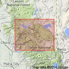
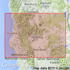
- Montgomery limestone
- Modifications:
-
- First used
- Dominant lithology:
-
- Limestone
- AAPG geologic province:
-
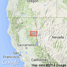
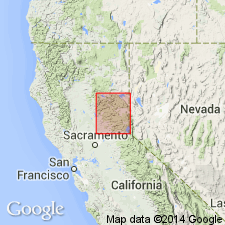
- Sierra Nevada province
Summary:
Shown in geologic column of Taylorville [Taylorsville] region as 10 to 60 ft thick and Silurian (Niagara) age. Underlies Taylorville slates and overlies Grizzly quartzite. Fossils collected along Montgomery Creek and crest of Grizzly Mountain were identified by Walcott (1891).
Source: GNU records (USGS DDS-6; Menlo GNULEX).
- Usage in publication:
-
- Montgomery limestone*
- Modifications:
-
- Named
- Biostratigraphic dating
- Dominant lithology:
-
- Limestone
- AAPG geologic province:
-
- Sierra Nevada province
Summary:
Named for occurrence on Montgomery Creek two and one-third mi south of Taylorsville, Plumas Co, CA. Consists of light to dark bluish-gray fossiliferous limestone with occasional knots or benches of black chert. Form of limestone is lenticular; largest lentil which is on crest of north end of Grizzly Mountain, has thickness of 60 ft and length of 200 ft. Five of these lentils have been found between Taylorsville and 40th Parallel. One is on south bank of Montgomery Creek where it forms prominent cliffs at altitude of about 4000 ft. Conformably overlies Grizzly formation. Believed to unconformably underlie Taylorsville formation. Fossil collections (identified by C.D. Walcott and E.O. Ulrich) indicate Silurian (Niagaran) age.
Source: GNU records (USGS DDS-6; Menlo GNULEX).
- Usage in publication:
-
- Montgomery Limestone*
- Modifications:
-
- Age modified
- Biostratigraphic dating
- AAPG geologic province:
-
- Sierra Nevada province
Summary:
Age of Montgomery Limestone is Early Silurian based on DALMANOPHYLLUM and GREWINGKIA-like streptelasmid corals. These are compared to corals of Horseshoe Gulch locality.
Source: GNU records (USGS DDS-6; Menlo GNULEX).
- Usage in publication:
-
- Montgomery Limestone†
- Modifications:
-
- Abandoned
- AAPG geologic province:
-
- Sierra Nevada province
Summary:
Unit abandoned as it is now recognized as consisting of separate blocks within the Sierra City melange (of Shoo Fly Complex). Its rocks are reassigned as unnamed limestone blocks in Sierra City melange.
Source: GNU records (USGS DDS-6; Menlo GNULEX).
For more information, please contact Nancy Stamm, Geologic Names Committee Secretary.
Asterisk (*) indicates published by U.S. Geological Survey authors.
"No current usage" (†) implies that a name has been abandoned or has fallen into disuse. Former usage and, if known, replacement name given in parentheses ( ).
Slash (/) indicates name conflicts with nomenclatural guidelines (CSN, 1933; ACSN, 1961, 1970; NACSN, 1983, 2005, 2021). May be explained within brackets ([ ]).