The National Geologic Map Database is migrating to a new infrastructure. We apologize for any service disruptions during this process.
|
|---|


- Usage in publication:
-
- Monserrate member*
- Modifications:
-
- Named
- AAPG geologic province:
-
- Caribbean region
Summary:
Augustinillo formation named in Jacaguas group. Consists of 17,000 ft of marine sediments. Includes the Collores member to the east and the Monserrate member to the west. Interfingers with the Naranjo formation, and may interfinger with the Rio Culebrinas formation to the west.
Source: GNU records (USGS DDS-6; Reston GNULEX).
- Usage in publication:
-
- Monserrate Formation*
- Modifications:
-
- Revised
- Biostratigraphic dating
- Dominant lithology:
-
- Mudstone
- Sandstone
- AAPG geologic province:
-
- Caribbean region
Summary:
The Monserrate Member of the Augustinillo Formation of Pessagno (1960) is here revised as the Monserrate Formation because of its wide areal extent in west-central PR in the Adjuntas and Jayuya quadrangles. Consists of laminated gray mudstone and tuffaceous sandstone. Conformably overlies the Rio Prieto Formation or unconformably overlies Cretaceous rocks; is interlayered with overlying Anon Formation. Age is probably middle Eocene based on fossils.
Source: GNU records (USGS DDS-6; Reston GNULEX).

- Usage in publication:
-
- Monserrate Formation*
- Modifications:
-
- Overview
- AAPG geologic province:
-
- Caribbean region
Summary:
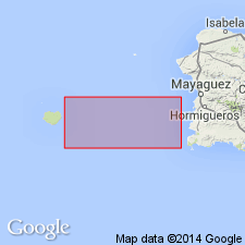
The Monserrate Formation occurs in southwestern Puerto Rico and consists of volcaniclastic siltstone and sandstone interbedded with tuff, subordinate conglomerate (clasts of augite andesite characteristic of the Lago Garzas Formation), calcarenite, and chert. Maximum thickness is 2000 meters. The Monserrate is of middle Eocene age.
Source: GNU records (USGS DDS-6; Reston GNULEX).
For more information, please contact Nancy Stamm, Geologic Names Committee Secretary.
Asterisk (*) indicates published by U.S. Geological Survey authors.
"No current usage" (†) implies that a name has been abandoned or has fallen into disuse. Former usage and, if known, replacement name given in parentheses ( ).
Slash (/) indicates name conflicts with nomenclatural guidelines (CSN, 1933; ACSN, 1961, 1970; NACSN, 1983, 2005, 2021). May be explained within brackets ([ ]).