- Usage in publication:
-
- Moencopie beds*
- Modifications:
-
- Original reference
- Dominant lithology:
-
- Shale
- Sandstone
- AAPG geologic province:
-
- Plateau sedimentary province
Summary:
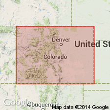
Pg. 401-418. Moencopie beds. Consist of (descending) 200 feet of dark chocolate-brown argillaceous and saliferous shale; 100 feet of soft dark-brown argillaceous sandstones; 200 feet of dark-brown argillaceous shale; 100 feet of white calcareous shale; and 100 feet of saliferous argillaceous shale. Rest unconformably on Upper Aubrey [Kaibab limestone] (Carboniferous) in Little Colorado Valley. Underlie Shinarump conglomerate.
Source: US geologic names lexicon (USGS Bull. 896, p. 1393-1394).
- Usage in publication:
-
- Moenkopi formation*
- Modifications:
-
- Revised
- AAPG geologic province:
-
- Great Basin province
Summary:
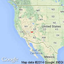
Pg. 90-92. Moenkopi formation. Includes Virgin limestone member and Shnabkaib shale member (both new).
Source: US geologic names lexicon (USGS Bull. 1200, p. 2542-2544).
- Usage in publication:
-
- Moenkopi formation*
- Modifications:
-
- Revised
Summary:
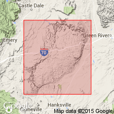
Pg. 797. Moenkopi formation. Includes Sinbad limestone member (new) in San Rafael Swell.
Source: US geologic names lexicon (USGS Bull. 1200, p. 2542-2544).

- Usage in publication:
-
- Moenkopi formation*
- Modifications:
-
- Overview
Summary:
Moenkopi formation. In some subsequent reports [post-Ward, 1901] Moenkopi formation was defined as underlying De Chelly sandstone. In other reports De Chelly sandstone was placed in lower part of Moenkopi. But true De Chelly sandstone is now known to be of Permian age, to be = uppermost part of Coconino sandstone, and to belong to Cutler formation. At De Chelly Canyon, Arizona, it is top member of Cutler formation (Permian), and is unconformably overlain by Moenkopi formation (Triassic). At Fort Defiance, Arizona, some red beds of the Cutler separate the light-colored De Chelly sandstone from the unconformably overlying Moenkopi, which is, in turn, unconformably overlain by Shinarump conglomerate. At places in Arizona (Grand Canyon, Lees Ferry, Red Canyon, Little Colorado River, etc.) and Utah (Circle Cliffs, San Rafael Swell, etc.) the Moenkopi rests on Kaibab limestone. (See A.A. Baker and J.B. Reeside, Jr., AAPG Bull., v. 13, no. 11, p. 1413-1448, 1929.) This is present approved definition of Moenkopi formation. Recognized in Arizona, southern Utah, and southeastern Nevada. Age is Early Triassic.
Named from Moenkopi Wash, Grand Canyon, AZ.
Source: US geologic names lexicon (USGS Bull. 896, p. 1393-1394).
- Usage in publication:
-
- Moenkopi formation*
- Modifications:
-
- Areal extent
Summary:
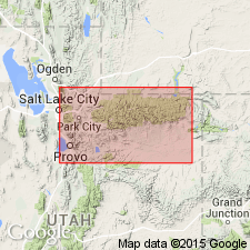
Pg. 477-478. As Woodside, Thaynes, and Akareh (restricted) formations are traced eastward along south flank of Uinta Mountains each becomes thinner and Thaynes limestone tongue disappears completely. It is clear from these relationships that red beds east of that point are in part equivalent to Ankareh (restricted) sandstone and shale, and in part to Woodside shale. Neither term alone can be appropriately applied to them. These beds are some times designated Moenkopi, but this name is not completely satisfactory because all of Moenkopi, at least in Zion area, is younger than Woodside shale. Since terms Woodside, Ankareh, or Moenkopi are not appropriate, these beds are herein named Red Wash formation.
Source: US geologic names lexicon (USGS Bull. 1200, p. 2542-2544).
- Usage in publication:
-
- Moenkopi formation*
- Modifications:
-
- Revised
Summary:
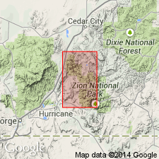
Pg. 224-226, pl. 1; [see also H.E. Gregory, USGS Prof. Paper 220, 1950]. Moenkopi formation. Described in Zion National Monument where it constitutes a regular north-south belt about 1 mile wide paralleling trend of Hurricane fault. Maximum thickness 1,452 feet. Six subdivisions recognized (ascending): Timpoweap member (new), lower red member, Virginia [Virgin] limestone member, middle red member, Shnabkaib member, and upper red member. Overlies Kaibab limestone and underlies Shinarump conglomerate. [Age is Triassic.]
Source: US geologic names lexicon (USGS Bull. 1200, p. 2542-2544).
- Usage in publication:
-
- Moenkopi formation
- Moenkopi group
- Modifications:
-
- Areal extent
Summary:
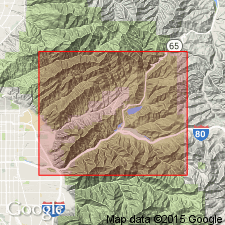
Pg. 1530. In central Wasatch Mountains, Utah, Thaynes formation thins and disappears to east and southeast where underlying Woodside and overlying Timothy join to constitute Moenkopi formation. Thus combined Woodside, Thaynes, and Timothy are recognized as constituting Moenkopi group. Age is Triassic.
Source: US geologic names lexicon (USGS Bull. 1200, p. 2542-2544).
- Usage in publication:
-
- Moenkopi formation*
- Modifications:
-
- Age modified
- Revised
- AAPG geologic province:
-
- Black Mesa basin
- Plateau sedimentary province
Summary:
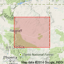
Pg. 85-88. Moenkopi formation. Three members recognized in Little Colorado River valley [Coconino and Navajo Counties, northeastern Arizona] (ascending): Wupatki (new), Winslow (new), and Holbrook. These do not correlate exactly with any of the six members of formation described by Gregory in southwestern Utah. [Age is considered Early and Middle(?) Triassic; Middle(?) Triassic age based on vertebrate fossil (Cyclotosaurus) which belongs to Middle Triassic in Europe and reptilian tracks which are similar to species from Middle Triassic in Old World.]
Source: US geologic names lexicon (USGS Bull. 1200, p. 2542-2544); supplemental information from GNU records (USGS DDS-6; Denver GNULEX).
- Usage in publication:
-
- Moenkopi formation*
- Modifications:
-
- Areal extent
- AAPG geologic province:
-
- Great Basin province
Summary:
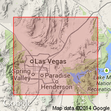
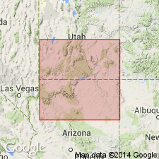
Pg. 34, 35. Moenkopi formation. In Muddy Mountains, Nevada, 1,500 to 2,000 feet thick; disconformably overlies Kaibab limestone and underlies Chinle formation with Shinarump member at base. In Frenchman Mountain area, underlies Thumb formation (new) with angular unconformity.
Source: US geologic names lexicon (USGS Bull. 1200, p. 2542-2544).
- Usage in publication:
-
- Moenkopi formation*
- Modifications:
-
- Revised
- Biostratigraphic dating
- AAPG geologic province:
-
- Plateau sedimentary province
Summary:
Moenkopi formation of Triassic age. Composed of series of deposits that form wedge thinning eastward from a maximum of about 2,000 feet in western Colorado, northeastern Arizona, and western New Mexico. Partly marine and partly continental in western sections; entirely continental in east. Invertebrate faunas indicate deposition began either during or preceding middle Early Triassic and continued into late Early Triassic and probably into Middle Triassic Time. Vertebrate faunas indicate an Early Triassic and probably, in part, Middle Triassic age. Three major transgressions and three regressions across southern Utah and northern Arizona are indicated. In southwestern Utah, subdivided into (ascending) Timpoweap, lower red, Virgin limestone, middle red, Shnabkaib, and upper red members. Present classification in Little Colorado River valley is (ascending) Wupatki, Moqui (new), and Holbrook members.
Source: US geologic names lexicon (USGS Bull. 1200, p. 2542-2544).
- Usage in publication:
-
- Moenkopi formation
- Moenkopi group
- Modifications:
-
- Revised
- Biostratigraphic dating
Summary:
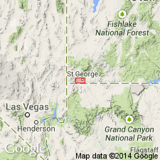
Pg. 972; see also GSA Bull., v. 63, no. 12, pt. 2, p. 1342, 1952 [abs.], and Plateau, v. 25, no. 4, p. 69, 1953. Virgin limestone member is herein given formational rank. Suggested that term Moenkopi group be used in St. George area for all lithologic units that have in past been known collectively as Moenkopi formation. Farther east, where Moenkopi is not readily divisible, name formation should be retained. [Age is Early and Middle(?) Triassic, based on fossils.]
Source: US geologic names lexicon (USGS Bull. 1200, p. 2542-2544).
- Usage in publication:
-
- Moenkopi formation*
- Modifications:
-
- Mapped
- AAPG geologic province:
-
- Mojave basin
Summary:
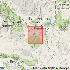
Pg. 47-48, pl. 1. Moenkopi formation described in Ivanpah quadrangle and mapped in San Bernardino County, California. Age is Early Triassic.
Source: US geologic names lexicon (USGS Bull. 1200, p. 2542-2544).
- Usage in publication:
-
- Moenkopi formation*
- Modifications:
-
- Areal extent
- AAPG geologic province:
-
- Paradox basin
Summary:
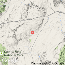
Pg. 2499-2506. Moenkopi formation. In San Rafael Swell, Utah, unconformably underlies Temple Mountain member (new) of Chinle. [Age is Triassic.]
Source: US geologic names lexicon (USGS Bull. 1200, p. 2542-2544).
- Usage in publication:
-
- Moenkopi formation*
- Modifications:
-
- Revised
- AAPG geologic province:
-
- San Juan basin
Summary:
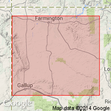
Pg. 86 (chart), 91, 92. Moenkopi formation. Stratigraphically extended to include Agua Zarca and Salitral members, units formerly included in Chinle. [Age is Triassic.]
Source: US geologic names lexicon (USGS Bull. 1200, p. 2542-2544).
- Usage in publication:
-
- Moenkopi formation
- Modifications:
-
- Areal extent
- AAPG geologic province:
-
- Black Mesa basin
Summary:
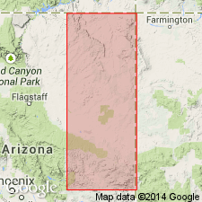
Pg. 7-15. Moenkopi formation. In Apache and Navajo Counties, [northeastern Arizona], Moenkopi unconformably underlies Mesa Redondo member (new) of Chinle ; Moenkopi incomplete in this area ; includes Holbrook member at top. [Age is Early and Middle(?) Triassic.]
Source: US geologic names lexicon (USGS Bull. 1200, p. 2542-2544).
- Usage in publication:
-
- Moenkopi formation*
- Modifications:
-
- Areal extent
Summary:
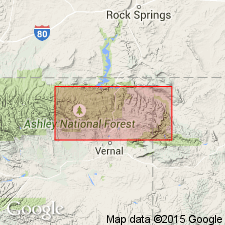
Pg. 101-108. Moenkopi formation. Discussion of stratigraphy of Triassic sequence in Wasatch and Uinta Mountains, [Utah]. Recommends use of name Moenkopi, Shinarump(?), and Chinle in eastern Uinta Mountains and considers revisions and introduction of new formational named by Williams (1945) and Thomas and Krueger (1946, AAPG Bull., v. 30, no. 8) to be neither necessary nor desirable.
Source: US geologic names lexicon (USGS Bull. 1200, p. 2542-2544).
- Usage in publication:
-
- Moenkopi formation*
- Modifications:
-
- Revised
- AAPG geologic province:
-
- Piceance basin
- Uinta basin
Summary:
Pg. 1835-1851. Moenkopi formation. In salt anticline region of Utah [Grand County] and Colorado [Mesa County], formation is subdivided into (ascending) Tenderfoot, Ali Baba, Sewemup, and Pariott members (all new). Underlies Chinle; overlies Cutler. Wherever Hoskinnini or Tenderfoot is present, age of Moenkopi is Triassic(?) and Early and Middle(?) Triassic.
Source: US geologic names lexicon (USGS Bull. 1200, p. 2542-2544).
- Usage in publication:
-
- Moenkopi formation
- Modifications:
-
- Revised
- AAPG geologic province:
-
- Black Mesa basin
- Paradox basin
Summary:
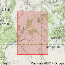
Pg. 1852-1868. Hoskinnini tongue of Cutler formation redefined as, member of Moenkopi; laterally continuous with Tenderfoot member. [Age is Early and Middle(?) Triassic.]
[Area of study between Moab, southeastern UT, and Kayenta, northeastern AZ.]
Source: US geologic names lexicon (USGS Bull. 1200, p. 2542-2544).
- Usage in publication:
-
- Moenkopi Formation*
- Modifications:
-
- Revised
- AAPG geologic province:
-
- Green River basin
- Uinta basin
Summary:
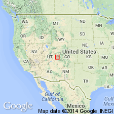
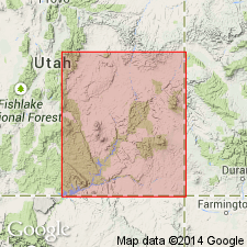
Triassic Moenkopi-Permian Park City contact modified on the south flank of the Uinta Mountains from Ashley Creek, Uintah Co, UT in the Uinta basin east to Red Rock Canyon, Moffat Co, CO in the Greater Green River basin. A 25 to 67 ft thick unit called the tawny beds, formerly mapped as part of the Moenkopi, are removed from Moenkopi and reassigned to the upper unit of the Franson Member of the Park City Formation. The tawny beds consist of gray silty limestone and dolomite. A very fine grained, hard, ledge-forming dolomite or limestone marker bed (4 ft thick) is distinguishable 10 to 30 ft below the top of the tawny beds. The marker bed is as much as 4 ft thick and contains phosphatic bioclastic debris, abundant fine to very coarse phosphorite pellets, glauconite, silt, sand, and sparse chert beds less than 1 ft thick. The marker bed can be traced (cross section) from Ashley Creek to Red Rock Canyon. A fossiliferous limestone 0.5 to 3.5 ft thick and 5 to 10 ft below the marker bed at Split Mountain has yielded Permian fossils (bryozoans, brachiopods, ammonoids, gastropods, etc, listed). Basal beds of overlying Moenkopi distinguished by interbedded red-brown and yellow-gray calcareous siltstone that are ripple marked and have gypsum veinlets.
Source: GNU records (USGS DDS-6; Denver GNULEX).
- Usage in publication:
-
- Moenkopi Formation
- Modifications:
-
- Revised
- AAPG geologic province:
-
- Paradox basin
- Plateau sedimentary province
Summary:
Divided into four members (ascending order): Black Dragon Member (new), Sinbad Limestone Member, Torrey Member (new), and Moody Canyon Member (new). Areal limits of all shown on figures. Deposited on a broad shelf between highlands and miogeosyncline under a variety of marine and paralic conditions. Assigned an Early and Middle? Triassic age. MEEKOCERAS fauna (Early Triassic, Smithian) found in San Rafael Swell, Teasdale uplift, and northwest Monument upwarp in the Paradox basin and Plateau sedimentary province. Lower contact in west part is with Kaibab Formation, a sharp change from cherty limestone to gray sandstone and mudstone interbedded with chert pebble conglomerate (Moenkopi), or in the Orange Cliffs area with White Rim Sandstone, a quartz sandstone. Contact with underlying Hoskinnini Formation in east part of area is a change from red-brown, poorly sorted sandstone and siltstone (Hoskinnini) with red-brown micaceous sandstone and siltstone (Moenkopi). Lower contact is erosional. Cross sections; measured sections; areal extent map.
Source: GNU records (USGS DDS-6; Denver GNULEX).
- Usage in publication:
-
- Moenkopi Formation
- Modifications:
-
- Age modified
- Biostratigraphic dating
- AAPG geologic province:
-
- San Juan basin
Summary:
Charophytes, spirorbid worms, and ostracods have been found in lacustrine and fluvial sediments of the Moenkopi Formation in Cibola Co, NM in the San Juan basin. This fauna is most abundant in the middle and upper parts of the basal lacustrine unit of the Moenkopi, a part of the Moenkopi that is equivalent to the Holbrook Member of the Moenkopi. The unit and the member are approximately equivalent to the middle Buntsandstein to lower Keuper of Europe. Information on systematic paleontology accompanied by graphic representation of two measured sections of Moenkopi at White Ridge and Mesa Gallena in Cibola Co. The Charophytes are two species of POROCHARA, one of ?ALTOCHARA. The spirobid is SPIRORBIS which resembles a species found in the Middle Triassic of Germany. The ostracods are DARWINULA (2 species), DARWINULOIDES (2 species) and GERDALIA (1 species). DARWINULOIDES is in the Lower Triassic of the Soviet Union and the Middle Triassic of Germany.
Source: GNU records (USGS DDS-6; Denver GNULEX).
- Usage in publication:
-
- Moenkopi Formation
- Modifications:
-
- Revised
- AAPG geologic province:
-
- Palo Duro basin
Summary:
A unit continuous from Holbrook, AZ, Black Mesa basin across NM as far east as Fort Sumner, De Baca Co, NM, Palo Duro basin (this report). A unit formerly assigned as lower red sandstone of Santa Rosa Formation, Bernal Formation, or Anton Chico Formation revised in this report as the Anton Chico Member of the Moenkopi Formation in the Tucumcari basin; this unit can be recognized as far west as the Lucero uplift in T5N, R4W, Cibola Co, NM, San Juan basin where it grades laterally into the Holbrook and Wupatki? Members of the Moenkopi. Disconformably underlies Tecolotito Member of Santa Rosa Formation. Of Middle Triassic age in report area. Nomenclature chart.
Source: GNU records (USGS DDS-6; Denver GNULEX).
- Usage in publication:
-
- Moenkopi Formation
- Modifications:
-
- Areal extent
- AAPG geologic province:
-
- Las Vegas-Raton basin
- Palo Duro basin
- San Juan basin
Summary:
Some rocks in north-central NM have been misidentified as Bernal Formation. Rocks at Ocate and La Cueva, Mora Co., Las Vegas-Raton basin, and at Hagan-Placitas and San Ysidro-Red Mesa, Sandoval Co., San Juan basin belong to Anton Chico Member of Moenkopi rather than Bernal. Section measured in sec. 36, T14N, R15E, San Miguel Co., Palo Duro basin is 50.5 ft. of Anton Chico, disconformably above Bernal [or Artesia], disconformably beneath mottled strata of Santa Rosa Formation, consists mostly of red to brown sandstone and conglomerate. Moenkopi rocks are immature lithic quartz wackestone and lithic arenite. Many of the larger siltstone and limestone clasts were derived from the underlying Permian. Is separable from Permian by its coarser grain size, trough cross-bedded sandstone and conglomerate deposited in a low- to medium-energy fluvial environment in braided to slightly meandering streams during Middle Triassic, Anisian time. Term Bernal abandoned at other localities; name replaced by Artesia Formation.
Source: GNU records (USGS DDS-6; Denver GNULEX).
- Usage in publication:
-
- Moenkopi Formation
- Modifications:
-
- Overview
- AAPG geologic province:
-
- Orogrande basin
- San Juan basin
Summary:
Anton Chico Member of Moenkopi Formation recognized in south-central NM where it disconformably overlies Permian rocks of the San Andres or Artesia Formations. A 1.) "paleo-weathering profile", the mottled strata, or 2.) a nonweathered Moenkopi underlies rocks of the Chinle Group, or locally of the Dakota Group. Shown on correlation diagram as underlying the Shinarump Formation (of Chinle Group) in west-central and part of east-central NM, and as underlying the Santa Rosa Formation (of Chinle Group) in parts of south-central and east-central NM. Is as much as 102 ft thick. Gray-red sandstone is the dominant lithology in this area. Most of the sandstones are very fine to fine grained, micaceous, trough cross-bedded or ripple laminated litharenites; a few are graywackes. Contains mostly fresh biotite implying a nearby volcanic source. Dips of crossbeds imply paleoflow to north and northwest. The mudstones and siltstones are gray-red. The conglomerates have intrabasinal pebbles of siltstone, mudstone, and nodular calcrete. Readily distinguished from underlying Permian red beds. Moenkopi red beds are grayish-red, devoid of gypsum, dominated by micaceous litharenites and graywackes, and have intraformational conglomerates. Permian Artesia red beds are red-brown, gypsiferous, dominated by quartzose sandstones and siltstones that are rarely trough cross-bedded massive, and laminar. Anton Chico identified in Carrizo Arroyo, Valencia Co., in Socorro and Lincoln Co., NM in the San Juan and Orogrande basins. Of Anisian, Middle Triassic age. Cross section.
Source: GNU records (USGS DDS-6; Denver GNULEX).
- Usage in publication:
-
- Moenkopi Formation*
- Modifications:
-
- Areal extent
- AAPG geologic province:
-
- Paradox basin
Summary:
Study area includes Glen Canyon National Recreation Area, Canyonlands National Park, and White Canyon of southeast UT, Paradox basin. Lowermost part of Black Dragon Member, basal member of Moenkopi in western part of study area, is a chert-pebble conglomerate that fills paleochannels cut into top of Lower Permian Kaibab Limestone and White Rim Sandstone. Conglomerate marks Permian-Triassic boundary. Basal conglomerate is traceable over much of south-central and southeast UT. In White Canyon, chert-pebble conglomerate interfingers with and is a lateral equivalent to Hoskinnini Member of Moenkopi which is lowermost Moenkopi in eastern part of study area (schematic cross section, fig 2). Lower part of Black Dragon-Hoskinnini interfingering occurs from west of Canyonlands National Park southward through Indian Head Pass and Happy Jack Mine (fig.1). Measured sections.
Source: GNU records (USGS DDS-6; Denver GNULEX).
- Usage in publication:
-
- Moenkopi Formation*
- Modifications:
-
- Areal extent
- AAPG geologic province:
-
- Great Basin province
- Paradox basin
- Wasatch uplift
Summary:
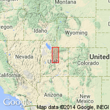
Occurs in southern half of study area of central UT which includes Utah and Sanpete Cos, (Wasatch uplift), Juab Co (Great Basin province), and Emery Co (Paradox basin). Laterally grades northward into Woodside Shale, Thaynes Formation, and possibly lower part of Ankareh Formation. In southwestern part of study area (southern Utah, Sanpete, and Juab Cos), Moenkopi divided into (ascending): Black Dragon and Sinbad Limestone Members, middle red member, Shnabkaib Member, and upper red member. In southernmost part of study area (part of Sanpete and Emery Cos), Moenkopi divided into (ascending): Black Dragon, Sinbad Limestone, Torrey, and Moody Canyon Members. Unconformably overlies Black Box Dolomite; unconformably underlies Moss Back Member of Chinle Formation. Early and Middle? Triassic age.
Source: GNU records (USGS DDS-6; Denver GNULEX).
- Usage in publication:
-
- Moenkopi Formation*
- Modifications:
-
- Mapped
- AAPG geologic province:
-
- Great Basin province
Summary:
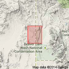
Members mapped in northeast part of quad (Washington Co, UT) and northwest, western edge and central part of southwest quarter of quad (Lincoln Co, NV), Great Basin province. Consists of (ascending) Rock Canyon Conglomerate Member, lower red member, Virgin Limestone Member, Shnabkaib Member, and upper red member. Unconformably overlies Kaibab Formation; older than Chinle Formation. Better exposed in adjacent Dodge Spring quad (Anderson and Hintze, 1992, USGS GQ-1721). Upper red member assigned Early and Middle? Triassic age; other members assigned Early Triassic age.
Source: GNU records (USGS DDS-6; Denver GNULEX).
For more information, please contact Nancy Stamm, Geologic Names Committee Secretary.
Asterisk (*) indicates published by U.S. Geological Survey authors.
"No current usage" (†) implies that a name has been abandoned or has fallen into disuse. Former usage and, if known, replacement name given in parentheses ( ).
Slash (/) indicates name conflicts with nomenclatural guidelines (CSN, 1933; ACSN, 1961, 1970; NACSN, 1983, 2005, 2021). May be explained within brackets ([ ]).

