

- Usage in publication:
-
- Missouri Mountain slate
- Modifications:
-
- Original reference
- Dominant lithology:
-
- Slate
- AAPG geologic province:
-
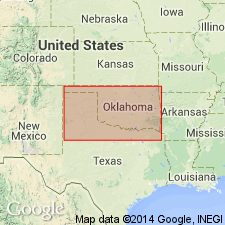
- Ouachita folded belt
Summary:
Pg. 37. Missouri Mountain slate. Mainly red clay slate, with green slate in basal portion. Thickness 50 to 300 feet. Underlies Arkansas novaculite and overlies, probably unconformably, Blaylock sandstone. May be Ordovician, Silurian, or Carboniferous, but scarcely Devonian. [As here defined replaces Slattington shale of Purdue, and is applied to older rocks than those called "Missouri Mountain formation" in his earlier 1909 publication (GSA abs.). This is established definition, while "Slatington shale" was never adequately defined and has been discarded.]
Source: US geologic names lexicon (USGS Bull. 896, p. 1389).

- Usage in publication:
-
- Missouri Mountain slate*
- Missouri Mountain shale*
- Modifications:
-
- Overview
- AAPG geologic province:
-
- Ouachita folded belt
Summary:
Missouri Mountain slate (also Missouri Mountain shale). Recognized in southwestern Arkansas and southeastern Oklahoma. Age is late Silurian. E.O. Ulrich tentatively refers this formation to Cayugan epoch of Silurian.
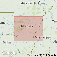
Named from exposures in Missouri Mountains, Polk and Montgomery Cos., southwestern AR.
Source: US geologic names lexicon (USGS Bull. 896, p. 1389).
- Usage in publication:
-
- Missouri Mountain shale*
- Modifications:
-
- Areal extent
- AAPG geologic province:
-
- Ouachita folded belt
Summary:
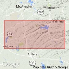
Pg. 781 (fig. 2), 787-788. Missouri Mountain shale. In Ouachita Mountains, southeastern Oklahoma, approximatey 100 feet thick and consists of green, hard siliceous shale, intercalated thin streaks of finely laminated chert, and locally lenses of conglomerate. Underlies Arkansas novaculite; unconformably overlies Polk Creek shale. Middle Silurian.
Source: US geologic names lexicon (USGS Bull. 1200, p. 2533).
- Usage in publication:
-
- Missouri Mountain slate*
- Modifications:
-
- Mapped 1:500k
- AAPG geologic province:
-
- Ouachita folded belt
Summary:
Missouri Mountain slate. Mapped as Silurian.
Source: US geologic names lexicon (USGS Bull. 1200, p. 2533).

- Usage in publication:
-
- Missouri Mountain Shale*
- Missouri Mountain Formation*
- Modifications:
-
- Overview
- AAPG geologic province:
-
- Ouachita folded belt
Summary:
Pg. 21. Missouri Mountain Shale; Missouri Mountain Formation. Shale interbedded with various amounts of conglomerate, novaculite, and sandstone. The shales are usually gray, green, black, or red but weather to buff, green, yellow, or reddish brown. The conglomerate is normally found at or near the base of the unit and may be up to 4 feet thick. Thin beds of novaculite are present in the upper parts of the unit. The thin quartzitic sandstones occur throughout the unit but are more common in the upper and lower parts. Thickness up to about 300 feet. Rests conformably on the Blaylock to the south and the Polk Creek to the north. Few identifiable fossils. Age is Silurian.
Recognized in Ouachita Mountains, west-central AR, and in southeastern OK.
Source: Publication.
For more information, please contact Nancy Stamm, Geologic Names Committee Secretary.
Asterisk (*) indicates published by U.S. Geological Survey authors.
"No current usage" (†) implies that a name has been abandoned or has fallen into disuse. Former usage and, if known, replacement name given in parentheses ( ).
Slash (/) indicates name conflicts with nomenclatural guidelines (CSN, 1933; ACSN, 1961, 1970; NACSN, 1983, 2005, 2021). May be explained within brackets ([ ]).