The National Geologic Map Database is migrating to a new infrastructure. We apologize for any service disruptions during this process.
|
|---|


- Usage in publication:
-
- Minturn formation*
- Modifications:
-
- Original reference
- Dominant lithology:
-
- Limestone
- Sandstone
- Shale
- Conglomerate
- Grit
- AAPG geologic province:
-
- Eagle basin
Summary:
Pg. 152 (table 1), 194-198, 205-228. Minturn formation. Name applied to series of clastic rocks about 6,000 feet thick lying between Belden shale and Maroon formation. Made up of lenticular beds of arkosic grit, shale, conglomerate, sandstone, and quartzite with a few relatively persistent beds of dolomite limestone. Includes (ascending) Wearyman dolomite (new), Hornsilver dolomite (new), Resolution dolomite (new), Robinson dolomite, Elk Ridge limestone, White Quail limestone, and Jacque Mountain limestone members. Pennsylvanian and Permian(?). Name Minturn is applied in preference to older names because none of these seems usable; Maroon is used for upper formation; Weber or Weber(?) has long been considered unsatisfactory; Battle Mountain introduced by Brill (1942) was in effect abandoned by him in 1944 when he proposed use of Maroon for same beds and Battle Mountain as defined does not correspond to divisions here recognized. [Age is Pennsylvanian.]
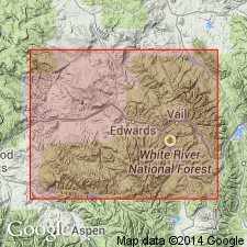
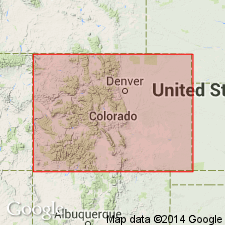
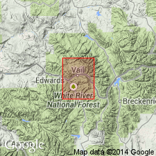
Named for extensive exposures in cliffs along east side of Eagle Valley near Minturn, Eagle Co., central CO.
Source: US geologic names lexicon (USGS Bull. 1200, p. 2524-2525).
- Usage in publication:
-
- Minturn formation
- Modifications:
-
- Revised
- AAPG geologic province:
-
- Denver basin
- Piceance basin
- Eagle basin
Summary:
Pg. 820, 821. Minturn formation. In South Park area, central Colorado, comprises Coffman conglomerate member, Chubb siltstone member, and lower part of Pony Spring siltstone; in Arkansas River section, includes Swissvale gypsum member (new). [Age is Pennsylvanian.]
Source: US geologic names lexicon (USGS Bull. 1200, p. 2524-2525).
- Usage in publication:
-
- Minturn formation*
- Modifications:
-
- Areal extent
- AAPG geologic province:
-
- Eagle basin
- Piceance basin
Summary:
Replaces use of term Kangaroo formation in report area in Chaffee Co, CO in the Eagle basin and Gunnison Co, CO in the Piceance basin. Thought to be equivalent to the upper part (1,500 ft) of Garfield formation and all of Kangaroo formation. Overlies Belden shale. Underlies Morrison formation. Mapped (geologic map) with Belden. Occurs in south and west parts of quad. Of Pennsylvanian and probably Permian age.
Source: GNU records (USGS DDS-6; Denver GNULEX).

- Usage in publication:
-
- Minturn formation
- Modifications:
-
- Revised
- AAPG geologic province:
-
- Eagle basin
Summary:
Name applied to rocks that interfinger with and lie above Belden formation and below top of Jacque Mountain Limestone Member of Minturn. Overlain by Maroon formation. Divided into: 1) lower zone of conglomerate, sandstone, and discontinuous carbonates; 2) middle zone of marine carbonates (Wearyman, Harnsilver, Resolution, and Robinson dolomite members) that are separated by sandstone and conglomerate and that interfinger toward the central part of the trough with the Eagle evaporite member (first published use); and 3) upper zone of widely spaced carbonates (Elk Ridge, White Quail, and Jacque Mountain limestone members) that are separated by sandstone and conglomerate. Ranges from 1,600 ft thick at Wilson Creek to 5,800 ft thick at Pando. Thins to northwest. Correlates with upper part of Morgan Formation of Uinta Mountains. Desmoinesian age. Cross section.
Source: GNU records (USGS DDS-6; Denver GNULEX).
- Usage in publication:
-
- Minturn formation
- Modifications:
-
- Areal extent
- AAPG geologic province:
-
- Las Vegas-Raton basin
Summary:
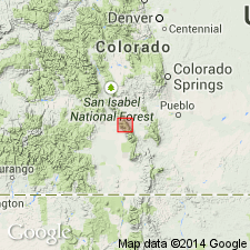
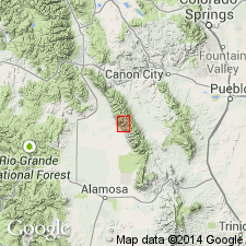
Pg. 1903 (fig. 5), 1919-1922 [see also D.W. Bolyard, 1956, Univ. Colorado unpub. MS thesis; D.W. Bolyard, 1956a, Permo-Pennsylvanian section at La Veta Pass, CO, Rocky Mtn. Geol. Raton Basin Gdbk.].
Minturn formation. Described in Sangre de Cristo Mountains between La Veta Pass and Westcliffe, where it is at least 5,000 feet thick and consists chiefly of grayish to greenish sandstones, conglomerates, and shales or siltstones. Base is probably an unconformity; overlies Kerber formation at two localities but elsewhere rests unconformably on Mississippian or older rocks. Underlies Maroon or Sangre de Cristo formations, boundary imperfectly defined. Grades southward into its stratigraphic equivalent, Madera formation. [Age is Pennsylvanian.]
Source: US geologic names lexicon (USGS Bull. 1200, p. 2524-2525).
- Usage in publication:
-
- Minturn Formation
- Modifications:
-
- Overview
- AAPG geologic province:
-
- Eagle basin
Summary:
Replaces use of McCoy Formation in McCoy area, CO in the Eagle basin. Overlies Leadville Limestone; underlies Maroon Formation. Contains marine and paralic fauna (productids, chonetid, coral, fusulinids, textularids) which lie in bands parallel to ancient shoreline.
Source: GNU records (USGS DDS-6; Denver GNULEX).
- Usage in publication:
-
- Minturn Formation*
- Modifications:
-
- Overview
- AAPG geologic province:
-
- Eagle basin
Summary:
Type section designated and measured in sec 22, T5S, R80W to SE1/4 sec 13, T6S, R81W, Eagle Co, CO, Eagle basin. Divided into (ascending): clastic units A, B, C, D, E, Robinson Limestone Member, clastic unit F, Elk Ridge Limestone Member, clastic unit G, White Quail Limestone Member, clastic unit H, and Jacque Mountain Limestone Member. Is 6,308 ft thick. Overlies Belden Formation; underlies Maroon Formation. Composed of, at type, interbedded or interlensed: 1) coarse grained, poorly sorted, feldspathic, micaceous, friable to finely cemented, gray grit which has quartz as the most abundant constituent; 2) feldspathic, micaceous, poorly sorted, fine- to medium- to coarse-grained gray to red sandstone which may be very thin bedded and dolomitic; 3) red and green shale; 4) green to gray, micaceous, silty siltstone; 5) red, gray, fossiliferous, fine- to medium-grained, medium crystalline, thin-bedded, locally oolitic, medium crystalline limestone; 6) gray, dense, thin-bedded dolomite; 7) gray conglomerate of pebbles and cobbles that may be subangular to subround generally of chert, sandstone, quartzite, phyllite, granite, etc. Of marine and nonmarine origin. Floods of coarse clastic debris came from highland to east. Fossil lists (corals, mollusks, plants, fusulinids). Lower part (through White Quail) is Atokan and Des Moinesian. Unit H and Jacque Mountain are Des Moinesian. Of Middle Pennsylvanian age. Geologic map.
Source: GNU records (USGS DDS-6; Denver GNULEX).
- Usage in publication:
-
- Minturn Formation*
- Modifications:
-
- Overview
- AAPG geologic province:
-
- San Luis basin
- Las Vegas-Raton basin
Summary:
Seven measured sections of main turbidite member of Middle Pennsylvanian Minturn Formation described, Custer Co, CO, Las Vegas-Raton basin and Saguache Co, CO, San Luis basin. Member lies 906 m above base of Minturn, reaches 150 m thick, and extends 13 km along strike. Contains land plant fossils. Overlies lower part of Minturn. Underlies upper part of Minturn. Is a prodelta deposit that formed in front of fan deltas and alluvial fans during uplift of ancestral Rockies in Middle Pennsylvanian time.
Source: GNU records (USGS DDS-6; Denver GNULEX).
- Usage in publication:
-
- Minturn Formation*
- Modifications:
-
- Reference
- Dominant lithology:
-
- Sandstone
- Siltstone
- Shale
- AAPG geologic province:
-
- Las Vegas-Raton basin
Summary:
Reference section designated in T44N, R12W, Custer Co, CO in Las Vegas-Raton basin. A measurement of 1,990 m made at reference section where lower part is cut by a fault. Original thickness unknown. Estimated to be 2,440 m thick in northern part of range. Divided at reference into: 1) sandstone, conglomerate, siltstone, and shale; 2) main turbidite member; 3) conglomeratic sandstone member; 4) shale and sandstone member; 5) shale and siltstone member; 6) brown limestone; 7) marker limestone; and 8) cross-bedded sandstone and siltstone member. The sandstones may be conglomeratic, coarse to medium grained, calcareous, thin-bedded to thick-bedded or cross-bedded. The siltstones may be dark gray to gray black, thin-bedded or ripple marked. The shales may be gray to brown black, silty, calcareous. The limestones may be brown or gray and silty. Conformably over Belden Shale. Conformably under Sangre de Cristo Formation. Of Atokan and Desmoinesian age (fusulinids). Brachiopod, crinoid, trunk and stem fossils also found, but are of no use in refining age. Deposited as a series of stacked alluvial fans that prograded into Middle Pennsylvanian seas of central CO trough.
Source: GNU records (USGS DDS-6; Denver GNULEX).
- Usage in publication:
-
- Minturn Formation*
- Modifications:
-
- Overview
- AAPG geologic province:
-
- Eagle basin
Summary:
Two of the limestone members of the Minturn--Robinson and Jacque Mountain--previously thought to pinch out just west of the type Minturn can be traced in six measured sections into the Eagle Valley Evaporite and west across the Wolcott syncline, Eagle County, Colorado. In vicinity of Avon, Colorado, and west across the syncline, the Robinson and Jacque Mountain are assigned to Eagle Valley as members. Several gypsum beds of the Eagle Valley extend east toward the Minturn type. Minturn was deposited on the northeast part of the basin and Eagle Valley, its correlative, was deposited in the central part of the basin. Both are of Middle Pennsylvanian age.
Source: GNU records (USGS DDS-6; Denver GNULEX).
For more information, please contact Nancy Stamm, Geologic Names Committee Secretary.
Asterisk (*) indicates published by U.S. Geological Survey authors.
"No current usage" (†) implies that a name has been abandoned or has fallen into disuse. Former usage and, if known, replacement name given in parentheses ( ).
Slash (/) indicates name conflicts with nomenclatural guidelines (CSN, 1933; ACSN, 1961, 1970; NACSN, 1983, 2005, 2021). May be explained within brackets ([ ]).