

- Usage in publication:
-
- Minnelusa sandstone
- Modifications:
-
- Named
- Dominant lithology:
-
- Sandstone
- AAPG geologic province:
-
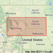
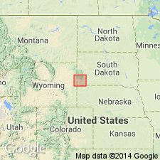
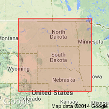
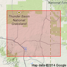
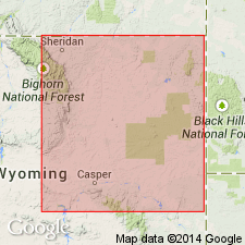
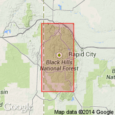
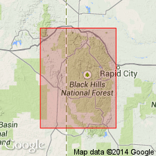
- Powder River basin
Summary:
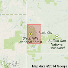
Name given to white sandstone, locally stained with iron so as to have a brick-red color. Thickness 75 ft. [Also called the Upper Sandstone on an accompanying geologic map.] Is the Indian name for the valley in which it was discovered [valley of present-day Soldier Creek, southeastern Crook Co, and northeastern Weston Co, WY in Powder River basin]. Underlies Upper limestone and overlies Lower limestone. Is Carboniferous? in age [based on stratigraphic position].
Source: GNU records (USGS DDS-6; Denver GNULEX).
- Usage in publication:
-
- Minnelusa formation*
- Modifications:
-
- Revised
- AAPG geologic province:
-
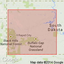
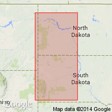
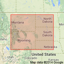
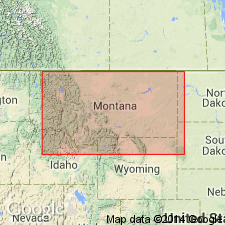
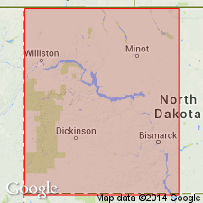
- Williston basin
- Chadron arch
- Powder River basin
Summary:
Minnelusa is the Dakota Indian name for Rapid Creek [Pennington Co, SD in Williston basin], and is employed to designate all the sandstones and limestones lying between the well defined limits of the Pahasapa limestone below and the deep-red sandstones and shales of the Opeche above. The sandstones are mostly fine-grained, massively bedded [red, gray, pink, and brown], and in their weathered condition contain a considerable proportion of carbonate of lime. Thin sheets of limestone occur in places, and less frequently, sandy shales of red or gray color. Some layers are cherty. Thickest on the western side [of the Black Hills] where it is fully 450 ft. It thins to the south and east to less than 400 ft on Spring Creek, Pennington Co, SD. Is Upper Carboniferous (pre-Permian).
Source: GNU records (USGS DDS-6; Denver GNULEX).
- Usage in publication:
-
- Minnelusa limestones and sandstones
- Modifications:
-
- Revised
- Redescribed
- Dominant lithology:
-
- Limestone
- Sandstone
- AAPG geologic province:
-
- Williston basin
Summary:
Pg. 178-181, and map. Minnelusa limestones and sandstones. In northern Black Hills consist of (descending): (1) Minnelusa saccharoidal sandstone, 200 feet; (2) Minnelusa "alternate" series, 300 feet; (3) Minnelusa white sandstone, 100 feet. Separated from overlying Minnekahta limestone by 90 feet of red sandstone. Rests on 200 to 700 feet of gray limestone equivalent to Madison limestone. [Age is Pennsylvanian; possibly includes some Permian at top and some Mississippian at base.]
Source: US geologic names lexicon (USGS Bull. 896, p. 1382).
- Usage in publication:
-
- Minnelusa formation*
- Modifications:
-
- Overview
- AAPG geologic province:
-
- Williston basin
Summary:
The lower part of the Pennsylvanian? Minnelusa formation of the Black Hills area, SD, Williston basin, is thought to be equivalent of the Amsden formation, a newly named unit of the Bighorn Mountains, WY, Powder River basin, and of the Hartville formation of the Hartville uplift, WY, Denver basin. The Tensleep sandstone (new) of the Bighorn Mountains is thought to be equivalent to the upper part of the Minnelusa. Correlation diagram.
Source: GNU records (USGS DDS-6; Denver GNULEX).
- Usage in publication:
-
- Minnelusa sandstone*
- Modifications:
-
- Overview
- AAPG geologic province:
-
- Williston basin
- Chadron arch
- Powder River basin
Summary:
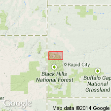
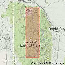
Designates Rapid Creek as the type locality. Describes a typical [type] section, 400 ft thick, on Rapid Creek, 5 mi west of Rapid City [sec 18, T1N, R7E, Pennington Co, SD in Williston basin]. In this vicinity the top member, 100 ft thick, is massive soft, red to brownish sandstone, some of which weathers brick-red. In most ledges the beds are considerably broken into an irregular coarse breccia, which in places carries much calcite in veins and geodes. The second and third members consist of alternations of limestone, sandstone, and sandy shale in beds ranging in thickness from 1 to 20 ft and presenting much local variation in character and succession. A bed of red shale at the base is 20 ft thick. Overlain by Opeche formation; overlies Pahasapa limestone. Gives details of lithology at several localities in the Black Hills. Lists fossils. Pennsylvanian in age.
Source: GNU records (USGS DDS-6; Denver GNULEX).
- Usage in publication:
-
- Minnelusa formation
- Modifications:
-
- Biostratigraphic dating
- Overview
- AAPG geologic province:
-
- Chadron arch
Summary:
Concludes from fossil collections made near Loring Siding [Custer Co, SD on Chadron arch] that the basal beds of the formation are the equivalent of the Desmoinesian stage of the Carboniferous.
Source: GNU records (USGS DDS-6; Denver GNULEX).
- Usage in publication:
-
- Minnelusa formation
- Modifications:
-
- Age modified
- AAPG geologic province:
-
- Chadron arch
- Powder River basin
Summary:
Partial sections given at Loring Siding [Custer Co] SD, and LaPlant Ranch [Crook Co], WY. Correlates formation with Kansas City, Marmaton, and Cherokee formations [groups] in KS and NE. Is Pennsylvanian (Missourian and Desmoinesian) in age.
Source: GNU records (USGS DDS-6; Denver GNULEX).
- Usage in publication:
-
- Minnelusa formation
- Modifications:
-
- Overview
- Biostratigraphic dating
- AAPG geologic province:
-
- Powder River basin
Summary:
Divided into four lithologic zones [in parts of Crook Co, WY and Lawrence Co, SD in the Powder River and Williston basins]. These are (descending): upper yellow zone, upper red zone, intermediate gray zone, and lower red and pink zone. Three sets of gypsum beds found in the upper yellow zone in South Redwater, Sundance, and Red Canyons [Crook Co, WY]. Concludes from fossils collected at six horizons and from fossils reported by Dille (1930) in the southern Black Hills that the formation is equivalent to parts of the Missourian and Desmoinesian series [Pennsylvanian], with the boundary [between the two series] placed tentatively at the base of the upper yellow zone.
Source: GNU records (USGS DDS-6; Denver GNULEX).
- Usage in publication:
-
- Minnelusa group
- Modifications:
-
- Areal extent
- AAPG geologic province:
-
- Chadron arch
Summary:
Name extended southward in the subsurface into northwestern NE on Chadron arch. Used in the Duthie Well, sec 33, T35N, R47W, Dawes CO, NE for sandstone, limestone, and shale at depths 1955-2194 ft. Underlies Opeche shale; overlies Pahasapa limestone. Pennsylvanian in age.
Source: GNU records (USGS DDS-6; Denver GNULEX).
- Usage in publication:
-
- Minnelusa formation
- Modifications:
-
- Biostratigraphic dating
- AAPG geologic province:
-
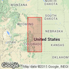
- Denver basin
- Chadron arch
Summary:
Describes and compares fusulinids from the lower 150 ft of Minnelusa formation near Loring Siding [Custer Co, SD]; from the middle and upper portions of Hartville formations in the canyons of the North Platte River about 8 mi southeast of Orin Junction [Platte Co], WY; and from the lower 450 ft of Hartville formation near Guernsey, [Platte Co], WY. Concludes that the fusulinids of the lower part of Minnelusa are closely related to those of the lower part of Hartville, and that the lower portions of both these formations should be referred to the Morrowan series [Pennsylvanian].
Source: GNU records (USGS DDS-6; Denver GNULEX).
- Usage in publication:
-
- Minnelusa formation
- Modifications:
-
- Revised
- AAPG geologic province:
-
- Powder River basin
Summary:
Pg. 680, 683. Minnelusa formation. In the Ohio Oil Company, Converse Sheep No. 5 well, in SE/4 SW/4 sec. 32, T. 36 N., R. 65 W., Lance Creek oil field, Niobrara County, Wyoming, includes oil-producing zones (descending) Leo sandstone, Converse sand, and Bell sandstone. Age is Pennsylvanian.
Source: Publication; GNU records (USGS DDS-6; Denver GNULEX).
- Usage in publication:
-
- Minnelusa sandstone
- Modifications:
-
- Revised
- Areal extent
- AAPG geologic province:
-
- Williston basin
Summary:
Name used in subsurface in southeastern MT in the Montana-Dakota Utilities Co. No. 1 Northern Pacific Railroad Co. well, sec. 17, T4N, R62E, Fallon Co, MT in Williston basin for white cross-bedded sandstone, containing some dolomite near the middle at depths of 5,631 to 5,736 ft. Overlain by Opeche shale; underlain by Amsden formation. Pennsylvanian in age. [Equivalent to only the upper part of the formation of the Black Hills area; lower part shown wedging out northward in the subsurface.]
Source: GNU records (USGS DDS-6; Denver GNULEX).
- Usage in publication:
-
- Minnelusa formation
- Modifications:
-
- Age modified
- AAPG geologic province:
-
- Chadron arch
Summary:
Composite section measured in the vicinities of Loring Siding, Custer County, South Dakota, and in Hot Brook Canyon and Warm Draw, west of Hot Springs, Fall River County, South Dakota (on Chadron arch). Correlations are made with formations in the Hartville uplift as follows (in ascending order): Fairbank formation, Reclamation group, "Meek and Wendover groups", Broom Creek group, and Cassia group. Age is Pennsylvanian and Early Permian. Report includes measured sections.
Source: Modified from GNU records (USGS DDS-6; Denver GNULEX).
- Usage in publication:
-
- Minnelusa formation
- Modifications:
-
- Overview
- AAPG geologic province:
-
- Chadron arch
- Denver basin
Summary:
Subdivisions of Hartville formation in the Hartville uplift [in Denver basin] recognized in the southern Black Hills [on Chadron arch]. A gray to buff sandstone zone, which has been correlated by some as Tensleep, marks the upper part of Division I of Hartville formation in the western part of Hartville uplift, and is present in the western Black Hills, or is represented by red sandstones and sandy shales included with Opeche shale of the region near Hot Springs [Fall River County, South Dakota]. The lower part of Division I of Hartville formation is correlative with uppermost part of Minnelusa formation [in the southern Black Hills], and its age is either Pennsylvanian or Permian. Divisions II, III, V, and VI of Hartville formation correlate with the main body of Minnelusa formation of the Black Hills, and the individual divisions are distinguishable in the Black Hills, although the boundary between III and IV is less well-defined there. Correlations are shown for sections measured in the Hartville uplift and the southern part of the Black Hills. Age is Middle and Late Pennsylvanian, with the uppermost part possibly Permian.
Source: Modified from GNU records (USGS DDS-6; Denver GNULEX).
- Usage in publication:
-
- Minnelusa formation
- Modifications:
-
- Areal extent
- AAPG geologic province:
-
- Powder River basin
Summary:
Minnelusa formation extended into the Lance Creek oil field, Niobrara County, Wyoming. 1st and 2nd Converse, Leo, Joss, and Bell sands or sandstones [oil field terms for oil-bearing horizons in Minnelusa] (in descending order) are identified. Converse, Leo, and Joss sands, and a red shale called the "red marker bed," shown in typical well sections of Paleozoic formations in Dewey Dome oil field, Weston County, Wyoming, Mule Creek oil field, Niobrara County, Wyoming, and Lance Creek oil field, Niobrara County, Wyoming [in Powder River basin]. Overlain by Opeche shale; underlain by Pahasapa (Madison) limestone. Age is Mississippian (Chesterian?) and Pennsylvanian.
Source: Modified from GNU records (USGS DDS-6; Denver GNULEX).
- Usage in publication:
-
- Minnelusa formation
- Modifications:
-
- Overview
- AAPG geologic province:
-
- Chadron arch
- Powder River basin
- Williston basin
- Denver basin
Summary:
Concludes that Converse, Leo, and Bell sandstone oil-bearing zones in the Lance Creek oil field [Niobrara County, Wyoming] are represented in Divisions I, II, and VI, respectively, of Hartville formation; and that Minnelusa formation, at its type locality on the east side of the Black Hills of South Dakota, is restricted to Divisions I and II of Hartville formation, and is no older than the Leo horizon of Lance Creek oil field. Age is Pennsylvanian and Permian. Report includes four cross-sections: (1) a regional section from Colorado Springs to the Black Hills; (2) a detailed section through Colorado; (3) a detailed section through Wyoming; and (4) a detailed section through the Black Hills area of both Wyoming and South Dakota.
Source: Modified from GNU records (USGS DDS-6; Denver GNULEX).
- Usage in publication:
-
- Minnelusa formation
- Modifications:
-
- Areal extent
- AAPG geologic province:
-
- Williston basin
- Powder River basin
- Chadron arch
Summary:
Used name and shows isopach map in the area surrounding the Black Hills in southeastern SD, eastern WY, southeastern MT, southwesternmost ND (Bowman Co.), and northwestern NE [in Williston and Powder River basins, and on Chadron arch]. Is Pennsylvanian and Permian in age. Overlain by Opeche formation; underlain unconformably by Big Snowy group, Madison limestone, or Pahasapa limestone.
Source: GNU records (USGS DDS-6; Denver GNULEX).

- Usage in publication:
-
- Minnelusa formation
- Modifications:
-
- Overview
- AAPG geologic province:
-
- Williston basin
- Chadron arch
Summary:
Name used in SD [in Williston basin and on Chadron arch]. Lower part contains Desmoinesian fossils; upper part probably contains Missourian and Virgilian deposits. Uppermost part Permian based on correlations of Condra, Reed, and Scherer (1940), although paleontological evidence lacking.
Source: GNU records (USGS DDS-6; Denver GNULEX).
- Usage in publication:
-
- Minnelusa formation
- Modifications:
-
- Overview
- AAPG geologic province:
-
- Williston basin
- Chadron arch
Summary:
Described in the subsurface in western SD [in Williston basin and on Chadron arch]. Most of the carbonates and virtually all calcium sulphate [present in the subsurface] dissolved in outcrops in the Black Hills, leading to very extensive solution collapse and thinning of 200 ft or more at the outcrop. Suggests that Amsden formation is represented by a laterite at base of Minnelusa. The laterite is the insoluble residue from solution of the underlying Madison limestone, produced under warm, moist conditions of weathering. The laterite contains diagnostic fossils of Early Pennsylvanian age. Near top of Minnelusa in the northern Black Hills, vicinity of Beulah, WY, associated with some thin gypsum beds, is a nondescript brachiopod fauna of either Pennsylvanian or Permian age. Overlain by Opeche formation; underlain by Madison limestone.
Source: GNU records (USGS DDS-6; Denver GNULEX).
- Usage in publication:
-
- Minnelusa formation
- Modifications:
-
- Overview
- AAPG geologic province:
-
- Powder River basin
- Denver basin
Summary:
Amsden formation of the Big Horn Mountains must pinch out toward the Black Hills [in Crook County, Wyoming]. The upper part of Minnelusa, in contrast, pinches out toward the Big Horn Mountains. Tensleep [sandstone of the Big Horn Mountains] is correlative with the lower part of Minnelusa, or /Roundtop-Hayden groups [of Hartville formation in the Hartville uplift, Wyoming]. Hartville formation is closely correlative with Minnelusa of the Black Hills. Age is Pennsylvanian (Virgilian to Morrowan) and Early Permian.
[The use of a hyphen between undifferentiated [groups] has not been considered proper notation since 1933 (see CSN, Art. 13a, p. 437-438). Where the [groups] have not been separated in the field, it is considered proper notation to add the word "and", "undifferentiated", "included", etc.; and list [groups] in order of age (youngest first).]
Source: Modified from GNU records (USGS DDS-6; Denver GNULEX).
- Usage in publication:
-
- Minnelusa formation
- Modifications:
-
- Overview
- AAPG geologic province:
-
- Williston basin
Summary:
Divides rocks of Pennsylvanian or presumed Pennsylvanian age in western ND in the Williston basin into Minnelusa and conformably underlying "Amsden" formations. Unconformable with overlying Opeche formation. Pennsylvanian in age.
Source: GNU records (USGS DDS-6; Denver GNULEX).
- Usage in publication:
-
- Minnelusa formation
- Modifications:
-
- Revised
- AAPG geologic province:
-
- Chadron arch
Summary:
Restricted the formation to exclude basal sandstone and shale, herein assigned to Fairbank formation. A section of Minnelusa formation (restricted) and underlying Fairbank formation described at Beaver Creek, secs 29, 30, and 32, T5S, R6E, Custer Co., SD [on the Chadron arch]. Pennsylvanian and Permian? in age.
Source: GNU records (USGS DDS-6; Denver GNULEX).
- Usage in publication:
-
- Minnelusa formation
- Modifications:
-
- Areal extent
- AAPG geologic province:
-
- Williston basin
Summary:
Uses the Minnelusa and Amsden nomenclature of Condra and others (1940, Nebraska Geol. Survey Bull., no. 13; Hartville uplift, Wyoming) instead of nomenclature of the North Dakota Geological Society (1954, Stratigraphy of the Williston basin) in the Williston basin, western North Dakota. Age is Pennsylvanian and Permian.
Source: Modified from GNU records (USGS DDS-6; Denver GNULEX).
- Usage in publication:
-
- Minnelusa formation
- Modifications:
-
- Age modified
- Biostratigraphic dating
- Overview
- AAPG geologic province:
-
- Powder River basin
Summary:
Shows detailed correlation of beds in the upper part of the formation [Upper Yellow Zone of his terminology] in T52N, R61W, Crook Co, WY, including a total of 127 ft of locally occurring gypsum and anhydrite in three groups of beds. Limestones and dolomites associated with the evaporites yield 40 species of fossils indicating a Late Pennsylvanian to Early Permian age for the Upper Yellow Zone, and a Pennsylvanian age for the part of the formation below the Upper Yellow Zone. Describes an incomplete section, 257 ft thick, in Sundance Canyon, SW1/4 sec 10, T52N, R61W, considered the type section [of the Upper Yellow Zone], and used as a reference section for the area of the study.
Source: GNU records (USGS DDS-6; Denver GNULEX).
- Usage in publication:
-
- Minnelusa formation
- Modifications:
-
- Age modified
- AAPG geologic province:
-
- Powder River basin
Summary:
Subdivided (in Powder River basin) into upper, middle, and lower Minnelusa, separated by regional unconformities. Unconformably overlies Madison limestone; unconformably overlain by Opeche shale. The upper part is correlated with Cassa and Broom Creek divisions of Hartville formation as exposed in Hartville uplift, WY (in Denver basin). The "red shale marker" of the Lance Creek area, which appears to be a buried soil, marks the unconformity at base of upper part. Upper part assigned an Early Permian (Wolfcampian) age. The middle part is correlated with Wendover, Meek, and Hayden divisions of Hartville formation, and is assigned a Middle and Late Pennsylvanian (Desmoinesian, Missourian, and Virgilian) age. The lower part is correlated with Roundtop, Reclamation, and Fairbank divisions of Hartville formation, and with the Amsden type section in the Big Horn Mountains; is Early Pennsylvanian in age, except that the basal nonfossiliferous sandstone may be Morrowan in age.
Source: GNU records (USGS DDS-6; Denver GNULEX).
- Usage in publication:
-
- Minnelusa formation
- Modifications:
-
- Biostratigraphic dating
- Overview
- AAPG geologic province:
-
- Powder River basin
- Williston basin
- Chadron arch
Summary:
An occurrence of Pennsylvanian upper Virgilian or lower Wolfcampian fusulinids is described in the northern Black Hills. Two additional fusulinid zones are reported from the southern Hills. In addition, two conodont faunas are described and illustrated. These fossiliferous horizons, together with previously reported fossils, indicate that the Pennsylvanian portion of Minnelusa is much thinner than has previously been reported. Sections at Hot Brook Canyon and Loring Siding [Fall River and Custer Cos, SD], Beaver Creek [Custer Co], Bear Butte Creek [Lawrence and Meade Cos, SD], and Sand Creek [Crook Co, WY] are correlated with each other, and with wells in the Powder River basin, WY, and outcrops in the Hartville uplift, WY. The "red marker", a shale bed used as the Pennsylvanian-Permian boundary in Powder River basin, is identified 200 ft below the top of the formation in Rapid Canyon [Pennington Co, SD] on the east flank of the Black Hills, and is also identified in Hot Brook Canyon [Custer Co, SD] on southwest flank of the Black Hills. Assigned an Early Permian (Wolfcampian) and Pennsylvanian (Virgilian to Atokan) age.
Source: GNU records (USGS DDS-6; Denver GNULEX).
- Usage in publication:
-
- Minnelusa Group
- Modifications:
-
- Redescribed
- Revised
- AAPG geologic province:
-
- Powder River basin
- Williston basin
- Chadron arch
- Denver basin
Summary:
Minnelusa is raised to group status [in eastern WY and adjacent parts of MT, ND, SD, and NE] and extended to include the strata formerly designated as Hartville. Tensleep, Amsden, and Sacajawea Formations (descending) comprise the Group. Correlation chart and diagrams show the three subdivisions of Minnelusa Group in the Black Hills and nearby areas [including the northern part of the Chadron arch, the southern part of Williston basin, eastern part of Powder River basin, and the northern part of Denver basin]. Age ranges from Late Mississippian (Chesterian?) to Early Permian (Wolfcampian or questionably Leonardian).
Source: GNU records (USGS DDS-6; Denver GNULEX).
- Usage in publication:
-
- Minnelusa Formation*
- Modifications:
-
- Overview
- AAPG geologic province:
-
- Chadron arch
- Powder River basin
Summary:
Divided into six units totaling 700 to 1,100 ft in thickness in the area between Hot Springs [Fall River Co, SD] and Stockade Beaver Creek [Weston Co, WY]. The units, numbered from youngest to oldest, correspond closely to the six divisions of Condra and Reed (1940). In outcrop, units 6, 5, and 4 in the lower part of Minnelusa consist, respectively, of a basal sandstone, a lavender to cream-colored limestone, and a sequence of interbedded red shales and gray to purple limestones and dolomites. Outcrops of units 3 and 2 of Middle and Late Pennsylvanian age are composed of cherty yellow dolomites and limestones, yellow sandstones, and black shales. Rocks of Permian age, designated unit 1, crop out as thick red and yellow sandstones, thin gray or yellow limestones and dolomites, and red mudstones. The base of unit 1 is the lower contact of the "Red Marker" (Thompson and Kirby, 1940), a red mudstone that may be traced in both surface and subsurface rocks in the southern Black Hills. Brecciation. with few exceptions, is restricted to the upper part of the formation and decreases in intensity downward from unit 1 to unit 3. Brecciation and collapse features are due to solution of calcium sulfate in the formation, and began in early Tertiary time. Permian and Pennsylvanian in age.
Source: GNU records (USGS DDS-6; Denver GNULEX).
- Usage in publication:
-
- Minnelusa formation
- Modifications:
-
- Overview
- AAPG geologic province:
-
- Powder River basin
Summary:
Divided into upper, middle, and lower members as described by Foster (1958) in northeastern WY in Powder River basin. Restricted to equivalents of the upper part in Williston basin in ND and eastern MT; equivalents of the middle and lower parts called the Amsden and Tyler formations. Correlation chart shows the relations of these units to other stratigraphic units of Pennsylvanian and early Permian age in the northern Rocky Mountains and Great Plains areas, including central Wasatch Mountains, UT, central MT, western, south-central, and northeastern WY, Hartville uplift, WY, Williston basin, ND and SD, and the Denver basin, CO and NE. Generalized isopach maps shown for the three members and their equivalents. Pennsylvanian and Early Permian (Wolfcampian) in age.
Source: GNU records (USGS DDS-6; Denver GNULEX).
- Usage in publication:
-
- Minnelusa Formation
- Modifications:
-
- Biostratigraphic dating
- AAPG geologic province:
-
- Williston basin
- Denver basin
Summary:
Describes specimens of FUSULINA collected from three localities in Custer Co, SD in Williston basin, which indicate conclusively that rocks of lower Desmoinesian Cherokee age are present in the formation in the southern Black Hills. Similar fauna are in the lower part of Division III (Hayden Group) in the Hartville Formation in the Hartville uplift, in Denver basin. Discusses other reported occurrences of fusulinids in the formation in the Black Hills.
Source: GNU records (USGS DDS-6; Denver GNULEX).
- Usage in publication:
-
- Minnelusa Formation*
- Modifications:
-
- Overview
- AAPG geologic province:
-
- Williston basin
- Powder River basin
Summary:
Name used in ND, northwestern SD, eastern WY, and southwestern MT. Upper part above the base of a red mudstone known as the "Red Marker" is assigned a Permian (Wolfcampian) age; part below the Red Marker not discussed.
Source: GNU records (USGS DDS-6; Denver GNULEX).
- Usage in publication:
-
- Minnelusa Formation*
- Modifications:
-
- Overview
- AAPG geologic province:
-
- Williston basin
Summary:
Divided into upper, middle, and lower members, separated by unconformities, in the subsurface, western ND and northwesternmost SD, in Williston basin. Upper member absent in central MT. Middle member equivalent to Quadrant and Devils Pocket Formations of central MT, and to Tensleep Sandstone and upper red shale member of Amsden Formation of the Big Horn Mountains. Lower member equivalent to Alaska Bench Limestone and lower red shale members of Amsden Formation of the Big Horn Mountains. Is Permian and Pennsylvanian in age.
Source: GNU records (USGS DDS-6; Denver GNULEX).
- Usage in publication:
-
- Minnelusa Group
- Modifications:
-
- Revised
- AAPG geologic province:
-
- Williston basin
Summary:
The Minnelusa Group is defined to include rock units in ND lying above the truncated formations of Big Snowy and Madison Groups (Mississippian), and below Opeche Formation (Permian), or younger rocks where Opeche Formation has been removed by pre-Jurassic erosion. [Formations included in the Group not identified. Presumably Pennsylvanian and Permian in age.]
Source: GNU records (USGS DDS-6; Denver GNULEX).
- Usage in publication:
-
- Minnelusa Formation*
- Modifications:
-
- Overview
- AAPG geologic province:
-
- Chadron arch
- Williston basin
- Powder River basin
Summary:
Divided into upper, middle, and lower members, separated by unconformities. Shows distribution, thickness, and lithofacies of the middle and lower members, both of Pennsylvanian age, in the Black Hills, and Powder River and Williston basins. Upper member Permian (Wolfcampian) in age; middle member Middle and Late Pennsylvanian (Desmoinesian, Missourian, and Virgilian) in age; lower member Early Pennsylvanian (Morrowan and Atokan) in age.
Source: GNU records (USGS DDS-6; Denver GNULEX).
- Usage in publication:
-
- Minnelusa Group
- Modifications:
-
- Revised
- AAPG geologic province:
-
- Williston basin
Summary:
Given group status in northeastern Williston basin, ND to include (descending): Broom Creek, Amsden, and Tyler Formations. Broom Creek Formation Permian in age, Amsden and Tyler Formations Pennsylvanian in age. Overlain by Opeche Formation, underlain by Heath Formation of Big Snowy Group. Permian and Pennsylvanian in age.
Source: GNU records (USGS DDS-6; Denver GNULEX).
For more information, please contact Nancy Stamm, Geologic Names Committee Secretary.
Asterisk (*) indicates published by U.S. Geological Survey authors.
"No current usage" (†) implies that a name has been abandoned or has fallen into disuse. Former usage and, if known, replacement name given in parentheses ( ).
Slash (/) indicates name conflicts with nomenclatural guidelines (CSN, 1933; ACSN, 1961, 1970; NACSN, 1983, 2005, 2021). May be explained within brackets ([ ]).