The National Geologic Map Database is migrating to a new infrastructure. We apologize for any service disruptions during this process.
|
|---|


- Usage in publication:
-
- Middle Fork Tongue
- Modifications:
-
- Named
- Dominant lithology:
-
- Shale
- Marlstone
- Limestone
- AAPG geologic province:
-
- Wasatch uplift
Summary:
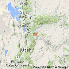
Named as a tongue in the lower part of the Green River Formation for exposures (type section) in east wall of canyon of Middle Fork across border between NE1/4 sec 19 and SE1/4 sec 18, T10S, R8E, Utah Co, UT on the Wasatch uplift. Extent of tongue beyond report area not discussed. Consists of tan-brown paper shale of fluviatile origin, some beds of which may be ostracodal, petroliferous, kerogenaceous. Some beds have concretions. Shale is interbedded with grayish- or greenish-brown, thin-bedded marlstone, and tan to buff and light-brown, thin-bedded to massive, ostracodal, petroliferous limestone. Contains several coquina beds of gastropod and pelecypod fragments up to 4 ft thick. Type section measured. Is 280 ft thick at type. Thins eastward. Is 250 ft thick east of town of Colton. Ostracod species identified. Unit beneath Middle Fork not discussed; lower contact not described. Overlain by fluviatile beds of Tabbyune Creek Tongue of Colton. Stratigraphic charts. Eocene age.
Source: GNU records (USGS DDS-6; Denver GNULEX).
For more information, please contact Nancy Stamm, Geologic Names Committee Secretary.
Asterisk (*) indicates published by U.S. Geological Survey authors.
"No current usage" (†) implies that a name has been abandoned or has fallen into disuse. Former usage and, if known, replacement name given in parentheses ( ).
Slash (/) indicates name conflicts with nomenclatural guidelines (CSN, 1933; ACSN, 1961, 1970; NACSN, 1983, 2005, 2021). May be explained within brackets ([ ]).