- Usage in publication:
-
- Mesilla Valley Shale
- Modifications:
-
- Named
- Dominant lithology:
-
- Shale
- Sandstone
- Limestone
- Siltstone
- AAPG geologic province:
-
- Orogrande basin
Summary:
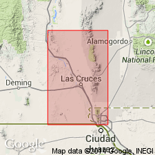
Named for an agricultural area on Rio Grande flood plain north of Cerro de Cristo Rey and in Dona Ana Co, NM. Type locality is on north side of railroad cut in NW1/4 NW1/4 NE1/4 sec 16, T29S, R4E, Dona Ana Co, Orogrande basin. Best exposures are on north and east sides of Cerro de Cristo Rey intrusion in Dona Ana Co, NM and Chihuahua, MX. Unit is 210 ft thick at type and consists of, in lower part, a 195 ft-thick olive-gray clay shale with a few limestone and siltstone beds up to 30 cm thick that contain abundant TEXIGRYPHAEA and CRIBRATINA and in upper part, a 15 ft-thick thinly bedded ferruginous sandstone and siliceous shale. Conformably overlies Muleros Formation (new); conformably underlies Anapra Sandstone (new). Geologic maps; cross sections; chart comparing nomenclature used in area. Equivalent to unit 6 of Bose (1910, Inst. Geol. Mexico, Bol. 25). Early Cretaceous (late Albian, Comanchean) age based on fossils (listed) as recorded by Bose (1910).
Source: GNU records (USGS DDS-6; Denver GNULEX).
For more information, please contact Nancy Stamm, Geologic Names Committee Secretary.
Asterisk (*) indicates published by U.S. Geological Survey authors.
"No current usage" (†) implies that a name has been abandoned or has fallen into disuse. Former usage and, if known, replacement name given in parentheses ( ).
Slash (/) indicates name conflicts with nomenclatural guidelines (CSN, 1933; ACSN, 1961, 1970; NACSN, 1983, 2005, 2021). May be explained within brackets ([ ]).

