The National Geologic Map Database is migrating to a new infrastructure. We apologize for any service disruptions during this process.
|
|---|


- Usage in publication:
-
- Merkle [Merkel] dolomite
- Modifications:
-
- Original reference
- Dominant lithology:
-
- Dolomite
- Shale
- AAPG geologic province:
-
- Permian basin
Summary:
Pg. 95, 96, 97. Merkel dolomite. Dolomite with clay parting 3 to 4 feet thick. Is characteristically ripple-marked and weathers in thin plates like cross-bedded sandstones. Thickness of formation 5 to 8 feet. Top member of Clear Fork beds. [Age is Permian.]
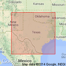
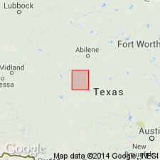
Named from exposures just west of Merkel, [a station on the Texas and Pacific RR, Taylor Co.], central northern TX. Traced across country to Abilene-Sweetwater section, Taylor and Nolan Cos., and to Double Mountain section, Haskell and Stonewall Cos., central northern TX.
Source: US geologic names lexicon (USGS Bull. 896, p. 1352).
- Usage in publication:
-
- Merkel dolomite
- Modifications:
-
- Revised
- AAPG geologic province:
-
- Permian basin
Summary:
Pg. 49. Merkel dolomite is highest dolomite of Choza formation of Clear Fork, lying 270 feet below top of Choza. Correlated by Mr. W.A. Riney with the Texas and Pacific RR (Taylor County, Texas) locality of Wrather. Age is Permian.
Source: Publication; US geologic names lexicon (USGS Bull. 896, p. 1352).

- Usage in publication:
-
- Merkel
- Modifications:
-
- Overview
- AAPG geologic province:
-
- Bend arch
- Palo Duro basin
- Permian basin
Summary:
Some geologists spell this name Merkle, but Post Office guide spells the town for which the dolomite was named Merkel.
Source: US geologic names lexicon (USGS Bull. 896, p. 1352).

- Usage in publication:
-
- Merkel Dolomite [Member]
- Modifications:
-
- Areal extent
- AAPG geologic province:
-
- Permian basin
- Palo Duro basin
Summary:
Area of report is north-central TX, approximately between the Brazos and Red Rivers; in this area the Choza, Vale, and Arroyo Formations of Clear Fork Group of the Colorado River Valley of TX are not distinguishable. [Author maps Clear Fork Group undivided, except for "Merkel Dolomite" and "Bullwagon Dolomite", some sandstone beds, and "Lytle Limestone". Listed in descending order: Merkel is topmost member of Choza Formation, Bullwagon is topmost member of Vale Formation, and Lytle is a middle member of Arroyo Formation, all of Clear Fork Group of the Colorado River Valley.] Merkel is described as: "light gray to white, fine grained, medium to thick bedded with solution cavities and ripple marks throughout; channeled out by San Angelo sandstones immediately west of map area; forms prominent escarpment; thickness 3-6 feet." Merkel is mapped in: Hardeman and Foard Cos, Palo Duro basin, and Knox and Haskell Cos, Permian basin. Assigned to the Leonard Series (Early Permian). Geologic map.
Source: GNU records (USGS DDS-6; Denver GNULEX).

- Usage in publication:
-
- Merkel Dolomite
- Modifications:
-
- Mapped 1:250k
- Dominant lithology:
-
- Dolomite
- AAPG geologic province:
-
- Permian basin
Summary:
Is Permian unit [unranked; member?] separately mapped at top of Choza Formation (Permian) along southeastern margin of map sheet south of Brazos River in southeastern Stonewall Co, TX (northeastern Permian basin). Feathers out northeastward; is not mapped north of Salt Fork Brazos River. Dolomite is not described; thickness is not given. Choza Formation described as shale and sandstone interbedded; thickness 100 ft.
Source: GNU records (USGS DDS-6; Denver GNULEX).
For more information, please contact Nancy Stamm, Geologic Names Committee Secretary.
Asterisk (*) indicates published by U.S. Geological Survey authors.
"No current usage" (†) implies that a name has been abandoned or has fallen into disuse. Former usage and, if known, replacement name given in parentheses ( ).
Slash (/) indicates name conflicts with nomenclatural guidelines (CSN, 1933; ACSN, 1961, 1970; NACSN, 1983, 2005, 2021). May be explained within brackets ([ ]).