

- Usage in publication:
-
- Menefee formation*
- Modifications:
-
- Original reference
- Dominant lithology:
-
- Sandstone
- Shale
- Coal
- AAPG geologic province:
-
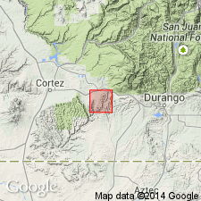
- Paradox basin
Summary:
Menefee formation of Mesaverde group. Middle formation of Mesaverde group in southwestern Colorado. Approximately 400 feet thick. Consists of sandstone, shale, and coal beds. Is "Middle Coal Group" of W.H. Holmes' subdivisions of Mesaverde group. Named from Menefee Mountain [Montezuma County, Colorado], in which coal in it is being actively mined. Underlies Cliff House sandstone and overlies Point Lookout sandstone. [Age is Late Cretaceous.]
[Recognized in southwestern Colorado and northwestern New Mexico.]
Source: US geologic names lexicon (USGS Bull. 896, p. 1347).

- Usage in publication:
-
- Menefee formation*
- Modifications:
-
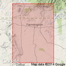
- Areal extent
- AAPG geologic province:
-
- San Juan basin
Summary:
Pg. 5. Menefee formation of Mesaverde group. Consists of rocks of fresh- and brackish-water origin with only a few marine beds. [Age is Late Cretaceous.]
Recognized in southwestern Colorado and northwestern New Mexico.
Source: US geologic names lexicon (USGS Bull. 896, p. 1347).
- Usage in publication:
-
- Menefee formation
- Modifications:
-
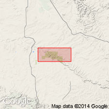
- Areal extent
- AAPG geologic province:
-
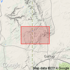
- San Juan basin
Summary:
Pg. 92, 95, pls. 1, 11. Menefee formation of Mesaverde group. Described in Fort Defiance-Tohatchi quadrangles where it underlies Tohatchi [Tohachi] formation and overlies Point Lookout sandstone. Thickness 1,200 to 2,290 feet. Lower 500 feet contain carbonaceous shales and thin coals and are equivalent environmentally of upper Gibson coal member of Sears (USGS Bull. 860-A, 1936), and rest of section above is equivalent to Allison barren member of Sears (1925). [Age is Late Cretaceous.]
Source: US geologic names lexicon (USGS Bull. 1200, p. 2460).
- Usage in publication:
-
- Menefee formation*
- Modifications:
-
- Revised
- AAPG geologic province:
-
- San Juan basin
Summary:
Pg. 2156, 2157. Menefee formation of Mesaverde group. Nomenclature of Mesaverde group, in San Juan basin, revised. Menefee formation includes, in southern part of basin, coal-bearing zone formerly called upper Gibson coal member, and above that zone bed formerly called Allison barren member. Unit formerly called upper Gibson coal member is here named Cleary coal member of Menefee. [Age is Late Cretaceous.]
Source: US geologic names lexicon (USGS Bull. 1200, p. 2460).
- Usage in publication:
-
- Menefee Formation*
- Modifications:
-
- Biostratigraphic dating
- AAPG geologic province:
-
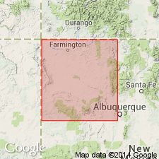
- San Juan basin
Summary:
Study of palynomorphs from a sample from the lowest coal in the Upper Cretaceous Menefee Formation (probably the Cleary Coal Member of the Menefee) indicates a biostratigraphic age assignment of Santonian. Sample is from middle of sec 5, T29N, R16W, San Juan Co, NM (San Juan basin). Menefee overlies the main body of the Point Lookout Sandstone (Santonian) and higher strata are not treated in this report. The stage assignments in this report are derived from invertebrate zone fossils found in associated marine rocks. The Hosta Tongue of the Point Lookout Sandstone yields the middle Santonian ammonite CLIOSCAPHITES VERMIFORMIS. The Gibson Coal Member (at the top of the Crevasse Canyon Formation) lies directly below the Hosta Tongue, consequently all the Gibson in the area is probably of Santonian age. By inference, the basal part of the Menefee Formation in this area is about the same age. The uppermost of four pollen zones recognized in the area is confined to the basal Menefee and younger rocks and is characterized by PROTEACIDITES pollen in significant numbers.
Source: GNU records (USGS DDS-6; Denver GNULEX).

- Usage in publication:
-
- Menefee Formation
- Modifications:
-
- Areal extent
- AAPG geologic province:
-
- San Juan basin
Summary:
About 25 mi northeast of Gallup, NM near Coal Mine Canyon, Hosta Tongue of Point Lookout pinches out. South of that locality, Gibson Coal Member of Crevasse Canyon Formation and Cleary Coal Member of Menefee Formation cannot be separated. [The stratigraphic restriction by Beaumont and others, 1956 of Gibson to only the lower part of what Sears in 1925 assigned to Gibson, and application of the name Cleary by Beaumont and others to the upper part of what Sears assigned to Gibson has set up a formation contact that cannot be mapped according to these authors.]
Source: GNU records (USGS DDS-6; Denver GNULEX).
- Usage in publication:
-
- Menefee Formation*
- Modifications:
-
- Revised
- AAPG geologic province:
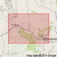
-
- San Juan basin
Summary:
Divided into Cleary Coal (base) and Allison (top) Members. Allison divided into lower beds, Juans Lake Beds (new name) and La Vida Beds (new name) in west-central San Juan basin, NM. Assigned to Late Cretaceous.
Source: GNU records (USGS DDS-6; Denver GNULEX).
- Usage in publication:
-
- Menefee Formation*
- Modifications:
-
- Mapped 1:50k
- Dominant lithology:
-
- Sandstone
- Shale
- Mudstone
- Limestone
- Coal
- AAPG geologic province:
-
- San Juan basin
Summary:
Is Upper Cretaceous formation mapped as two units in San Juan and McKinley Cos, NM (San Juan basin). Main body is heterogeneous sequence of thick, lenticular beds of grayish-yellow to brown, fine- to medium-grained, cross-bedded sandstone and interbeds of dusky-yellow to olive-gray, sandy shale and mudstone, moderate-brown, sandy limestone; and lenticular beds of carbonaceous shale and shaly coal. Coal beds occur sporadically in the upper 246 ft. Coal beds are commonly burned at the outcrop; red outcrops across from Casa Chiquita are result of burned coal. Menefee is widely exposed in southern San Juan basin; base of formation crops out 18.6 mi south of the Park. Unit is 400 ft thick at type locality at Menefee Mountain in southwestern CO about 87 mi north of Chaco Canyon; it thickens southward. In a drillhole 5.9 mi north of northern map area boundary, unit is 1,500 ft thick. Tongues of Menefee described as gray and brown lenticular sandstone interbedded with black, carbonaceous shale, gray claystone and siltstone, some thin beds of highly weathered coal. Occurs as beds within Cliff House Sandstone that thin northward. Beds represent two or more separate tongues extending northward from main body of Menefee. Stratigraphic connection has since been removed by erosion in map area. Thickness of tongues 0-80 ft.
Source: GNU records (USGS DDS-6; Denver GNULEX).
For more information, please contact Nancy Stamm, Geologic Names Committee Secretary.
Asterisk (*) indicates published by U.S. Geological Survey authors.
"No current usage" (†) implies that a name has been abandoned or has fallen into disuse. Former usage and, if known, replacement name given in parentheses ( ).
Slash (/) indicates name conflicts with nomenclatural guidelines (CSN, 1933; ACSN, 1961, 1970; NACSN, 1983, 2005, 2021). May be explained within brackets ([ ]).