- Usage in publication:
-
- Mendenhall Formation
- Modifications:
-
- Named
- Dominant lithology:
-
- Limestone
- Dolomite
- AAPG geologic province:
-
- Williston basin
Summary:
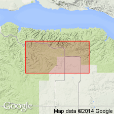
Named as a subsurface formation (1 of 8) of Interlake Group. Type section is interval between 11,785 ft and 12,220 ft--or 435 ft--in Amerada #1 Mendenhall Unit Well No. 9 in sec 9, T154N, R95W, Williams Co, ND in Williston basin. Overlies Grondale Formation (new) of Interlake Group; contact placed at appearance of rounded quartz grains and green and red mottling, and increased radioactivity in basal Mendenhall. Locally overlies Cedar Lake Formation of Interlake; contact more difficult to locate. Underlies Missouri Breaks Formation (new) of Interlake; contact placed at a strong radioactive spike, and at presence of quartzite or quartz-bearing limestone. Composed of carbonates [limestone/dolomite] dominated by mud, pellets, lumps, lithoclasts and skeletal grains and minor amounts of sand, silt, and clay. Presence of root tubules, fissure systems, and solution channels suggest subaqueous deposition interrupted by subaerial exposure. Erosional breaks within formation. Chalky textures resulted from solution of dolomite and melanization (result of "soil processes or algal-bacterial mats"). Thought to be a freshwater, fluviatile, marsh and lacustrine deposit. History of stratigraphic nomenclature chart. Assigned to part of the "upper Interlake beds" by some earlier workers. Silurian age.
Source: GNU records (USGS DDS-6; Denver GNULEX).
For more information, please contact Nancy Stamm, Geologic Names Committee Secretary.
Asterisk (*) indicates published by U.S. Geological Survey authors.
"No current usage" (†) implies that a name has been abandoned or has fallen into disuse. Former usage and, if known, replacement name given in parentheses ( ).
Slash (/) indicates name conflicts with nomenclatural guidelines (CSN, 1933; ACSN, 1961, 1970; NACSN, 1983, 2005, 2021). May be explained within brackets ([ ]).

