The National Geologic Map Database is migrating to a new infrastructure. We apologize for any service disruptions during this process.
|
|---|


- Usage in publication:
-
- Medford Member
- Modifications:
-
- Principal reference
- Dominant lithology:
-
- Till
- Silt
- Sand
- Clay
- AAPG geologic province:
-
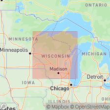
- Wisconsin arch
Summary:
Pg. vi (chart), 4-7. Medford Member of Marathon Formation. (Name credited to J.W. Attig and M.A. Muldoon, in press [Wisconsin Geol. Nat. Hist. Survey Inf. Circ., no. 65, 1989], and M.A. Muldoon, 1987, Univ. Wisconsin MS thesis.)
Till. Very dark gray to gray calcareous loam or silt loam. Pebble fabric strongly developed; long axes oriented NNW-SSE direction and dip upglacier (north-northwest). Is only exposed at type section where it underlies Merrill Member of Lincoln Formation with sharp contact; thickness 3 m. In subsurface, lies above Wausau Member and below Edgar Member (both of Marathon Formation); thickness 4 to 7 m. When compared with the Edgar, the Medford is darker, grayer, and contains more shale fragments and montmorillonite clay. Age is tentatively considered pre-Wisconsinan. Possibly age-equivalent of Hersey Member of Pierce Formation in western Wisconsin which Baker, 1984 (Wisconsin Geol. Nat. Hist. Survey Gdbk., no. 11, p. 1-16) interpreted to be pre-Illinoian.
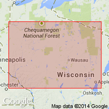
Type section: stream cut in south bank of Little Black River, in SE/4 NE/4 SE/4 sec. 3, T. 30 N., R. 1 E., [approx. Lat. 45 deg. 06 min. 33 sec. N., Long. 90 deg. 21 min. 21 sec. W.], Stetsonville 7.5-min quadrangle, Taylor Co., north-central WI.
Named from town of Medford, Taylor Co., north-central WI, [northeast of type section]; name credited to John W. Attig and Maureen A. Muldoon.
Reference section [composite]: two closely spaced power-auger holes (Wisconsin Geol. Nat. Hist. Survey (WGNHS) nos. Mr-1138 and Mr-1169) near crest of hill, btw. two barns, on north side County Trunk Highway N, in SE/4 SW/4 SW/4 sec. 17, T. 28 N., R. 2 E., [approx. Lat. 44 deg. 54 min. 10 sec. N., Long. 90 deg. 17 min. 44 sec. W.], Abbotsford 7.5-min quadrangle, Marathon Co., north-central WI.
[Additional locality information from USGS historical topographic map collection TopoView and Wisconsin Highways, www.wisconsinhighways.org; accessed on June 9, 2018.]
Source: Publication.
- Usage in publication:
-
- Medford Member
- Modifications:
-
- Overview
- AAPG geologic province:
-
- Wisconsin arch
Summary:
[Not synopsized to date. Lithology, thickness, distinguishing characteristics, contacts, sections, areal extent, age, correlations discussed.]
Pg. 4 (fig. 2), 7 (fig. 3), 8, 33
Source: NA
For more information, please contact Nancy Stamm, Geologic Names Committee Secretary.
Asterisk (*) indicates published by U.S. Geological Survey authors.
"No current usage" (†) implies that a name has been abandoned or has fallen into disuse. Former usage and, if known, replacement name given in parentheses ( ).
Slash (/) indicates name conflicts with nomenclatural guidelines (CSN, 1933; ACSN, 1961, 1970; NACSN, 1983, 2005, 2021). May be explained within brackets ([ ]).