- Usage in publication:
-
- McKissick Grove shale member
- Modifications:
-
- Revised
- AAPG geologic province:
-
- Forest City basin
Summary:
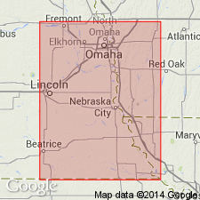
Pg. 73, 74, 80. McKissick Grove shale member of Wabaunsee formation. As originally defined by Smith it included all Pennsylvanian beds above Tarkio limestone in Iowa. This definition is objectionable, because topmost bed of Pennsylvanian of Iowa probably is covered somewhere in Missouri River bluffs or in uplands, awaiting discovery, and therefore is not a fixed horizon. Highest known exposed Pennsylvanian horizon of Iowa is in lower part of Aspinwall shale, but highest well-defined marker would be Brownville limestone or the better-shown Dover limestone, which outcrops at McKissick Grove, below which Tarkio limestone is exposed. If McKissick Grove is to be retained it should have definite upper and lower boundaries. This has been taken up with Iowa Geol. Survey in field and decided that top of McKissick Grove member should be at base of Brownville limestone. As thus defined the member is 63 feet thick, and is divided into (descending) Pony Creek shale, Dover limestone, Table Creek shale, Maple Hill limestone, and Pierson Point shale. Age is Late Pennsylvanian (Missouri age). Report includes cross sections, measured sections, geologic maps, stratigraphic tables.
Source: US geologic names lexicon (USGS Bull. 896, p. 1255); GNC KS-NE Pennsylvanian Corr. Chart, sheet 1, Oct. 1936; supplemental information from GNU records (USGS DDS-6; Denver GNULEX).

- Usage in publication:
-
- McKissick Grove shale
- Modifications:
-
- Revised
- AAPG geologic province:
-
- Nemaha anticline
Summary:
Pg. 96. McKissick Grove shale of Wabaunsee group. Includes (descending) Pony Creek shale, Jim Creek limestone [so-called], Table Creek shale, Dover limestone, Frenck shale [French Creek], Maple Hill limestone, and Pierson Point shale members. Underlies Brownville limestone and overlies Tarkio limestone, both of Wabaunsee. Age is Late Pennsylvanian (Virgil).
Source: US geologic names lexicon (USGS Bull. 896, p. 1255-1256); GNC KS-NE Pennsylvanian Corr. Chart, sheet 2, Oct. 1936.
For more information, please contact Nancy Stamm, Geologic Names Committee Secretary.
Asterisk (*) indicates published by U.S. Geological Survey authors.
"No current usage" (†) implies that a name has been abandoned or has fallen into disuse. Former usage and, if known, replacement name given in parentheses ( ).
Slash (/) indicates name conflicts with nomenclatural guidelines (CSN, 1933; ACSN, 1961, 1970; NACSN, 1983, 2005, 2021). May be explained within brackets ([ ]).

