- Usage in publication:
-
- McKinney basalt*
- Modifications:
-
- Original reference
- Dominant lithology:
-
- Basalt
- AAPG geologic province:
-
- Snake River basin
Summary:
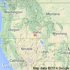
Pg. 434-439; H.T. Stearns, 1932 (Corr. chart of Idaho compiled by M.G. Wilmarth, dated Sept. 1, 1932). McKinney basalt. Decidedly porphyritic grayish-black pahoehoe basalt containing phenocrysts of fresh green olivine and long laths of plagioclase. Thickness 20 feet on plains and 500 feet in Snake River Canyon. Issued from McKinney Butte, northwest of Gooding, and displaced part of Big Wood River and Snake River between King Hill and Bliss, Gooding County region, southern Idaho. Older than Sand Springs basalt and may be older than Bliss basalt, or latter may be a subaqueous facies of the McKinney. Age is Pleistocene.
Type locality: McKinney Butte, northwest of Gooding, [in sec. 5, T. 4 S., R. 14 E., approx. Lat. 43 deg. 01 min. 13 sec. N., Long. 114 deg. 49 min. 11 sec. W., McKinney Butte 7.5-min quadrangle], Gooding Co., southern ID (additional locality information from USGS GNIS database, accessed April 21, 2012).
Source: US geologic names lexicons (USGS Bull. 896, p. 1255; USGS Bull. 1200, p. 2305).
- Usage in publication:
-
- McKinney basalt*
- Modifications:
-
- Areal extent
- AAPG geologic province:
-
- Snake River basin
Summary:
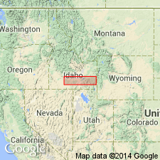
Pg. 30, 76-78, pl. 5. McKinney basalt. Mapped along the Snake River between King Hill and Big Wood River, in Gooding and Elmore Counties, southern Idaho. Thickness about 500 feet. Rests on Hagerman lake beds and Malad basalt. Pleistocene, but age is difficult to determine.
[GNC remark (ca. 1960, US geologic names lexicon, USGS Bull. 1200, p. 2305): The USGS currently designates age of McKinney Basalt as Recent on basis of study now in progress.]
Source: Publication; US geologic names lexicon (USGS Bull. 1200, p. 2305).
- Usage in publication:
-
- McKinney Basalt*
- Modifications:
-
- Age modified
- Areal extent
- AAPG geologic province:
-
- Snake River basin
Summary:
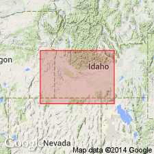
Pg. 1216, 1217. McKinney Basalt of Snake River Group (new). Restricted to Recent lava flow from McKinney Butte; the columnar lava thought to be younger McKinney by Stearns and others (1938) is called Bancroft Springs Basalt. Extends 20 miles west of McKinney Butte to the Snake River near Glenns Ferry, [Gooding County], southern Idaho. Consists of highly porphyritic plagioclase-olivine basalt. Overlies Melon Gravel or Wendell Grade Basalt. Age is considered Recent, based on comparatively unmodified surfaces and, along Snake River, stratigraphic relations.
Source: Publication.
- Usage in publication:
-
- McKinney Basalt*
- Modifications:
-
- Age modified
- Areal extent
- AAPG geologic province:
-
- Snake River basin
Summary:
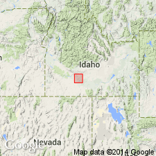
F2 (fig. 2), F4, F16-F18. McKinney Basalt of Snake River Group. Lies beneath Melon Gravel, in exposures along the Union Pacific RR 4 miles southeast of King Hill, 200 feet above Snake River. Thus the McKinney (and Wendell Grade Basalt) is older than previously thought and considered late Pleistocene. The columnar basalts and pillow lava included in the McKinney and †Bliss Basalts, respectively, by Stearns (1936) and Stearns and others (1938), and later termed †Bancroft Springs Basalt (abandoned) by Malde and Powers (1962) are here considered part of the same flow, based on paleomagnetic studies (see section on paleomagnetism by Allan Cox, p. F19-F20) and stratigraphic relations, and are included in the McKinney.
Source: Publication; Changes in stratigraphic nomenclature, 1971 (USGS Bull. 1372-A, p. A12-A13).
- Usage in publication:
-
- McKinney Basalt*
- Modifications:
-
- Overview
- AAPG geologic province:
-
- Snake River basin
Summary:
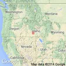
Erupted from McKinney Butte 9 mi northeast of Bliss, ID in Snake River basin. The lacustrine clay upstream from the lava dam created by the Pleistocene McKinney has previously been assigned to Bruneau Formation of Idaho Group. The upstream clay is younger than Bruneau and is assigned as a new unit, Yahoo Clay, to the Snake River Group.
Source: GNU records (USGS DDS-6; Denver GNULEX).
For more information, please contact Nancy Stamm, Geologic Names Committee Secretary.
Asterisk (*) indicates published by U.S. Geological Survey authors.
"No current usage" (†) implies that a name has been abandoned or has fallen into disuse. Former usage and, if known, replacement name given in parentheses ( ).
Slash (/) indicates name conflicts with nomenclatural guidelines (CSN, 1933; ACSN, 1961, 1970; NACSN, 1983, 2005, 2021). May be explained within brackets ([ ]).

