The National Geologic Map Database is migrating to a new infrastructure. We apologize for any service disruptions during this process.
|
|---|


- Usage in publication:
-
- McKenzie Hill limestone
- Modifications:
-
- Overview
- Dominant lithology:
-
- Limestone
- AAPG geologic province:
-
- South Oklahoma folded belt
Summary:
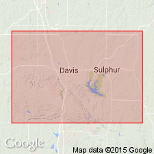
Pg. 982-983. McKenzie Hill limestone of McKenzie group. C.E. Decker has recently subdivided Arbuckle limestone into several units, but the published digest of his paper (Tulsa Geol. Soc. Digest, 1933, p. 55-57) does not give much idea of boundaries of his subdivisions. The Honey Creek, Fort Sill, Royer, and Signal Mountain formations had previously been described by Ulrich. The names Chapman Ranch and McKenzie Hill (the former from Chapman's Ranch on Highway 77 and the latter from a small hill south of Signal Mountain, near Fort Sill, Oklahoma) have never been defined, although Ulrich has used them repeatedly in correspondence and manuscript. The following sequence and approximate position of these units (descending): (1) Undifferentiated Arbuckle limestone; (2) McKenzie Hill, boundary indefinite to (3) Chapman Ranch; (4) unnamed unit, boundary indefinite to (5) Signal Mountain; (6) Royer; (7) Fort Sill; and (8) Honey Creek, which rests on Reagan sandstone. In describing fossils from Missouri, Ulrich and I (Missouri Geol. Survey Bull., no. 24, 1930, p. 195) stated that some of species also occur in Ulrich's proposed Chapman Ranch formation, and also that the Chapman is in part = the Van Buren. This would restrict it to the 144 feet of beds in Decker's unit 184 and possibly some of unit 183. Ulrich has always used McKenzie Hill to denote limestones in Arbuckle and Wichita Mountains which carry Gasconade fauna, and in this section the name should be applied to Decker's units 181, 182, and possibly 183. The contact between the two has not been satisfactorily established in the section. Age is Early Ordovician. Present in Murray Co., central southern OK. See also under Arbuckle group, Decker, 1933.
Source: US geologic names lexicon (USGS Bull. 896, p. 1254).
- Usage in publication:
-
- McKenzie Hill formation*
- Modifications:
-
- Principal reference
- AAPG geologic province:
-
- South Oklahoma folded belt
Summary:
Pg. 16 (table 1), 23-24; 1939, GSA Bull., v. 50, no. 7, p. 1318-1319, table 1. McKenzie Hill Formation. Divided into two members: Chapman Ranch below and McMichel (new) above. Thickness 674 to 1,122 feet in Arbuckles; 223 to 1,019 feet in Wichitas. Overlies Butterly formation (new); underlies Strange formation (new); or where the Strange is absent, underlies Cool Creek formation. Type section and derivation of name given.
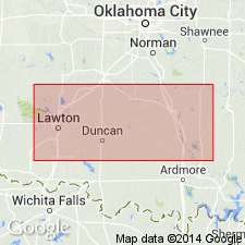
Type section: near top of McKenzie Hill on its westem slope. Named from McKenzie Hill, a limestone hill about 7 mi northwest of Lawton and 1 mi south of Signal Mountain, in secs. 8 and 9, T. 2 N., R. 12 W., Comanche Co., central southern OK.
Source: US geologic names lexicon (USGS Bull. 1200, p. 2304).
For more information, please contact Nancy Stamm, Geologic Names Committee Secretary.
Asterisk (*) indicates published by U.S. Geological Survey authors.
"No current usage" (†) implies that a name has been abandoned or has fallen into disuse. Former usage and, if known, replacement name given in parentheses ( ).
Slash (/) indicates name conflicts with nomenclatural guidelines (CSN, 1933; ACSN, 1961, 1970; NACSN, 1983, 2005, 2021). May be explained within brackets ([ ]).