

- Usage in publication:
-
- McKenney Ponds limestone member*
- Modifications:
-
- Named
- Biostratigraphic dating
- Dominant lithology:
-
- Limestone
- Arkose
- Conglomerate
- Slate
- Sandstone
- AAPG geologic province:
-
- New England province
Summary:
Pg.159, 168-169, pl. 34. McKenney Ponds limestone member of Tarratine formation (new). Occurs in a small area in northern Somerset County, Maine, just northwest of Enchanted Pond. Consists of white-weathering, coarse-grained limestone exhibiting rounded solution surfaces and composed largely of pelmatozoan debris with some quartz and feldspar grains. Also consists of subordinate slate and dark sandstone resembling that of Tarratine formation near contacts with main body. Base of member northeast of McKenney Ponds is arkosic, containing angular, unweathered, cream-colored feldspar fragments and well-rounded frosted quartz grains, and much calcareous cement. Northwest of McKenney Ponds, contains shell debris and quartz, feldspar, granitic, and felsite pebbles. Occurs near base of formation. Thickness as much as 200 feet in McKenney Ponds area, thinner elsewhere. Grades laterally into main part of Tarratine. In places rests on granitic rocks of basement complex and in others on undifferentiated volcanic rocks of Silurian or Ordovician age. Contacts hard to distinguish. Age is Devonian (Oriskany), based on brachiopods BEACHIA and HIPPARIONYX. Report includes geologic map and correlation chart.
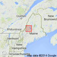
Type section: at northeast end of McKenney Ponds, Upper Enchanted Twp., Pierce Pond 15-min quadrangle, northern Somerset Co., west-central ME. Named from McKenney Ponds.
Source: GNU records (USGS DDS-6; Reston GNULEX); US geologic names lexicon (USGS Bull. 1350, p. 453).

- Usage in publication:
-
- McKenney Ponds Limestone Member*
- Modifications:
-
- Age modified
- Biostratigraphic dating
- AAPG geologic province:
-
- New England province
Summary:
Age refined to Early Devonian, late Siegenian (Oriskanian) based on shelly fauna and conodonts at three localities in Pierce Pond quad, ME, near McKenney Ponds (Boucot and Heath, 1969).
Source: GNU records (USGS DDS-6; Reston GNULEX).
For more information, please contact Nancy Stamm, Geologic Names Committee Secretary.
Asterisk (*) indicates published by U.S. Geological Survey authors.
"No current usage" (†) implies that a name has been abandoned or has fallen into disuse. Former usage and, if known, replacement name given in parentheses ( ).
Slash (/) indicates name conflicts with nomenclatural guidelines (CSN, 1933; ACSN, 1961, 1970; NACSN, 1983, 2005, 2021). May be explained within brackets ([ ]).