- Usage in publication:
-
- McCracken sandstone member
- Modifications:
-
- Original reference
- Dominant lithology:
-
- Sandstone
- Dolomite
- Shale
- AAPG geologic province:
-
- Paradox basin
Summary:
Pg. 56, 57 (fig. 1); J.C. Cooper, 1955, same vol., p. 62 (tbl. 1) McCracken Sandstone Member of Elbert Formation. Recognized in subsurface of southeastern Utah, northeastern Arizona, southwestern Colorado, and northwestern New Mexico. Consists predominantly of white, light-gray to red sandstone, fine- to medium-grained, some coarse, generally poorly sorted, commonly glauconitic, with a few streaks of sandy dolomite. Thickness of 112 feet in type well, between depths of 8,049 and 8,161 feet. Underlies unnamed upper member of Elbert formation with transitional contact; overlies Aneth formation (new) probably unconformably. Interfingers out into Elbert formation undifferentiated to the west. Age is Late Devonian.
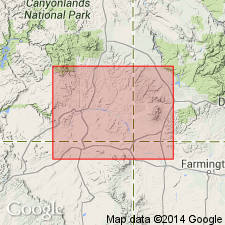
Type section (subsurface): depth-interval 8,049 to 8,161 ft, in Shell Oil Bluff Unit No. 1 well, in sec. 32, T. 39 S., R. 23 E., on McCracken Mesa near town of Blanding, [Recapture Pocket 7.5-min quadrangle], San Juan Co., southeastern UT.
[Typographical errors: on p. 63 of Cooper (1955), location of well given as T. 29 S.; on p. 2293 (US geologic names lexicon, USGS Bull. 1200), top of the McCracken given as 8,059 ft below surface.]
Source: Publication; US geologic names lexicon (USGS Bull. 1200, p. 2293).
For more information, please contact Nancy Stamm, Geologic Names Committee Secretary.
Asterisk (*) indicates published by U.S. Geological Survey authors.
"No current usage" (†) implies that a name has been abandoned or has fallen into disuse. Former usage and, if known, replacement name given in parentheses ( ).
Slash (/) indicates name conflicts with nomenclatural guidelines (CSN, 1933; ACSN, 1961, 1970; NACSN, 1983, 2005, 2021). May be explained within brackets ([ ]).

