The National Geologic Map Database is migrating to a new infrastructure. We apologize for any service disruptions during this process.
|
|---|


- Usage in publication:
-
- McAlester shale*
- Modifications:
-
- Original reference
- Dominant lithology:
-
- Shale
- Sandstone
- Coal
- AAPG geologic province:
-
- Arkoma basin
Summary:
Pg. 437. McAlester shale. Consists of (ascending): (1) 800 feet of shale with thin sandstone and coal, the Hartshorne or Grady coal at or just above base; (2) three or four beds of sandstone separated by shale beds, 100 to 200 feet thick, aggregating 500 feet; and (3) 700 feet of blue, gray, or black shale, with McAlester coal about 50 feet above base and several thin coals higher up. Overlies Hartshorne sandstone and underlies Savanna sandstone. Age is Pennsylvanian (Allegheny). Report includes geologic map.
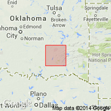
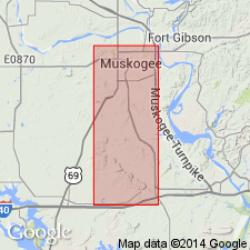
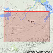
Named from exposures around McAlester, in McAlester coal district, McAlester quadrangle, Pittsburg Co., eastern OK. Also occurs in the Lehigh coal district, Atoka and Colgate quadrangles, eastern OK, where it consists generally of cherty sandstone beds and two workable coal beds.
Source: US geologic names lexicon (USGS Bull. 896, p. 1245-1246); supplemental information from GNU records (USGS DDS-6; Denver GNULEX).

- Usage in publication:
-
- McAlester shale*
- Modifications:
-
- Overview
- AAPG geologic province:
-
- Arkoma basin
- Chautauqua platform
Summary:
In 1907 (USGS Bull. 326) the McAlester shale was raised to rank of a group in Arkansas coal field, [western Arkansas], where its supposed equivalents were named (descending) Paris shale, Fort Smith formation, and Spadra shale, the sandstone overlying Paris shale being supposed to correspond to true Savanna sandstone of Oklahoma. Later work (by T.A. Hendricks and C.B. Read) led to opinion that true Savanna sandstone of Oklahoma corresponded to lower part of Savanna sandstone, the Paris shale, and upper part of Fort Smith formation of Arkansas. (See AAPG Bull., v. 18, no. 8, 1934, p. 1050, 1058.) Subsequent work (by B. Parks and T.A. Hendricks) led to (1) identification of Boggy shale of Oklahoma with so-called Savanna sandstone and upper part of Paris shale of Arkansas coal field; (2) identification of true Savanna sandstone of Oklahoma with lower part of Paris shale and upper part of Fort Smith formation of Arkansas; and (3) identification of lower part of Fort Smith formation and Spadra shale of Arkansas with true McAlester shale of Oklahoma. They therefore extended the Oklahoma names (descending) Boggy shale, Savanna sandstone, and McAlester shale into Arkansas coal field, to replace so-called Savanna sandstone, Paris shale, Fort Smith formation, and Spadra shale of that area, all of which names were discarded, as was McAlester group as used in Arkansas.
The base of McAlester shale in Oklahoma is drawn at top of 1st sandstone below Upper Hartshorne coal, and in Arkansas at top of 1st sandstone below Lower Hartshorne coal.
Age is Pennsylvanian (Allegheny).
Source: US geologic names lexicon (USGS Bull. 896, p. 1245-1246).
- Usage in publication:
-
- McAlester formation*
- Modifications:
-
- Revised
- AAPG geologic province:
-
- Chautauqua platform
Summary:
Pg. 507-508. McAlester formation (McAlester shale). Includes four recognizable members (ascending): McCurtain shale, Warner sandstone, Lequire sandstone, and Cameron sandstone (all new). Upper Hartshorne occurs near base. Thickness 125 to 382 feet. Overlies Hartshorne sandstone; underlies Savanna sandstone. Age is Pennsylvanian. Report includes geologic map, columnar sections, measured sections.
Source: Publication; US geologic names lexicon (USGS Bull. 1200, p. 2288); supplemental information from GNU records (USGS DDS-6; Denver GNULEX).
- Usage in publication:
-
- McAlester formation*
- Modifications:
-
- Revised
- AAPG geologic province:
-
- Arkoma basin
Summary:
Pg. 17, 26-44. McAlester formation. Redefined [Revised]; stratigraphically expanded below to include Lower Hartshorne coal and underlying shale; expanded above to include Tamaha sandstone and Keota sandstone members formerly included in Savanna formation. As thus redefined, includes (ascending) McCurtain shale, Warner sandstone, unnamed shale, Lequire sandstone, unnamed shale, Cameron sandstone, unnamed shale, Keote sandstone, and unnamed shale members. Thickness 700 to 2,000 feet; thinning is northward. Overlies Hartshorne sandstone; underlies Savanna formation. Age is Middle Pennsylvanian (Des Moines). Report includes geologic map, measured sections, nomenclature history.
Source: Publication; US geologic names lexicon (USGS Bull. 1200, p. 2288).
For more information, please contact Nancy Stamm, Geologic Names Committee Secretary.
Asterisk (*) indicates published by U.S. Geological Survey authors.
"No current usage" (†) implies that a name has been abandoned or has fallen into disuse. Former usage and, if known, replacement name given in parentheses ( ).
Slash (/) indicates name conflicts with nomenclatural guidelines (CSN, 1933; ACSN, 1961, 1970; NACSN, 1983, 2005, 2021). May be explained within brackets ([ ]).