The National Geologic Map Database is migrating to a new infrastructure. We apologize for any service disruptions during this process.
|
|---|


- Usage in publication:
-
- Maynardville limestone
- Modifications:
-
- Named
- Dominant lithology:
-
- Limestone
- Dolomite
- AAPG geologic province:
-
- Appalachian basin
Summary:
Named Maynardville limestone. Consists of thin-bedded to massive, light-bluish gray to dark-gray, fine to coarse-grained, more or less laminated limestone, with dark-gray dolomite forming upper third of formation. Basal third contains limestone conglomerate in which small black clay balls suggest oolitic textures. Sometimes thin bluish-green calcareous shale occurs in lower part and dark-gray chert occurs sparingly in upper beds. On west side of valley top is usually marked by 2 feet of dark-gray shaly dolomite with undulating upper contact. On east side of valley upper limit is formed by 5 to 10 feet of sandstone. Thin arenaceous zones occur. Thickness is 60 to 250 feet. Unit has been included in the Knox dolomite previously. Its known fossils consist of problematical cystid plates and an unidentified species of CRYPTOZOON. Croixan trilobites occur up to the base of the formation. The Maynardville unconformably underlies Conococheague-Copper Ridge formation and overlies Nolichucky formation.
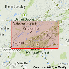
Named for Maynardville, Union Co., TN.
Source: Modified from GNU records (USGS DDS-6; Reston GNULEX).

- Usage in publication:
-
- Maynardville Limestone*
- Modifications:
-
- Revised
- Areal extent
- AAPG geologic province:
-
- Appalachian basin
Summary:
The Maynardville Limestone of the Conasauga Group is used in the Rome thrust sheet in GA and AL. It overlies the Nolichucky Shale and is the uppermost unit of the group. Age is Late Cambrian.
Source: GNU records (USGS DDS-6; Reston GNULEX).

- Usage in publication:
-
- Maynardville Limestone
- Modifications:
-
- Overview
- AAPG geologic province:
-
- Appalachian basin
Summary:
Maynardville Limestone mapped in Roane Co., eastern TN. Unit is unassigned to group in this report. Upper third of unit consists of light- to medium-gray, fine-grained, laminated to thinly bedded dolomite. Distinguished from overlying Knox Group by lack of chert. Limestone below is medium-gray, fine-grained, thin- to very thick bedded and characteristically ribboned with shale seams and dolomite laminae. Thickness ranges from 200 to 400 ft. Overlies Middle Cambrian Conasauga Shale. Age is Late Cambrian.
Source: GNU records (USGS DDS-6; Reston GNULEX).
- Usage in publication:
-
- Maynardville Limestone*
- Modifications:
-
- Areal extent
- AAPG geologic province:
-
- Appalachian basin
Summary:
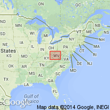
Geographically extended the Maynardville Limestone of the Conasauga Group into the subsurface of WV in the Rome trough of section F-F'. Overlies the Nolichucky Shale of the Conasauga Group and underlies the lower sandstone member of the Copper Ridge Dolomite. The Maynardville is of Late Cambrian (Franconian) age.
Source: GNU records (USGS DDS-6; Reston GNULEX).
- Usage in publication:
-
- Maynardville Limestone*
- Modifications:
-
- Overview
- AAPG geologic province:
-
- Appalachian basin
Summary:
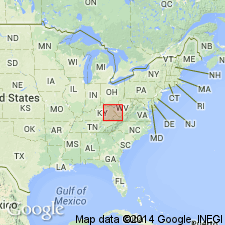
The Maynardville Limestone of the Conasauga Group occurs in the subsurface of KY in the Rome trough as shown in section G-G'. Overlies the Nolichucky Shale of the Conasauga Group and underlies the Copper Ridge Dolomite. Unit extends eastward into the Valley and Ridge province of WV and VA. The Maynardville is of Late Cambrian age.
Source: GNU records (USGS DDS-6; Reston GNULEX).
For more information, please contact Nancy Stamm, Geologic Names Committee Secretary.
Asterisk (*) indicates published by U.S. Geological Survey authors.
"No current usage" (†) implies that a name has been abandoned or has fallen into disuse. Former usage and, if known, replacement name given in parentheses ( ).
Slash (/) indicates name conflicts with nomenclatural guidelines (CSN, 1933; ACSN, 1961, 1970; NACSN, 1983, 2005, 2021). May be explained within brackets ([ ]).