

- Usage in publication:
-
- Maxon sandstone
- Modifications:
-
- Original reference
- Dominant lithology:
-
- Sandstone
- AAPG geologic province:
-
- Permian basin
Summary:
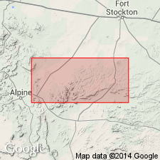
Pg. 91-93, geol. map. Maxon sandstone. Outcrops in prominent ledge midway up scarps along east side of Marathon basin. Extends south from vicinity of Gap Tank at least as far as southeast corner of Marathon basin. Southernmost observed outcrop is 1 mile north of Jones Ranch house. First described by Baker and Bowman (1917, Univ. Texas Bull., no. 1753, p. 61-177), but age not discussed. Later mentioned by T.W. Stanton (1928, Amer. Jour. Sci., 5th ser., v. 16, p. 404), who noted that it has much same age and relationships as Paluxy sand of north-central Texas. These sands are but part of a transgressive series of basal sands of indefinite stratigraphic position. For this reason, within area of this report (Glass Mountains), the basal sands in the north are termed Basement sands; those to the south occur at definite level between rocks of Fredericksburg and Trinity ages and are deserving of a formational name. Paluxy cannot appropriately be applied here because the two sands are now widely separated and probably were never a continuous deposit. A new name (Maxon) is thus necessary. It outcrops in rather prominent ledges about 100 feet above valley level east of type locality and caps several buttes of Glen Rose formation to west of it. It is a brown, well indurated, coarse- to medium-grained sandstone with prominent cross-bedding. In places there are one or more thin shaly layers. It is 90 feet thick 1.5 miles south of Gap Tank, sec. 61. According to Stanton it is 145 feet thick in scarps immediately north of Tesnus Station. Near the tank it loses its massive character and is interbedded with conglomerate and sandy marl. Passes out by overlap about 1 mile north of this place. In Mesas 5 to 8 miles east of Gap Tank it can be traced north, overlapping beyond point of disappearance of Glen Rose formation, to form Basement sands of that area. No fossils found. Stanton writes: "Whether it should be classified as Trinity or Fredericksburg is largely a matter of personal preference. Following the precedent established in classifying Paluxy sand of north-central Texas, which is in approximately same stratigraphic position, it would be placed in Trinity, but it may well be in part at least of Fredericksburg age."
Type locality: Maxon Station, near point where the Southern Pacific RR leaves Marathon basin, northeastern Brewster Co., TX. Named from Maxon Station.
[No longer exists; formerly a rail siding and station stop on the Southern Pacific RR 29 mi southeast of Marathon. It was once called Maxon Spring after Lt. Mason M. Maxon, who discovered the spring while on calvary patrol in 1871 (Handbook of Texas Online, http://www.tshaonline.org/handbook/online/articles/MM/hvm51.html). Located in vicinity of Lat. 30 deg. 04 min. 15 sec. N., Long. 102 deg. 51 min. 14 sec. W., Tesnus SE 7.5-min quadrangle, TX (from ; TXGenWeb (http://www. ); G.F. Cram, 1888, Railroad and County map of Texas, scale 1:2,344,000 (http://www. ) available online through the University of Alabama).]
Source: US geologic names lexicon (USGS Bull. 896, p. 1323-1324).
- Usage in publication:
-
- Maxon Limestone*
- Modifications:
-
- Redescribed
- Mapped 1:62.5k
- Dominant lithology:
-
- Limestone
- Sandstone
- Siltstone
- AAPG geologic province:
-
- Permian basin
Summary:
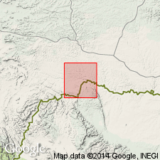
Is formation mapped in eastern Brewster Co, TX along Rio Grande in Permian basin. Overlies Glen Rose Limestone; underlies Walnut Clay. Redescribed [locally] as limestone [no explanation or discussion given]. Map unit described as mostly limestone and clayey limestone, with subordinate sandstone and siltstone. Limestone is medium gray, partly clayey, thin bedded, fossiliferous, and weathers to nodules in part. Siltstone and fine- to medium-grained sandstone are moderate yellowish brown weathering dark yellowish brown, friable to firmly cemented with calcite, and are in five thick beds that compose about 10 percent of unit. Exposed along Rio Grande. About 250 ft thick. Age is Early Cretaceous.
Source: GNU records (USGS DDS-6; Denver GNULEX).
- Usage in publication:
-
- Maxon Sandstone
- Modifications:
-
- Mapped 1:250k
- Dominant lithology:
-
- Sandstone
- Limestone
- AAPG geologic province:
-
- Permian basin
Summary:
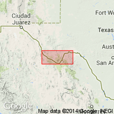
Is Lower Cretaceous formation mapped in central Brewster Co, TX (southern part of Permian basin). Overlies Glen Rose Formation. Overlain by Telephone Canyon Formation. Map unit described as mostly sandstone, fine grained, calcareous, well cemented to friable, massive to bedded, white to yellow and reddish; limestone, nodular to bedded, hard to soft, white to yellow; thickness 114 ft in area of Santiago Mountains, feathers out eastward and southward short of Big Bend National Park and Black Gap area.
Source: GNU records (USGS DDS-6; Denver GNULEX).
For more information, please contact Nancy Stamm, Geologic Names Committee Secretary.
Asterisk (*) indicates published by U.S. Geological Survey authors.
"No current usage" (†) implies that a name has been abandoned or has fallen into disuse. Former usage and, if known, replacement name given in parentheses ( ).
Slash (/) indicates name conflicts with nomenclatural guidelines (CSN, 1933; ACSN, 1961, 1970; NACSN, 1983, 2005, 2021). May be explained within brackets ([ ]).