The National Geologic Map Database is migrating to a new infrastructure. We apologize for any service disruptions during this process.
|
|---|


- Usage in publication:
-
- Mauzy Formation*
- Modifications:
-
- Named
- Dominant lithology:
-
- Shale
- Siltstone
- Limestone
- AAPG geologic province:
-
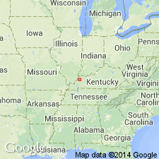
- Illinois basin
Summary:
Interbedded shale, siltstone, and limestone with minor sandstone and coal beds are here named the Mauzy Formation in the western Kentucky coal field. Conformably overlies the Sturgis Formation, and includes strata of Early Permian age previously included in the Sturgis; the upper contact has been removed by erosion. Thickness at type section is 390 ft; total thickness may be as much as 1,300 ft. The boundary between the Pennsylvanian and Permian Systems cannot be defined precisely, but is placed at the proposed contact between the Sturgis and the Mauzy. Fusulinids of Early Permian age are found 140 ft above the boundary.
Source: GNU records (USGS DDS-6; Reston GNULEX).
For more information, please contact Nancy Stamm, Geologic Names Committee Secretary.
Asterisk (*) indicates published by U.S. Geological Survey authors.
"No current usage" (†) implies that a name has been abandoned or has fallen into disuse. Former usage and, if known, replacement name given in parentheses ( ).
Slash (/) indicates name conflicts with nomenclatural guidelines (CSN, 1933; ACSN, 1961, 1970; NACSN, 1983, 2005, 2021). May be explained within brackets ([ ]).