The National Geologic Map Database is migrating to a new infrastructure. We apologize for any service disruptions during this process.
|
|---|


- Usage in publication:
-
- Masuk shale
- Modifications:
-
- Original reference
- Dominant lithology:
-
- Shale
- AAPG geologic province:
-
- Paradox basin
Summary:
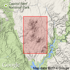
Pg. 4+. Masuk shale. Gray argillaceous shale, slightly arenaceous toward top. Thickness 500 feet. Underlies Masuk sandstone and overlies Blue Gate sandstone in Masuk Plateau. Present in Henry Mountains region, [Wayne and Garfield Counties], central southern Utah. Age is Late Cretaceous.
[GNC remark (ca. 1938, US geologic names lexicon, USGS Bull. 896, p. 1318): †Masuk shale in Mancos shale. [??]Now treated by USGS as top member of Mancos in Henry Mountains region, but name conflicts with Masuk sandstone, the adopted name.]
Source: US geologic names lexicon (USGS Bull. 896, p. 1318).
- Usage in publication:
-
- Masuk Member*
- Modifications:
-
- Revised
- Areal extent
- AAPG geologic province:
-
- Paradox basin
Summary:
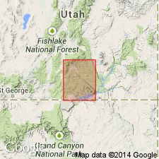
Is upper member (of five) members of Upper Cretaceous Mancos Shale mapped only in northeast part of quad, in the Henry basin, east of Waterpocket fold, Garfield Co, UT in the Paradox basin. Mapped limit represents the southwest limit for the member. Is 700 to 900 ft thick. Overlies Emery Sandstone Member; underlies Mesaverde Formation. Term "Shale" not used as part of geologic name. Is equivalent to upper part of Wahweap Formation and lower part of Kaiparowits Formation of Kaiparowits Plateau to southwest in quad.
Source: GNU records (USGS DDS-6; Denver GNULEX).

- Usage in publication:
-
- Masuk Member*
- Modifications:
-
- Areal extent
- AAPG geologic province:
-
- Paradox basin
Summary:
Restricted to the Henry Mountains, Paradox basin. Name has been applied to rocks between the Emery Sandstone and the Star Point Sandstone in the western Book Cliffs and Wasatch Plateau; these strata are neither the same lithology nor age as the type Masuk in the Henry Mountains. Rocks of the Book Cliffs and Wasatch Plateau areas assigned to the upper part of the Blue Gate Member of the Mancos.
Source: GNU records (USGS DDS-6; Denver GNULEX).
- Usage in publication:
-
- Masuk Shale Member
- Modifications:
-
- Contact revised
- AAPG geologic province:
-
- Paradox basin
Summary:
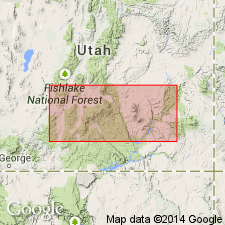
Is uppermost member (of five members) of Mancos Shale in Henry Mountains and in Paradox basin. Lower contact revised in that Masuk overlies Muley Canyon Sandstone Member (named) of Mancos. Upper contact revised in that Masuk underlies Tarantula Mesa Sandstone (named). Is of Late Cretaceous, or early and late Campanian age. Correlates with lower member of Wahweap Formation on Kaiparowits Plateau and with upper part of Blackhawk Formation on Wasatch Plateau. Is of inter-deltaic fluvial and estuarine origin.
Source: GNU records (USGS DDS-6; Denver GNULEX).
- Usage in publication:
-
- Masuk Formation
- Modifications:
-
- Revised
- Dominant lithology:
-
- Coal
- Shale
- Sandstone
- Siltstone
- Mudstone
- AAPG geologic province:
-
- Paradox basin
Summary:
Is a unit recognized in the Henry Mountain area, Garfield Co, UT in the Paradox basin. Removed from Mancos Shale. Stratigraphic rank modified from Masuk Member to Masuk Formation because of its dominant lithology and mappability. Overlies Muley Canyon Sandstone (also removed from Mancos and assigned formation rank). Underlies Tarantula Mesa Sandstone. Stratigraphic charts. Measured section. Type section measured and designated at SE NE sec 27, T31S, R8E through SW NW sec 26, T31S, R8E on prominent west-facing cliff on east side of Blind Trail, Garfield Co, where it is 223.7 m thick. Divided into: 1) lower member 4 to 20 m thick consisting of coal, carbonaceous shale, ripple laminated sandstone; 2) middle member 120 m thick consisting of drab mudstone, carbonaceous shale, and sandstone; 3) upper member 38 m thick consisting of sandstone, mudstone, carbonaceous siltstone at type. Fossils: freshwater mollusks, crab claws, vertebrates (fish, salamanders, frogs, crocodiles, turtles, dinosaurs, mammals). Is a nonmarine unit--partly fluvial, poorly drained floodplain deposit. Assigned an early Campanian age.
Source: GNU records (USGS DDS-6; Denver GNULEX).
For more information, please contact Nancy Stamm, Geologic Names Committee Secretary.
Asterisk (*) indicates published by U.S. Geological Survey authors.
"No current usage" (†) implies that a name has been abandoned or has fallen into disuse. Former usage and, if known, replacement name given in parentheses ( ).
Slash (/) indicates name conflicts with nomenclatural guidelines (CSN, 1933; ACSN, 1961, 1970; NACSN, 1983, 2005, 2021). May be explained within brackets ([ ]).