- Usage in publication:
-
- Mashipacong Member*
- Modifications:
-
- Named
- Dominant lithology:
-
- Shale
- Limestone
- AAPG geologic province:
-
- Appalachian basin
Summary:
Pg. 2 (fig. 1), 14-16, 48-51, pl. 1. Mashipacong Member of Rondout Formation of Helderberg Group. Consists of medium-dark-gray shale and calcareous shale and light-, medium-light, and medium-dark-gray, very fine-grained to medium-grained, argillaceous limestone, which commonly exhibit curly bedding, weather yellowish-gray, and are generally mud-cracked. Many beds graded; some exhibit cut-and-fill structure. Upper 1.5 feet is medium-dark- to medium-light-gray and grayish-orange to pale-yellowish-orange calcareous mud-cracked shale ("paper shales"). Member present in New Jersey, New York, and Pennsylvania. Is thickest in New Jersey; thins slightly to the southwest and persists to the southwest end of Godfrey Ridge in Saylorsville quadrangle. Thickness 15 feet at type section; 11 feet near Tocks Island, Pennsylvania. Overlies Whiteport Dolomite Member. Underlies Depue Limestone Member (new) of Coeymans Formation southwest of Hainesville, New Jersey, and Thacher Member of Manlius Limestone northeast of Hainesville. Age is Early Devonian. Report includes measured sections. (Mashipacong Member of Rondout Formation of Helderberg Group adopted by the USGS.)
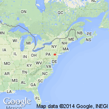
Type section: in the abandoned William Nearpass quarry, 1.8 mi southwest of Duttonville, in northwest quarter of Port Jervis South 7.5-min quadrangle [approx. Lat. 41 deg. 20.1 min. N., Long. 74 deg. 42.3 min. W., Sussex Co., NJ (A.G. Harris, written commun., ca. 1995)]. Named for its proximity to Mashipacong Island in the Delaware River, Sussex Co., NJ, 1.7 mi west-northwest of quarry.
[Misprint: US geologic names lexicon (USGS Bull. 1350, p. 474) states the Mashipacong overlies the Depue and Thacher. Mashipacong underlies the Depue and Thacher.]
Source: Publication; US geologic names lexicon (USGS Bull. 1350, p. 474); GNU records (USGS DDS-6; Reston GNULEX); Changes in stratigraphic nomenclature, 1967 (USGS Bull. 1274-A, p. A13).
For more information, please contact Nancy Stamm, Geologic Names Committee Secretary.
Asterisk (*) indicates published by U.S. Geological Survey authors.
"No current usage" (†) implies that a name has been abandoned or has fallen into disuse. Former usage and, if known, replacement name given in parentheses ( ).
Slash (/) indicates name conflicts with nomenclatural guidelines (CSN, 1933; ACSN, 1961, 1970; NACSN, 1983, 2005, 2021). May be explained within brackets ([ ]).

