The National Geologic Map Database is migrating to a new infrastructure. We apologize for any service disruptions during this process.
|
|---|


- Usage in publication:
-
- Martinsburg shale*
- Modifications:
-
- Named
- Dominant lithology:
-
- Shale
- AAPG geologic province:
-
- Appalachian basin
Summary:
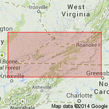
Shale in Blue Ridge region near Harpers Ferry, WV of small but uniform thickness called Martinsburg shale. [Unit is not well described.] Overlies Shenandoah limestone and underlies Massanutten sandstone. Equivalent to Hudson River. Age is Ordovician.
Source: GNU records (USGS DDS-6; Reston GNULEX).
- Usage in publication:
-
- Martinsburg group*
- Modifications:
-
- Revised
- AAPG geologic province:
-
- Appalachian basin
Summary:
In South Mountain, PA and adjacent areas, calcareous strata of Chambersburg limestone of Shenandoah group are followed by series of shales and soft sandstones previously called "Martinsburg shale" but herein called Martinsburg group. At the base are a few feet of dark calcareous shale and thin beds of carbonaceous limestone, transition beds, containing fauna regarded as Trenton in age. These are followed by dark to gray platy shale, with LEPTOBULUS INSIGNIA, TRIARTHUS BECKI, and other Utica forms, including numerous graptolites, and is therefore named "Utica shale." It is intricately folded but thickness is estimated to be 1,000 ft. Above is greenish to buff sandstone which is named Eden because it contains fauna referred by Ulrich to the Eden. It is about 500 ft thick.
Source: GNU records (USGS DDS-6; Reston GNULEX).
- Usage in publication:
-
- Martinsburg shale
- Modifications:
-
- Revised
- AAPG geologic province:
-
- Appalachian basin
Summary:
Described in Big A Mountain area where the Martinsburg consists chiefly of thin beds of highly fossiliferous limestone alternating with thinner beds of calcareous shale; near top is buff sandy shale. Thickness about 1600 feet. Unit is divided, on basis of paleontology and to some extent also on lithology, into three parts: the Trenton, Eden, and Maysville. Only where there is good exposure of entire formation is this subdivision possible, and it is not feasible in area of present report. Trenton member (Upper Mohawkian) recognized in this area. Remainder of Martinsburg is Cincinnatian. Hiatus between Martinsburg and overlying Juniata indicated by absence of Oswego sandstone elsewhere 200 to 500 ft thick. Overlies Moccasin (Lowville). The term Sevier shale has been applied to Martinsburg in southwestern VA.
Source: GNU records (USGS DDS-6; Reston GNULEX).
- Usage in publication:
-
- Martinsburg shale
- Modifications:
-
- Revised
- AAPG geologic province:
-
- Appalachian basin
Summary:
Martinsburg shale described in south-central PA. Passes gradually into Chambersburg or older limestone or is faulted against even older beds. Above, it may intergrade with "Oswego" sandstone, the Juniata red beds, or be in unconformable contact with Tuscarora sandstone. Usually called shale, the Martinsburg is variable lithologic group. Often contains heavy sandstone, principal body of which is herein named West Fairview member. Also contains pebbly unit herein named Paxton Creek conglomerate.
Source: GNU records (USGS DDS-6; Reston GNULEX).
- Usage in publication:
-
- Martinsburg formation, shale
- Modifications:
-
- Revised
- AAPG geologic province:
-
- Appalachian basin
Summary:
In PA, Martinsburg shale or formation (group would be better term) normally rests of Chambersburg limestone west of the Susquehanna, the Leesport limestone in Schuylkill Valley. Between, it may be in fault contact with older formations, as the Beekmantown east of Harrisburg. Martinsburg formation comprises (ascending) Cocalico shale, unnamed and undifferentiated dark shales, Jonestown beds, Fairview or Shochary sandstone [members]. Age is from early Trenton at least through early, perhaps, middle Maysville.
Source: GNU records (USGS DDS-6; Reston GNULEX).
- Usage in publication:
-
- Martinsburg shale
- Modifications:
-
- Revised
- AAPG geologic province:
-
- Appalachian basin
Summary:
The Fairview is treated as the upper member of the Martinsburg shale. Relationships of the Martinsburg, Bald Eagle, Juniata, and Tuscarora are all transitional. In Schuylkill Gap area, massive sandstone at top of Martinsburg is herein named the Shochary sandstone member. Lithologically, stratigraphically, and faunally, appears correlative to Fairview sandstone in south-central sections but is not traceable through. Based on interpretation of sedimentary cycle, the Ordovician-Silurian boundary in PA separates the Tuscarora or Shawangunk from underlying strata, whether these are Juniata, Bald Eagle, or Martinsburg.
Source: GNU records (USGS DDS-6; Reston GNULEX).
- Usage in publication:
-
- Martinsburg group
- Modifications:
-
- Revised
- AAPG geologic province:
-
- Appalachian basin
Summary:
Martinsburg raised to group and includes Fairveiw and Shochary and Jonestown bed and Dauphin shale. Locally the Jonestown red beds, Edenian and younger, are continental equivalents of marine Martinsburg with which they intergrade. Reedsville shale is partial equivalent of the Martinsburg.
Source: GNU records (USGS DDS-6; Reston GNULEX).
- Usage in publication:
-
- Martinsburg shale*
- Modifications:
-
- Areal extent
- AAPG geologic province:
-
- Appalachian basin
Summary:
Geographically extended Martinsburg shale into northeastern TN. Only lower part of formation is present; overlies Bays formation.
Source: GNU records (USGS DDS-6; Reston GNULEX).
- Usage in publication:
-
- Martinsburg Shale*, Formation*
- Modifications:
-
- Revised
- AAPG geologic province:
-
- Appalachian basin
Summary:
Stratigraphically extended the Martinsburg to include so-called lower member of Massanutten Sandstone.
Source: GNU records (USGS DDS-6; Reston GNULEX).
- Usage in publication:
-
- Martinsburg Formation*
- Modifications:
-
- Revised
- AAPG geologic province:
-
- Appalachian basin
Summary:
Martinsburg in study area divided into basal Bushkill Member and informally named sandstone at Pine Bush and shale and graywacke at Mamakating. Detailed correlations are unclear, but authors state that it is safe to say that the combined Ramseyburg and Pen Argyl Members of PA and NJ correlate with the combined Pine Bush and Mamakating of the Wallkill Valley, southeastern NY.
Source: GNU records (USGS DDS-6; Reston GNULEX).
- Usage in publication:
-
- Martinsburg Formation
- Modifications:
-
- Biostratigraphic dating
- Overview
Summary:
Paleontological collections from northern NJ, eastern PA, and southern NY confirm that Martinsburg can be divided into three members according to the nomenclature of Drake and Epstein (1967): Bushkill, Ramseyburg, and Pen Argyl Members. Bushkill and Pen Argyl are not age equivalents as has been suggested by other authors. Data show that Pen Argyl and Ramseyburg Members are definitely younger than Bushkill, but are insufficient to place upper limit on Pen Argyl.
Source: GNU records (USGS DDS-6; Reston GNULEX).
- Usage in publication:
-
- Martinsburg Formation*
- Modifications:
-
- Revised
- AAPG geologic province:
-
- Appalachian basin
Summary:
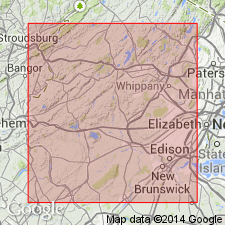
The High Point Member of the Martinsburg Formation is here named in northern NJ and southeastern NY. Consists of thick graywacke beds resulting from sedimentary amalgamation with interbeds of dark-colored shale. Graywacke has siliceous cement, rip-up clasts of shale, and abundant load casts. Assigned to turbidite facies B and C and was deposited in a much higher energy environment than the other parts of the Martinsburg. Overlies the Ramseyburg Member of the Martinsburg in an unknown manner, probably gradationally. Rocks similar to the High point, called the informal graywacke at Pine Bush (Epstein and Lyttle, 1987), are interbedded with rocks resembling the Ramseyburg in the Pine Bush quad., NY. Unconformably underlies the Shawangunk Formation. Thickness of the High Point is as much as 4,500 ft in the Unionville quad. Age of the upper part of the member at least is Late Ordovician (Edenian, Caradocian) based on graptolites.
Source: GNU records (USGS DDS-6; Reston GNULEX).
- Usage in publication:
-
- Trenton ("Martinsburg") Formation
- Modifications:
-
- Overview
- AAPG geologic province:
-
- Appalachian basin
Summary:
"Martinsburg" is used parenthetically following Trenton Formation in most instances throughout the text. Author explains that the name Martinsburg was originally given to strata exposed in the Massanutten synclinorium near Martinsburg, WV, where the unit is a flysch sequence of basinal calcareous and argillaceous turbidites. However, many geologists have used that name to refer to thin-bedded fossiliferous strata that occur between the Eggleston or Bays Formation and the Reedsville in southwest VA and nearby areas. In VA, use of the name Martinsburg should be restricted to the turbidites in the Massanutten synclinorium. Although the Trenton ("Martinsburg") Formation terminology is used in this report for strata overlying the Eggleston and Bays Formations, author would prefer a more suitable name such as Dolly Ridge Formation of Trenton Group (Perry, 1972) in this region. [Author does not explain why he uses Trenton ("Martinsburg") Formation if he prefers other nomenclature.]
Source: GNU records (USGS DDS-6; Reston GNULEX).
- Usage in publication:
-
- Martinsburg Formation
- Modifications:
-
- Biostratigraphic dating
- AAPG geologic province:
-
- Appalachian basin
Summary:
Sample of approximately 150 graptolites specimens from outlier of Bushkill Member of Martinsburg Formation near Port Murray are indicative of the CORYNOIDES AMERICANUS zone as defined by Finney (1982; 1986). Age, therefore, is Shermanian. Martinsburg in the outlier appears to be conformable above older Ordovician carbonate rocks to the northwest. Mapping by Lyttle and Epstein (1987) had shown the outlier as fault-bounded.
Source: GNU records (USGS DDS-6; Reston GNULEX).
- Usage in publication:
-
- Martinsburg Formation*
- Modifications:
-
- Revised
- AAPG geologic province:
-
- Appalachian basin
Summary:
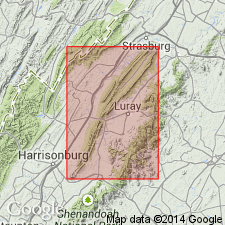
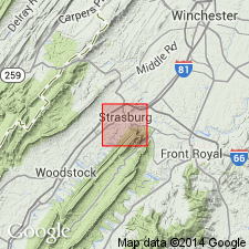
Named the Stickley Run Member of the Martinsburg Formation in the Shenandoah Valley of northern VA and the eastern panhandle of WV for Stickley Run near Strasburg, Shenandoah Co., VA. This new member includes all rocks above the highest knobbly-weathering limestone of the Edinburg Formation up to and including all platy limestones that are interbedded with shale and graywacke of the Martinsburg; this includes rocks previously assigned to the Oranda Formation (abandoned herein). Consists of dark-gray, laminated to thin-bedded shaly limestone and calcareous shale. Thickness is 610 to 900 feet. Member is recognized on both limbs of the Massanutten synclinorium and thins to 350 feet at the south end of the synclinorium. Overlies the Edinburg Formation and underlies shale, siltstone, and graywacke of the Martinsburg Formation. The lower contact is placed at the base of the lowest calcareous shale or shaly limestone that overlies thicker-bedded, cobbly limestone of the Edinburg; upper contact placed at top of uppermost platy limestone underlying noncalcareous shales and graywacke of the Martinsburg. The Stickley Run is of Middle Ordovician age based on conodonts.
Source: GNU records (USGS DDS-6; Reston GNULEX).
- Usage in publication:
-
- Martinsburg Formation*
- Modifications:
-
- Overview
- AAPG geologic province:
-
- Appalachian basin
Summary:
In southwestern VA and adjoining WV, on section F-F', the name Martinsburg Formation is used for the shale and limestone sequence of Middle and Late Ordovician age overlying the Eggleston Formation and underlying the Juniata Formation. The Martinsburg correlates with the Trenton Limestone and Reedsville Shale of western WV.
Source: GNU records (USGS DDS-6; Reston GNULEX).
For more information, please contact Nancy Stamm, Geologic Names Committee Secretary.
Asterisk (*) indicates published by U.S. Geological Survey authors.
"No current usage" (†) implies that a name has been abandoned or has fallen into disuse. Former usage and, if known, replacement name given in parentheses ( ).
Slash (/) indicates name conflicts with nomenclatural guidelines (CSN, 1933; ACSN, 1961, 1970; NACSN, 1983, 2005, 2021). May be explained within brackets ([ ]).