

- Usage in publication:
-
- Martinez group
- Modifications:
-
- Named
- AAPG geologic province:
-
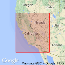
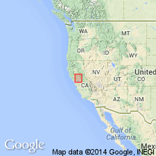
- California Coast Ranges province
Summary:
In preface on p. xiii, J.D. Whitney notes that Martinez Group is proposed provisionally to include series of beds of small geographic extent, found at Martinez and on northern flank of Mount Diablo. "It may eventually prove to be worthy of ranking only as a subdivision of the Chico Group". Underlies Tejon Group and overlies Chico Group.
Source: GNU records (USGS DDS-6; Menlo GNULEX).
- Usage in publication:
-
- Martinez group*
- Modifications:
-
- Revised
- Biostratigraphic dating
- AAPG geologic province:
-
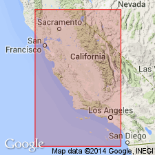
- California Coast Ranges province
Summary:
Author refers to Gabb (1869, Synopsis of the Cretaceous Invertebrate Fossils of California IN Palaeontology of California v.II p.209-254) where four localities are listed as yielding species belonging to Martinez group: Benicia, Curry's (south of Mount Diablo), Martinez, and near Suisun. Species from Benicia are of Cretaceous age; author refers this area to the Chico group. Species from other locations include both those of Cretaceous and Tejon (Eocene) age. Martinez group, as characterized by fossils assigned to it by Gabb, can not be treated as single formation nor as subdivision of Chico. Martinez should be restricted to Eocene portion.
Source: GNU records (USGS DDS-6; Menlo GNULEX).
- Usage in publication:
-
- Martinez group
- Modifications:
-
- Revised
- Age modified
- Dominant lithology:
-
- Sandstone
- Shale
- Sand
- AAPG geologic province:
-
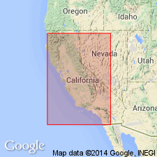
- California Coast Ranges province
Summary:
Name Martinez group is here applied to that part of Gabb's (1896) Martinez group which remains after removal of Chico Cretaceous element. Is lower Tejon of Stanton (1896) and consists of sandstones, shales, and glauconitic sands. Is from 1000 to 2000 ft thick. Martinez group differs from adjoining groups in that it contains considerable quantities of glauconite. Color of sandstone is grayish and fauna is distinctive. At Martinez unit appears to conformably underlie Tejon group and to conformably overlie Chico group. Contains known fauna of over 60 species. Age is regarded as Eocene.
Source: GNU records (USGS DDS-6; Menlo GNULEX).
- Usage in publication:
-
- Martinez formation*
- Modifications:
-
- Adopted
- Revised
- Biostratigraphic dating
- AAPG geologic province:
-
- California Coast Ranges province
Summary:
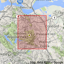
Martinez group as named by [Gabb and] Whitney (1896) and defined by Merriam (1897) is adopted. Type locality designated as exposures south of town of Martinez, Contra Costa Co, CA. Also occurs at Clayton, Pacheco and Army Point (near Benicia) in Contra Costa Co; Lower Lake, Lake Co; between headwaters of Pescadero Creek and San Lorenzo River in San Mateo Co(?). Fauna list (Foraminifera, Anthozoa, Echinoidea, Brachiopoda, Pelecypoda, Gastropoda, Crustacea) with localities included in report. Age of fossils given as early Eocene.
Source: GNU records (USGS DDS-6; Menlo GNULEX).
- Usage in publication:
-
- Martinez formation*
- Modifications:
-
- Age modified
- AAPG geologic province:
-
- California Coast Ranges province
Summary:
Martinez formation assigned to Paleocene because its fauna seem distinct and because it corresponds in stratigraphic sequence to strata of Paleocene of European sequence. Section on north side of Mt. Diablo (columns 8 and 11) is better practical type [reference] locality because definite top and bottom are recognizable. Columnar sections with fossil lists included.
Source: GNU records (USGS DDS-6; Menlo GNULEX).
- Usage in publication:
-
- Martinez Formation*
- Modifications:
-
- Areal extent
- AAPG geologic province:
-
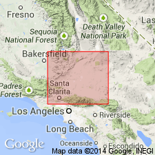
- Mojave basin
Summary:
Rocks of Martinez Formation of Kew (1924) and of Clements (1937) exposed in San Francisquito Canyon area westward from Bouquet Reservoir are here named San Francisquito Formation. San Francisquito Formation also includes rocks formerly assigned to Martinez Formation of Noble (1954) in Big Rock Creek area southwest of San Andreas fault south of Valyermo and in Cajon Creek just northeast of that fault 1 mi south of Cajon junction. [Thus Martinez Formation is restricted from Mojave basin].
Source: GNU records (USGS DDS-6; Menlo GNULEX).
- Usage in publication:
-
- Martinez Formation*
- Modifications:
-
- Areal extent
- AAPG geologic province:
-
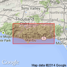
- Transverse Ranges province
Summary:
Kew (1923, 1924) extended Martinez Formation to so-called lower Eocene (Paleocene) strata in Simi Hills area. Present report restricts Martinez from southwestern coastal area of CA because of distance from its type in Martinez area, Contra Costa Co. Named replaced by Coal Canyon Formation (new) of Paleocene age in central Santa Monica Mountains.
Source: GNU records (USGS DDS-6; Menlo GNULEX).
For more information, please contact Nancy Stamm, Geologic Names Committee Secretary.
Asterisk (*) indicates published by U.S. Geological Survey authors.
"No current usage" (†) implies that a name has been abandoned or has fallen into disuse. Former usage and, if known, replacement name given in parentheses ( ).
Slash (/) indicates name conflicts with nomenclatural guidelines (CSN, 1933; ACSN, 1961, 1970; NACSN, 1983, 2005, 2021). May be explained within brackets ([ ]).