

- Usage in publication:
-
- Marshallville Formation
- Modifications:
-
- Named
- Dominant lithology:
-
- Sand
- Clay
- AAPG geologic province:
-
- South Georgia sedimentary province
Summary:
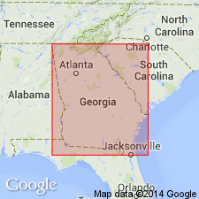
Name Marshallville Formation is proposed here for prominently bedded sand to pebbly sand with scattered beds of gray, thinly bedded clay or massive kaolins in the Fort Valley Group (new). The Fort Valley includes all sandy, kaolinitic deposits of coastal marine origin in the Fort Valley plateau region of the GA Coastal Plain, while the Oconee Group (new) includes lithologically similar deposits of fluvial origin. Previously various parts of the Marshallville have been included in the Cusseta and Providence Sands or the Ripley Formation. Unit occurs in a band from eastern Taylor Co. in the west to the vicinity of the Ocmulgee River in the east. Grades laterally eastward into the Marion Member (new) of the Huber Formation and grades downdip into the Clayton Formation. In addition to the type section along the Flint River, several reference localities are designated: (1) a series of roadcuts in the northern valley wall of Nakomis Creek, 2.3 mi northeast of Nakomis; (2) a series of roadcuts and a sand pit along a paved county road between Powersville and GA Hwy 49, 1.4 mi southwest of Byron, Peach Co; (3) Georgia Geologic Survey core Crawford 2a (GGS-3600) on the north shoulder of GA Hwy 96, approximately 1.9 mi west of the community of Nakomis and 5 mi west of Fort Valley; and (4) a ravine on the north side of GA Hwy 49, approximately 2.1 mi northeast of the I-75 and GA 49 junction. The Marshallville is 13.3 m thick and disconformably underlies the Mossy Creek Sand (new) of the Fort Valley Group at the type section. At the lower boundary stratotype (Crawford 2a core), 105 ft of Marshallville disconformably overlie the Nakomis Formation (new) of the Fort Valley. In updip areas, the Marshallville disconformably overlies the Gaillard Formation of the Oconee Group. Early Paleocene (early Midwayan, early Danian) age of the Marshallville is based on the occurrence of silicified OSTREA CRENULIMARGINATA and its correlation with the Clayton Formation.
Source: GNU records (USGS DDS-6; Reston GNULEX).
For more information, please contact Nancy Stamm, Geologic Names Committee Secretary.
Asterisk (*) indicates published by U.S. Geological Survey authors.
"No current usage" (†) implies that a name has been abandoned or has fallen into disuse. Former usage and, if known, replacement name given in parentheses ( ).
Slash (/) indicates name conflicts with nomenclatural guidelines (CSN, 1933; ACSN, 1961, 1970; NACSN, 1983, 2005, 2021). May be explained within brackets ([ ]).