- Usage in publication:
-
- Maroon conglomerate*
- Modifications:
-
- Original reference
- Dominant lithology:
-
- Conglomerate
- Sandstone
- AAPG geologic province:
-
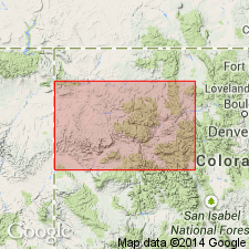
- Eagle basin
Summary:
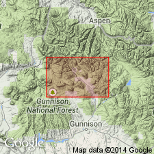
[Credited to G.H. Eldridge, "Description of the sedimentary formations" section.] Maroon conglomerate. Includes all beds above Weber limestone (100 to 550 feet thick) and unconformably below Gunnison sandstone [Morrison formation]. Maximum observed thickness over 4,500 feet. Lower division consists of alternating yellowish-gray grits; thin limestones, and shale beds reaching maximum observed tliickness of 2,000 feet. The upper division is composed of alternating beds of conglomerate and sandstone, with some shales and occasional limestone beds, and reaches maximum observed thickness of 2,500+/- feet at Mount Teocalli and Double Top; it is of a peculiar red or chocolate color, except in regions of local metamorphism, where greenish hues occur, arising from development of minerals containing lime and iron silicates. [As thus defined includes the so-called "Weber grits" of later reports.]
Named from typical developments on Maroon Creek, north of quadrangle. [In Aspen quadrangle, Pitkin Co., western central CO.]
Source: US geologic names lexicon (USGS Bull. 896, p. 1306-1307).
- Usage in publication:
-
- Maroon formation*
- Modifications:
-
- Revised
- AAPG geologic province:
-
- Eagle basin
Summary:
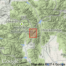
Restricted Maroon formation to beds (1,500 feet thick) above the so-called "Weber grits."
Source: US geologic names lexicon (USGS Bull. 896, p. 1306-1307).
- Usage in publication:
-
- Maroon formation
- Modifications:
-
- Revised
- AAPG geologic province:
-
- Eagle basin
- South Park basin
Summary:
Pg. 971-1009. Maroon formation. Subdivided to include Coffman conglomerate (Pennsylvanian?), Chubb siltstone (Permian), and Pony Spring siltstone (Permian) members.
Source: US geologic names lexicons (USGS Bull. 1200, p. 2389-2391); USGS Bull. 896, Chubb entry p. 440, Coffman entry p. 483, Pony Spring entry p. 1699).

- Usage in publication:
-
- Maroon conglomerate*
- Maroon formation*
- Modifications:
-
- Overview
Summary:
The present [ca. 1936] approved definition of Maroon formation is for the beds above †Weber grits and below Entrada sandstone and Morrison formation. However, because of variation
in lithology arid the difficulty of separating the Maroon strata (which also include grits, especially in their upper part) from the underlying beds, the name Maroon formation has in several areas been used to include the equivalent †Weber grits. Age is Pennsylvanian(?) and Permian.
Recognized in western central CO.
Source: US geologic names lexicon (USGS Bull. 896, p. 1306-1307).
- Usage in publication:
-
- Maroon formation
- Modifications:
-
- Revised
- AAPG geologic province:
-
- Eagle basin
Summary:
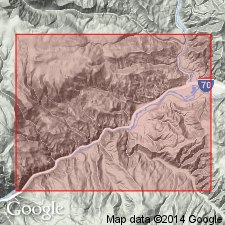
Pg. 1863-1864. Maroon formation. H.F. Donner, 1936 (Univ. Michigan unpub. PhD dissert.) divided Maroon formation, in McCoy area, into Rock Creek conglomerate member below and State Bridge siltstone above. Overlies McCoy formation.
[See also Donner, H.F., 1949, GSA Bull., v. 60, no. 8, p. 1215-1248.]
Source: US geologic names lexicons (USGS Bull. 1200, p. 2389-2391).
- Usage in publication:
-
- Maroon formation
- Modifications:
-
- [Not used]
Summary:
Pg. 1375-1397. Maroon formation. In Gore area, Eagle and Summit Counties, Colorado, names Weber and Maroon are abandoned and term Battle Mountain proposed for the thick sequence of Pennsylvanian clastics.
Source: US geologic names lexicon (USGS Bull. 1200, p. 2389-2391).
- Usage in publication:
-
- Maroon formation
- Modifications:
-
- Areal extent
- AAPG geologic province:
-
- Eagle basin
- Piceance basin
Summary:
Pg. 627-632, measured sections. Maroon formation. In west-central and northwestern Colorado, overlies Belden shale; rank raised to formation. Consists of red, yellow, and brown shale, sandstone, arkose, and conglomerate with intercalated beds of gypsum and thin limestone. Thickness as much as 7,000 feet. Contact with Belden shale gradational; contact arbitrarily drawn where coarse clastics predominate over dark shale and limestone. Underlies Weber quartzite or Chinle formation. Most, if not all, of unit is Des Moines in age.
Source: US geologic names lexicons (USGS Bull. 1200, p. 2389-2391).
- Usage in publication:
-
- Maroon formation*
- Modifications:
-
- Areal extent
- AAPG geologic province:
-
- Eagle basin
Tweto, Ogden, and Lovering, T.S., 1947, The Gilman district, Eagle County, [Colorado]: Colorado Mineral Resources Board [Bulletin], p. 378-387., (Part 2 prepared by the U.S. Geological Survey, under the general supervision of W.S. Burbank.)
Summary:
Pg. 380 (chart of geologic formations in Gilman district). Maroon formation. In Gilman district, [Eagle County, Colorado], is 4,500 to 6,000 feet thick. Overlies Leadville limestone. Age is Pennsylvanian and Permian(?).
Source: US geologic names lexicon (USGS Bull. 1200, p. 2390-2391).
- Usage in publication:
-
- Maroon formation
- Modifications:
-
- Revised
- AAPG geologic province:
-
- Eagle basin
- South Park basin
Summary:
Pg. 42-47, pl. 1. Maroon formation. In South Park area, crops out over wide belt across western part of Park, from Mount Silverheels on north to beyond Antero reservoir on south; forms floor of valley west of Dalwta hogback; south of reservoir, it continues along west side of Park, but outcrops are irregular as result of faulting. In southwestern area, includes Chubb siltstone member below and Pony Spring siltstone member above; thickness about 7,700 feet; undifferentiated in northern area where it is about 8,500 feet thick and consists essentially of red beds. Overlies Weber(?) formation, which contains Coffman conglomerate at top. Separated from overlying deposits by erosional unconformity; underlies Garo sandstone. Age is Pennsylvanian and Permian.
Source: US geologic names lexicons (USGS Bull. 1200, p. 2389-2391).
- Usage in publication:
-
- Maroon formation*
- Modifications:
-
- Revised
- AAPG geologic province:
-
- Eagle basin
Summary:
Pg. 152 (table 1), 229-235. Maroon formation. Name Maroon formation applied to all Pennsylvanian or Permian redbeds overlying Minturn formation in Gore and Mosquito Ranges. As so used, Maroon corresponds to Wyoming formation of Emmons, 1898 (USGS Geol. Atlas folio, no. 48), to "upper unit" of Pennsylvanian and Permian(?) of Koschmann and Wells, 1946 (Colorado Sci. Proc., v. 15, no. 2), to upper half to three-fourths of Maroon as recognized by the USGS in recent years, and, in part, to uppermost part of Maroon as used by Brill (1944). Upper part probably includes beds equivalent to part of State Bridge formation of Brill (1944), but siltstone facies typical of State Bridge is poorly developed in Pando-Kokomo region. Formation in Pando-Kokomo region consists of unfossiliferous redbeds which, on Jacque Peak, on north edge of district, reach thickness of almost 2,000 feet. Overlies Jacque Mountain limestone member of Minturn [ore horizon in Kokomo area]; top of formation not preserved and original thickness unknown.
Source: US geologic names lexicon (USGS Bull. 1200, p. 2389-2391).
- Usage in publication:
-
- Maroon
- AAPG geologic province:
-
- Piceance basin
Summary:
Pg. 1540-1551. Maroon formation. In Glenwood Springs area, [Garfield County, Colorado], includes South Canyon Creek dolomite member (new) at top of formation. Underlies Chinle formation. [Age is considered Pennsylvanian and Permian.]
Source: Publication; US geologic names lexicon (USGS Bull. 1200, p. 2390-2391).
- Usage in publication:
-
- Maroon
- AAPG geologic province:
-
- Eagle basin
- Piceance basin
Summary:
Pg. 822-823. Maroon formation. Described in paper on Permo-Pennsylvanian zeugogeosyncline, Colorado and New Mexico, where it crops out in northern part of trough and is equivalent to Sangre de Cristo formation. Division between these two formations is placed arbitrarily at Fremont-Park County line. In this paper, Maroon formation includes those strata which overlie Jacque Mountain limestone or its equivalent and underlies Weber sandstone or younger strata. In middle of trough where Jacque Mountain limestone is absent or greatly altered in appearance, it is difficult to distinguish between Maroon and Minturn formation. Age is either Wolfcampian or Late Pennsylvanian.
Source: US geologic names lexicon (USGS Bull. 1200, p. 2389-2391).
- Usage in publication:
-
- Maroon formation
- Modifications:
-
- Revised
- AAPG geologic province:
-
- Piceance basin
Summary:
Pg. 552 (fig. 3), 553-556 (measured sections), 563-569. Maroon formation. In the Crested Butte quadrangle, Gunnison County, Colorado, the buff-colored sandstones and siltstones, previously included in lower part of Maroon formation, are transferred to underlying Gothic formation (new). As restricted, the Maroon consists of coarse red arkosic and reworked clastic rock assemblages. Thickness 1,189 feet at type section of Gothic formation; probable maximum thickness 3,500 feet within area. Unconformably underlies Entrada sandstone. Fossils [listed]. Carries typical Pennsylvanian to Early Permian plants. [Age is considered Pennsylvanian, post- Des Moines.]
Source: Publication; US geologic names lexicon (USGS Bull. 1200, p. 2390-2391).
- Usage in publication:
-
- Maroon Formation*
- Modifications:
-
- Revised
- AAPG geologic province:
-
- Eagle basin
Summary:
The eolian unit called "sandstone of the Fryingpan River," formerly assigned to the basal State Bridge Formation in Pitkin and Eagle Cos, CO in the Eagle basin, is removed from the State Bridge and reassigned to the Maroon Formation as its upper member. The unit is newly named Fryingpan Sandstone Member which occurs in the Aspen sub-basin of the Central Colorado trough. Correlation chart. The Maroon contains extensive eolian deposits, whereas the overlying State Bridge was deposited in shallow, marginal marine and lacustrine environments. Maroon is primarily a redbed unit with 20 to 30 percent eolianites. Deposited in a mixed fluvial and lacustrine environment. Is 300 to 1000 m thick in the Eagle basin and 4600 m in the Aspen sub-basin. Overlies Minturn Formation or Eagle Valley Evaporite. Underlies and interfingers with Schoolhouse Tongue of Weber Sandstone in northwest part of report area. Unconformably underlies State Bridge Formation. Desmoinesian to Wolfcampian in age.
Source: GNU records (USGS DDS-6; Denver GNULEX).
- Usage in publication:
-
- Maroon Formation*
- Modifications:
-
- Revised
- AAPG geologic province:
-
- Eagle basin
- Piceance basin
Summary:
Upper contact revised to include the Schoolhouse, a sandstone formerly thought to be an eastward extending tongue of the Weber Sandstone but demonstrated in this report to be related to the Maroon Formation in its primary physical properties and origin. Its distinction from the Maroon is the result of its diagenetic history. Acid, reducing basinal fluid, is inferred to have dissolved carbonate cement and hematitic grain coatings and to have bleached the sandstone. Schoolhouse is removed from the Weber and reassigned to the Maroon as its upper member. Schoolhouse is known to be present from west of the Eagle River to Ripple, Fawn, and Miller Creeks of the Eagle and Piceance basins. The lower contact of Schoolhouse with Maroon is gradational. Isopach map of Schoolhouse. Schoolhouse ranges from 0-216+ ft thick. The Maroon varies from 1,640 to 3,159+ ft thick in report area. The Maroon is assigned a Pennsylvanian and Early Permian age. No diagnostic fossils. The Schoolhouse is only of Early Permian age. Correlation chart; isopach map. The Maroon (and the Schoolhouse) correlate with the Weber of the Uinta Mountains and northwest CO.
Source: GNU records (USGS DDS-6; Denver GNULEX).
For more information, please contact Nancy Stamm, Geologic Names Committee Secretary.
Asterisk (*) indicates published by U.S. Geological Survey authors.
"No current usage" (†) implies that a name has been abandoned or has fallen into disuse. Former usage and, if known, replacement name given in parentheses ( ).
Slash (/) indicates name conflicts with nomenclatural guidelines (CSN, 1933; ACSN, 1961, 1970; NACSN, 1983, 2005, 2021). May be explained within brackets ([ ]).

