The National Geologic Map Database is migrating to a new infrastructure. We apologize for any service disruptions during this process.
|
|---|


- Usage in publication:
-
- Marmaton
- Modifications:
-
- Original reference
- Dominant lithology:
-
- Shale
- Limestone
- AAPG geologic province:
-
- Cherokee basin
Summary:
Pg. 23-24. Marmaton formation. Shale, 30 to 50 feet thick, carrying thin beds of limestone, forming middle member of Henrietta formation in southwestern Missouri and southeastern Kansas. Underlies Pawnee limestone and overlies Fort Scott limestone. [As thus defined is same as Labette shale. Age is Pennsylvanian. See Grace Wilmarth, compiler, KS-NE Pennsylvanian Corr. Chart, sheet 2, Oct. 1936.]
Named from exposures on Marmaton River, Vernon Co., southwestern MO, and Bourbon Co., KS, whose channel, throughout almost its entire length, is within the formation.
Source: US geologic names lexicon (USGS Bull. 896, p. 1305-1306).

- Usage in publication:
-
- Marmaton
- Modifications:
-
- Revised
- AAPG geologic province:
-
- Cherokee basin
Summary:
Pg. 92-94. Marmaton formation. As Marmaton River crosses this formation at right angles, and has cut channel in it, the name Marmaton formation will be given to it. It includes all beds above Cherokee shale and below top of Pleasanton shales. [As thus defined it includes Henrietta and Pleasanton formations and extended up to base of a limestone (called Hertha limestone) underlying Ladore shale. Age is Pennsylvanian.]
Source: US geologic names lexicon (USGS Bull. 896, p. 1305-1306).

- Usage in publication:
-
- Marmaton formation
- Marmaton group
- Modifications:
-
- Overview
- AAPG geologic province:
-
- Cherokee basin
Summary:
Haworth continued to use Marmaton formation (1904, 1908, 1913), but other writers used Pleasanton and Henrietta formations, although Beede (1909) called these combined formations stage B of Carboniferous of Kansas and Oklahoma. In 1912 the USGS discarded Marmaton from its classification, using instead (as did Hinds and Greene, 1915) the subdivisions Pleasanton and Henrietta. R.C. Moore and W.P. Haynes in 1917 revived Marmaton formation (for the beds between top of Cherokee shale and base of Hertha limestone), reduced Pleasanton to rank of member, and discontinued Henrietta in Kansas, treating the subdivisions of latter as members of Marmaton formation. The Kansas Geol. Survey continued to use this classification until 1932; some Oklahoma geologists also used it; but USGS, Nebraska Geol. Survey, Missouri Geol. Survey, and some other geologists continued to use Pleasanton and Henrietta. In Bull. 5 (1932) of Nebraska Geol. Survey is a chart (credited to G.E. Condra, R.C. Moore, and C.O. Dunbar) in which the rocks of Nebraska beneath the limestone (called Hertha limestone) underlying Ladore shale are called Marmaton group and divided into Pleasanton shale above and Henrietta formation below. [Age is Pennsylvanian.]
[See Grace Wilmarth, compiler, KS-NE Pennsylvanian Corr. Chart, sheet 2, Oct. 1936.]
Source: US geologic names lexicon (USGS Bull. 896, p. 1305-1306).

- Usage in publication:
-
- Marmaton group
- Modifications:
-
- Revised
- AAPG geologic province:
-
- Cherokee basin
Summary:
Pg. 89. Marmaton group. Strata at top of Marmaton group that overlie the unconformity separating Des Moines and Missouri series are removed from Marmaton and included as part of lowermost Missouri beds. [The beds removed by Moore he listed as (ascending): Unnamed shale and sandstone; Uniontown limestone (so-called Hertha of some reports); Ladore shale [not Ladore shale of previous reports]; Schubert Creek limestone ("called 'Hertha' by Hinds and Greene"); Tennison Creek shale; Critizer limestone; and Mound City shale. The limestone overlying the Mound City, which according to Moore had also been called Hertha limestone by Hinds and Greene, Moore named Sniabar limestone. This definition of Marmaton group (in which both Pleasanton and Henrietta were discarded, their subdivisions being treated as formations of Marmaton group) was adopted by Moore and Condra in their Oct. 1932 revised classification of Pennsylvanian rocks of Kansas.
[See Grace Wilmarth, compiler, KS-NE Pennsylvanian Corr. Chart, sheet 2, Oct. 1936.]
Source: US geologic names lexicon (USGS Bull. 896, p. 1305-1306).

- Usage in publication:
-
- Marmaton group
- Modifications:
-
- Revised
- AAPG geologic province:
-
- Cherokee basin
- Usage in publication:
-
- Marmaton formation†
- Marmaton group†
- Modifications:
-
- Abandoned
- AAPG geologic province:
-
- Cherokee basin
Summary:
†Marmaton formation; †Marmaton group. Pennsylvanian.
[ca. 1938 abandoned. Previously recognized in eastern Kansas and wesstern Missouri. See Grace Wilmarth, compiler, KS-NE Pennsylvanian Corr. Chart, sheet 2, Oct. 1936.]
Source: US geologic names lexicon (USGS Bull. 896, p. 1305-1306).

- Usage in publication:
-
- Marmaton group
- Modifications:
-
- Revised
- AAPG geologic province:
-
- Forest City basin
- Cherokee basin
- Chautauqua platform
Summary:
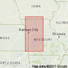
Divided into (ascending): Fort Scott limestone, Labette shale, Pawnee limestone, Bandera shale, Altamont limestone, Nowata shale, Lenapah limestone, and Memorial shale. Outcrop area of Marmaton rocks extends from southern IA across MO and southeastern KS into northeastern OK. This study deals with southeastern KS in the Forest City basin and adjoining areas that include the Cherokee basin and Chautauqua platform. Conformably overlies Cherokee shale; disconformably underlies Hepler sandstone. Beds are obviously divisible into megacyclothems. Consists of about 250 ft of shale, sandstone, and limestone beds and a very minor amount of coal. Brachiopods; bryozoans, crinoid remains, mollusks, corals; conodonts. Composite section; cross section. Of Pennsylvanian, Des Moines age.
Source: GNU records (USGS DDS-6; Denver GNULEX).

- Usage in publication:
-
- Marmaton group*
- Modifications:
-
- Areal extent
- AAPG geologic province:
-
- Anadarko basin
Summary:
Extended as an undivided unit into the subsurface of Baca County, Colorado, in the Anadarko basin, east of the Las Animas arch. Overlies Cherokee shale and underlies Bronson group (undivided). Age is Middle Pennsylvanian (Desmoinesian). Report includes correlation chart.
Source: Modified from GNU records (USGS DDS-6; Denver GNULEX).
- Usage in publication:
-
- Marmaton Group
- Modifications:
-
- Revised
- AAPG geologic province:
-
- Iowa shelf
Summary:
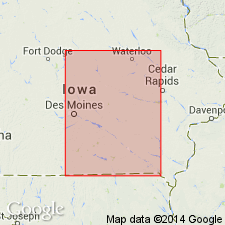
Is the upper group of the Des Moines Supergroup. Divided in south-central IA on the Iowa shelf into 11 formations. The newly named Mouse Creek Formation is divided into Excello Shale and Blackjack Creek Members. The overlying 10 formations in sequence are: 1) Morgan School Shale (new) with its Summit Coal Member at top, 2) Stephens Forest Formation (new) with its Little Osage Shale Member, Houx Limestone Member, unnamed shale member, and Higginsville Limestone Member; 3) Labette Shale (includes Marshall and Mystic Coal Members), 4) Pawnee Formation (includes Anna Shale, Myrick Station Limestone, Mine Creek Shale, Coal City Limestone Members), 5) Bandera Shale, 6) Altamont Formation (includes Amoret Limestone, Lake Neosho Shale, and Worland Limestone Members, 7) Nowata Shale, 8) Lenapah Limestone, 9) unnamed shale, 10) "Lost Branch" Formation (includes Sni Mills Limestone Member, unnamed shale member. Cooper Creek Limestone Member). Marmaton overlies Mulky Coal Member of the newly named Swede Hollow Formation. Nomenclature chart. Graphic sections. Of Pennsylvanian, Desmoinesian age. Contact with overlying unit not described.
Source: GNU records (USGS DDS-6; Denver GNULEX).
For more information, please contact Nancy Stamm, Geologic Names Committee Secretary.
Asterisk (*) indicates published by U.S. Geological Survey authors.
"No current usage" (†) implies that a name has been abandoned or has fallen into disuse. Former usage and, if known, replacement name given in parentheses ( ).
Slash (/) indicates name conflicts with nomenclatural guidelines (CSN, 1933; ACSN, 1961, 1970; NACSN, 1983, 2005, 2021). May be explained within brackets ([ ]).