The National Geologic Map Database is migrating to a new infrastructure. We apologize for any service disruptions during this process.
|
|---|


- Usage in publication:
-
- Maricao Basalt*
- Modifications:
-
- Overview
- AAPG geologic province:
-
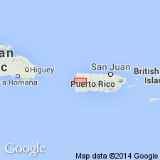
- Caribbean region
Summary:
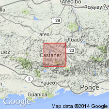
The Maricao Basalt of Mattson (1960), here adopted, is a sequence of thick-bedded to massive, coarse basaltic tuff and tuff breccia and thin-bedded coarse tuff exposed southeast of Anasco. Concordantly and probably conformably overlies and intertongues with Yauco Mudstone. Age is Campanian and Maastrichtian based on age of Yauco.
Source: GNU records (USGS DDS-6; Reston GNULEX).
- Usage in publication:
-
- Maricao Formation*
- Modifications:
-
- Revised
- Age modified
- AAPG geologic province:
-
- Caribbean region
Summary:
The Maricao Basalt is here redefined Maricao Formation because the Maricao consists chiefly of rock other than lava flows. Consists of dark-green volcaniclastic breccia with augite and plagioclase phenocrysts. In the Adjuntas quadrangle the Maricao was mapped as the Robles by Mattson (1968), but is unlike the Robles of the type locality. Along the border of the Adjuntas and Penuelas quadrangles, the Robles (Maricao) is identical to the Anon (former Santas Pascuas Member). Lithofacies characteristic of the Anon, Maricao, and Yauco are interbedded in the Monte Guilarte quadrangle. Age is Late Cretaceous (Campanian, Maastrichtian) through Eocene(?).
Source: GNU records (USGS DDS-6; Reston GNULEX).

- Usage in publication:
-
- Maricao Formation*
- Modifications:
-
- Overview
- AAPG geologic province:
-
- Caribbean region
Summary:
The Maricao Formation occurs in southwestern Puerto Rico and consists of volcanic trachybasalt breccia, tuffaceous sandstone and mudstone, tuff, and subordinate lava and limestone. Characteristically contains large augite phenocrysts. Estimated maximum thickness is 2000 meters. The Maricao is of Late Cretaceous and Tertiary(?) age.
Source: GNU records (USGS DDS-6; Reston GNULEX).
For more information, please contact Nancy Stamm, Geologic Names Committee Secretary.
Asterisk (*) indicates published by U.S. Geological Survey authors.
"No current usage" (†) implies that a name has been abandoned or has fallen into disuse. Former usage and, if known, replacement name given in parentheses ( ).
Slash (/) indicates name conflicts with nomenclatural guidelines (CSN, 1933; ACSN, 1961, 1970; NACSN, 1983, 2005, 2021). May be explained within brackets ([ ]).