The National Geologic Map Database is migrating to a new infrastructure. We apologize for any service disruptions during this process.
|
|---|


- Usage in publication:
-
- Maravillas Formation*
- Modifications:
-
- Named
- Dominant lithology:
-
- Sandstone
- Siltstone
- Pyroclastics
- AAPG geologic province:
-
- Caribbean region
Summary:
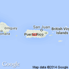
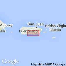
The Maravillas Formation, here named, consists of well-bedded volcanic siltstone and sandstone with some pyroclastic rocks. At the type locality it contains 80 m of massive brownish-gray coarse-grained lithic tuff overlain by 300 m of gray and brown siltstone and sandstone. Interfingers with and grades downward into the Achiote Conglomerate; conformably underlies the Coamo Formation. In west-central PR the Coamo is restricted to the massive volcanic rocks, excluding the bedded units (San Diego Lapilli Tuff Member, Santa Ana Limestone Member, and unnamed conglomerate and sandstone and siltstone units) below the massive volcanic units. The Maravillas Formation has been defined to include the sequence below the restricted Coamo and limestone blocks and lenses in the Maravillas may be correlative with the Santa Ana Member and lapilli tuff and tuff lenses may be correlative with the San Diego Member. Age is probably late Santonian and Campanian and possibly as young as Maastrichtian based on fossils.
Source: GNU records (USGS DDS-6; Reston GNULEX).
- Usage in publication:
-
- Maravillas Formation*
- Modifications:
-
- Revised
- AAPG geologic province:
-
- Caribbean region
Summary:
In the Orocovis quadrangle the Maravillas includes the Sabana Hoya, San Diego (which forms the bulk of the Maravillas in this quadrangle), and Toyosa Members. The name Toyosa is applied to beds correlated with the Santa Ana Limestone Member elsewhere.
Source: GNU records (USGS DDS-6; Reston GNULEX).
- Usage in publication:
-
- Maravillas Formation*
- Modifications:
-
- Revised
- AAPG geologic province:
-
- Caribbean region
Summary:
In the Coamo area the Maravillas Formation includes the basal Sabana Hoyos Limestone Member, reassigned from the underlying Cariblanco Formation, the San Diego Member, here redefined from Tuff Member to Member, the Santa Ana Limestone Member, reassigned to the Maravillas Formation from the overlying Coamo Formation, and younger unnamed map units of mudstone, pyroclastic rocks, limestone, and conglomerate.
Source: GNU records (USGS DDS-6; Reston GNULEX).

- Usage in publication:
-
- Maravillas Formation*
- Modifications:
-
- Overview
- AAPG geologic province:
-
- Caribbean region
Summary:
The Maravillas Formation occurs in central Puerto Rico and consists of tuffaceous sandstone, siltstone, volcanic breccia, limestone, and limestone conglomerate with irregular interbeds of calcarenite and limestone conglomerate. Maximum estimated thickness is 1100 meters. The Maravillas is of Late Cretaceous age.
Source: GNU records (USGS DDS-6; Reston GNULEX).
For more information, please contact Nancy Stamm, Geologic Names Committee Secretary.
Asterisk (*) indicates published by U.S. Geological Survey authors.
"No current usage" (†) implies that a name has been abandoned or has fallen into disuse. Former usage and, if known, replacement name given in parentheses ( ).
Slash (/) indicates name conflicts with nomenclatural guidelines (CSN, 1933; ACSN, 1961, 1970; NACSN, 1983, 2005, 2021). May be explained within brackets ([ ]).