

- Usage in publication:
-
- Maple formation
- Modifications:
-
- First used
- Dominant lithology:
-
- Limestone
- AAPG geologic province:
-
- Wasatch uplift
Summary:
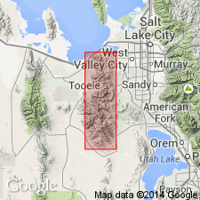
Pg. 2 (table 1), 11, pl. 5. Maple formation (first used), basal formation of Oquirrh group (rank raised; restricted to Pennsylvanian rocks). Name applied to lower 3,200 feet of Oquirrh; consists of cyclical sandstones and limestones. Lower 2,300 feet is dark-gray, very fine-grained, argillaceous, platy limestone with much nodular black chert, and coarsely bioclastic limestone near base. Upper 900 feet is coralline and bioclastic limestone. Lower part of Maple formation is synonymous with West Canyon member of Oquirrh (Nygreen, 1958). Underlies "White Pine" formation (first used); overlies Manning Canyon formation. Contains brachiopods, corals (SYRINGOPORA colonies), fusulinids (FUSULINELLA and PROFUSULINELLA), and CHAETETES. Age is Early Pennsylvanian (Morrowan) and Middle Pennsylvanian (Atokan). Units and names described herein are those used by Kennecott Copper Corp. geologists within Bingham mining district. They are not intended as formal names unless they are applicable. Report includes cross section.
Type section: in secs. 22 and 27, T. 4 S., R. 3 W., Utah and Salt Lake Cos., UT (Wasatch uplift). Section begins in Maple Flat and traverses north-northeast up spur opposite Maple Canyon, Bingham mining district. Derivation of name not stated by authors, but probably named from Maple Flat.
[Misprint: GNU records (USGS DDS-6; Denver GNULEX) state Maple Formation is 2,300 feet thick. It is 3,200 feet thick.]
Source: US geologic names lexicon (USGS Bull. 1350, p. 466); supplemental information from GNU records (USGS DDS-6; Denver GNULEX).
- Usage in publication:
-
- Maple Formation†
- Modifications:
-
- [Abandoned]
- AAPG geologic province:
-
- Wasatch uplift
Summary:
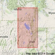
Pg. 33. Maple Formation in Oquirrh Group. Name invalid as either name now extant (Hall Canyon Member or Bridal Veil Falls [Bridal Veil] Member) is utilitarian.
Source: US geologic names lexicon (USGS Bull. 1350, p. 466).
For more information, please contact Nancy Stamm, Geologic Names Committee Secretary.
Asterisk (*) indicates published by U.S. Geological Survey authors.
"No current usage" (†) implies that a name has been abandoned or has fallen into disuse. Former usage and, if known, replacement name given in parentheses ( ).
Slash (/) indicates name conflicts with nomenclatural guidelines (CSN, 1933; ACSN, 1961, 1970; NACSN, 1983, 2005, 2021). May be explained within brackets ([ ]).