The National Geologic Map Database is migrating to a new infrastructure. We apologize for any service disruptions during this process.
|
|---|


- Usage in publication:
-
- Mansfield sandstone and conglomerate
- Modifications:
-
- Original reference
- Dominant lithology:
-
- Sandstone
- Conglomerate
- AAPG geologic province:
-
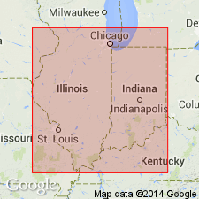
- Illinois basin
Summary:
Pg. 186-213. Mansfield sandstone and conglomerate. Coarse-grained massive variegated sandstone, with some conglomerate, lying at base of Coal Measures. Thickness few feet to more than 190 feet. In previous Indiana reports called Conglomerate, also Millstone grit. Overlain, unconformably in places, by coal-bearing shales and sandstones; unconformably underlain by Mississippian. Age is Pennsylvanian.
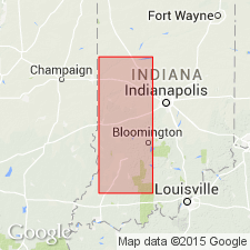
Named from Mansfield, Parke Co., southwestern IN.
[GNC remark (ca. 1938, US geologic names lexicon, USGS Bull. 896, p. 1288): For many years this name was applied to all Pottsville rocks of Indiana, Illinois, and western Kentucky, but that use of the name has now been discontinued, and in Indiana it is now applied to base few to 300+/- feet of Pottsville group, or to the beds beneath Brazil formation. Adopted by the USGS as Mansfield sandstone of Pottsville group.]
Source: US geologic names lexicon (USGS Bull. 896, p. 1288).

- Usage in publication:
-
- Mansfield group
- Modifications:
-
- Revised
- AAPG geologic province:
-
- Illinois basin
Summary:
Pg. 87 (fig. 1), 88-89. Mansfield group. Includes Ferdinand and Fulda limestones (both new).
Source: US geologic names lexicon (USGS Bull. 1200, p. 2362-2363).
- Usage in publication:
-
- Mansfield sandstone
- Modifications:
-
- Revised
- AAPG geologic province:
-
- Illinois basin
Summary:
Pg. 14 (fig. 4). Mansfield sandstone. Hindostan beds occur in lower part of Mansfield sandstone.
Source: US geologic names lexicon (USGS Bull. 1200, p. 2362-2363).
- Usage in publication:
-
- Mansfield formation
- Modifications:
-
- Areal extent
- AAPG geologic province:
-
- Illinois basin
Summary:
Pg. 6, pl. 2. Mansfield formation. Ranges from 250 to 300 feet in thickness, includes many rock types: cross-bedded and wavy-bedded, fine- to medium-grained sandstone, locally conglomeratic; gray, commonly silty shale that in many places carries ironstone concretions; thin discontinuous beds of coal and clay; and one thin bed of marine limestone and chert near top. Regional unconformity separates the Mississippian from the Pennsylvanian. Pre-Pennsylvanian erosion has removed progressively older Chester formations at increasing distances north of Ohio River. Because Mansfield directly overlies rocks of late Chester age near Ohio River in Perry County and rests directly on Ste. Genevieve limestone of late Meramec age in central Putnam County, base of Mansfield had descended through a stratigraphic interval of approximately 600 feet in distance of 125 miles. In southern part of area, Mansfield generally rests on Tar Springs formation; to the north, it is typically on Golconda formation; where it rests on a clastic formation in Chester Series, distinction between rocks of early Pennsylvanian and Chester age is difficult. Outcrop belt extends in northwesterly direction from Ohio River to Warren County; strata have regional westerly and southwesterly dip of approximately 25 to 30 feet per mile, and main Mainsfield outcrop lies immediately west of Chester outcrop belt. Age is Pennsylvanian (Pottsville).
Source: US geologic names lexicon (USGS Bull. 1200, p. 2362-2363).
- Usage in publication:
-
- Mansfield formation*
- Modifications:
-
- Revised
- AAPG geologic province:
-
- Illinois basin
Summary:
Mansfield formation. Designated formation since it is mappable unit containing large amounts of shale, thin beds of coal, underclay, and limestone and is only locally predominantly sandstone. Thickness about 60 feet. Underlies Brazil formation. Age is Pennsylvanian.
Source: US geologic names lexicon (USGS Bull. 1200, p. 2362-2363).
- Usage in publication:
-
- Mansfield formation
- Modifications:
-
- Revised
- AAPG geologic province:
-
- Illinois basin
Summary:
Pg. 22-29, pl. 1. Mansfield formation. Described in Huron area. As now defined, includes all rocks of Pennsylvanian age below Lower Block coal which forms base of overlying Brazil formation. Divisible into two parts designated as lower and upper. Boundary of lower and upper parts placed at top of Pinnick coal member (new) or at inferred equivalent horizon where coal is absent. Upper part, about 160 feet thick, includes Blue Creek coal member (new) about 100 feet above base. Lower part, 50 to 150 feet thick, includes Pinnick coal member at top and French Lick coal member (new) about 50 feet below top. Unconformably overlies Glen Dean limestone (restricted) of Stephensport group (redefined).
Source: US geologic names lexicon (USGS Bull. 1200, p. 2362-2363).

- Usage in publication:
-
- Mansfield Formation
- Modifications:
-
- Overview
- AAPG geologic province:
-
- Illinois basin
Summary:
Pg. 86-88, pls. Mansfield Formation, lower formation of Raccoon Creek Group. Follows definition of Cumings (1922, IN Logan, W.N., and others, Handbook of Indiana geol., Indiana Dept. Conserv. Pub., no. 21, pt. 4, p. 403-470). Includes all rocks between base of Pennsylvanian and base of Lower Block Coal Member; in ascending order: French Lick Coal Member, St. Meinrad Coal Member, Pinnick Coal Member, Blue Creek Coal Member, Mariah Hill Coal Member, Lead Creek Limestone Member, and Shady Lane Coal Member. Equivalent to: Caseyville Formation and lower part of Abbott Formation of Illinois; Caseyville Formation and lower part of Tradewater Formation of western Kentucky; part of what has commonly been called Pottsvillian Series (Appalachians); and Morrowan Series (Midcontinent). Underlies Brazil Formation of Raccoon Creek. Rests unconformably, with as much as 150 feet (46 m) of local relief, on Mississippian rocks. Age is Pennsylvanian (Morrowan and early Atokan). Report includes map of type sections-localities-areas, correlation chart.
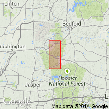
Indiana geologists consider type area to be along Raccoon Creek, in T. 14 N., R. 6 W., southern Parke Co., southwestern IN.
Source: Publication.
- Usage in publication:
-
- Mansfield Formation*
- Modifications:
-
- Overview
- AAPG geologic province:
-
- Illinois basin
Summary:
Used as Lower and Middle Pennsylvanian Mansfield Formation in report area.
Source: GNU records (USGS DDS-6; Reston GNULEX).
For more information, please contact Nancy Stamm, Geologic Names Committee Secretary.
Asterisk (*) indicates published by U.S. Geological Survey authors.
"No current usage" (†) implies that a name has been abandoned or has fallen into disuse. Former usage and, if known, replacement name given in parentheses ( ).
Slash (/) indicates name conflicts with nomenclatural guidelines (CSN, 1933; ACSN, 1961, 1970; NACSN, 1983, 2005, 2021). May be explained within brackets ([ ]).