The National Geologic Map Database is migrating to a new infrastructure. We apologize for any service disruptions during this process.
|
|---|


- Usage in publication:
-
- Manicaboa Formation*
- Modifications:
-
- Named
- Dominant lithology:
-
- Tuff
- Breccia
Summary:
Pg. 16 (table 1), 45-49, pl. 1. Manicaboa Formation. Consists of waterlaid clastic debris (tuff, lapillistone, breccia) of volcanic origin. Thickness approximately 2,140 meters in southwestern part of Ciales quadrangle. Conformably overlies Avispa Lava Member of Rio Orocovis Formation. Intertonguing relation between lower part of Manicaboa and upper part of Avispa indicated; possibility that tongue of volcanic breccia that seems to be a part of the Manicaboa may be lens within Avispa Member. Conformably underlies Minguillo Lava and Blacho Tuff Members of the Pozas Formation (all new); contact sharp at most places, locally unconformable. May be equivalent to the upper Cariblanco or lower Coamo Formations in central and south-central Puerto Rico, and to the Frailes, Tortugas, or Guaynabo formations in northeastern Puerto Rico. Age is Late Cretaceous. Stratigraphic relations to associated rocks suggest Campanian to Maestrichtian(?) age. Positive data for dating not available.
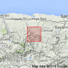
Named for exposures along Rio Toro Negro east and west of the mouth of Quebrada Manicaboa [GNU records (USGS DDS-6; Reston GNULEX) indicate this is type locality]. Restricted mainly to southwest quarter of Ciales quadrangle, north-central PR.
Source: US geologic names lexicon (USGS Bull. 1350, p. 465); supplemental information from GNU records (USGS DDS-6; Reston GNULEX).

- Usage in publication:
-
- Manicaboa Formation*
- Modifications:
-
- Overview
- AAPG geologic province:
-
- Caribbean region
Summary:
The Manicaboa Formation occurs in central Puerto Rico and consists of volcanic breccia and conglomerate interbedded with tuff. Maximum estimated thickness is 2200 meters. The Manicaboa is of Late(?) Cretaceous age.
Source: GNU records (USGS DDS-6; Reston GNULEX).
For more information, please contact Nancy Stamm, Geologic Names Committee Secretary.
Asterisk (*) indicates published by U.S. Geological Survey authors.
"No current usage" (†) implies that a name has been abandoned or has fallen into disuse. Former usage and, if known, replacement name given in parentheses ( ).
Slash (/) indicates name conflicts with nomenclatural guidelines (CSN, 1933; ACSN, 1961, 1970; NACSN, 1983, 2005, 2021). May be explained within brackets ([ ]).