The National Geologic Map Database is migrating to a new infrastructure. We apologize for any service disruptions during this process.
|
|---|


- Usage in publication:
-
- Malo Breccia*
- Modifications:
-
- Named
- Dominant lithology:
-
- Breccia
- Lava
- AAPG geologic province:
-
- Caribbean region
Summary:
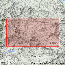
Malo Breccia, here named, consists of pyroclastic breccia blocks of buff, brown, or gray porphyritic lava with phenocrysts. Breccia is massive with individual lenses up to 200 m thick. Total thickness more than 1,300 m. Interfingers with the Robles Formation to the east and pinches out between the Robles and the overlying Cariblanco Formation in the Barranquitas quadrangle. Pinches out in Jayuya quadrangle to the west where it interfingers with the Vista Alegre and Tetuan Formations. Underlies Cotorra Tuff, possibly gradationally. Age is probably Late Cretaceous based on stratigraphic equivalence to marine facies of the Robles.
Source: GNU records (USGS DDS-6; Reston GNULEX).

- Usage in publication:
-
- Malo Breccia*
- Modifications:
-
- Overview
- AAPG geologic province:
-
- Caribbean region
Summary:
The Malo Breccia occurs in central Puerto Rico and consists of andesitic to basaltic-andesite tuff interbedded with hyaloclastite breccia and pillowed lava, volcanic sandstone, siltstone, and conglomerate. Maximum estimated thickness is 1300 meters. The Malo is of Late Cretaceous age.
Source: GNU records (USGS DDS-6; Reston GNULEX).
For more information, please contact Nancy Stamm, Geologic Names Committee Secretary.
Asterisk (*) indicates published by U.S. Geological Survey authors.
"No current usage" (†) implies that a name has been abandoned or has fallen into disuse. Former usage and, if known, replacement name given in parentheses ( ).
Slash (/) indicates name conflicts with nomenclatural guidelines (CSN, 1933; ACSN, 1961, 1970; NACSN, 1983, 2005, 2021). May be explained within brackets ([ ]).