The National Geologic Map Database is migrating to a new infrastructure. We apologize for any service disruptions during this process.
|
|---|


- Usage in publication:
-
- Mallow Member
- Modifications:
-
- Named
- Dominant lithology:
-
- Siltstone
- Shale
- Sandstone
- AAPG geologic province:
-
- Appalachian basin
Summary:
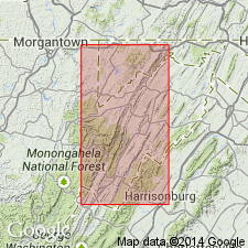
Mallow Member is here named for Mallow Knob, 1 mi north of Riverton and assigned as the basal unit of the newly named Foreknobs Formation (Greenland Gap Group). Unit is totally marine and consists of much olive gray-weathering siltstone, some shale, and much fairly massive sandstone in units several feet thick; some brownish-gray, probably brackish-water siltstones and sandstones; and a few quartz-pebble conglomerates and conglomeratic sandstones in thin beds. 864 ft (263 m) at type. Ranges from 741 ft (225 m) to 1100 ft (335 m). Underlies Briery Gap Sandstone Member (Foreknobs Formation) and overlies Scherr Formation (Greenland Gap Group). Age is Late Devonian. Unit is probably diachronous, becoming slightly younger to the southwest.
Source: GNU records (USGS DDS-6; Reston GNULEX).
- Usage in publication:
-
- Mallow Member
- Modifications:
-
- Areal extent
- AAPG geologic province:
-
- Appalachian basin
Summary:
In south-central PA, the Minnehaha Springs Member of the Scherr Formation and the Mallow, Briery Gap, Blizzard, Pound, and Red Lick Members of the Foreknobs Formation of the Greenland Gap Group are recognized. Mallow Member is composed of green and gray siltstone and shale with minor sandstone. Commonly contains AMBOCOELIA UMBONATA, DEVONOCHONETES SCITULIS, TYLOTHYRIS MESACOSTALIS, DOUVILLINA CAYUTA. Lower portion of Mallow contains fine-grained turbidites deposited in a low angle, slope apron environment. Upper portion is sandier, ripple-marked, and cross-bedded, which indicates deposition in shelf and delta front environment.
Source: GNU records (USGS DDS-6; Reston GNULEX).
- Usage in publication:
-
- Mallow Member
- Modifications:
-
- Areal extent
- AAPG geologic province:
-
- Appalachian basin
Summary:
The term Foreknobs Formation is not used in the stratigraphic cross section south of Gap Mills, WV. Arbitrary cutoffs are drawn where diagnostic characteristics are lost by facies change. The Mallow Member coarsens upward and also becomes finer grained toward the southwest. Cutoffs of the base of the Mallow Member are drawn between Alleghany and White Sulphur Springs. All sandstone in the Mallow, Briery Gap, Blizzard, and Pound Members is lost southwest of White Sulphur Springs resulting in an arbitrary cutoff of the base of the Foreknobs, which jumps up to the base of the Red Lick Member near Gap Mills. The Red Lick then loses all of its sandstone between Gap Mills and Bluefield.
Source: GNU records (USGS DDS-6; Reston GNULEX).
For more information, please contact Nancy Stamm, Geologic Names Committee Secretary.
Asterisk (*) indicates published by U.S. Geological Survey authors.
"No current usage" (†) implies that a name has been abandoned or has fallen into disuse. Former usage and, if known, replacement name given in parentheses ( ).
Slash (/) indicates name conflicts with nomenclatural guidelines (CSN, 1933; ACSN, 1961, 1970; NACSN, 1983, 2005, 2021). May be explained within brackets ([ ]).