The National Geologic Map Database is migrating to a new infrastructure. We apologize for any service disruptions during this process.
|
|---|


- Usage in publication:
-
- Makanaka drift
- Modifications:
-
- Named
- Dominant lithology:
-
- Andesite
- AAPG geologic province:
-
- Hawaii
Summary:
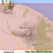
Named for cinder cone, Puu Makanaka, against which is conspicuous blocky moraine on Mauna Kea Volcano, Island of Hawaii, HI. Extends for mile or more on either side of Pohakuloa Gulch at 11,000 ft elev. Most blocks are fairly coarse-grained andesitic lava but unweathered light-gray to tan rock fragments are outstanding. Youngest of four stages of glaciation (youngest to oldest); Makanaka, Waihu, Pohakuloa, and pre-Pohakuloa. Unit tentatively correlated with Wisconsin stage in North America.
Source: GNU records (USGS DDS-6; Menlo GNULEX).
- Usage in publication:
-
- Makanaka drift*
- Modifications:
-
- Areal extent
- AAPG geologic province:
-
- Hawaii
Summary:
Only latest stage of glaciation on Mauna Kea, Island of Hawaii, (of Wentworth and Powers, 1941) can be accepted as definitely glacial drift. Forms a sloping bluff 50 ft thick along the rim of Pohakuloa Gulch. Characterized by large angular and subangular blocks of andesite with yellow or light-gray patina set in indurated light-gray matrix. Composite stratigraphic section also shows Makanaka "outwash".
Source: GNU records (USGS DDS-6; Menlo GNULEX).
- Usage in publication:
-
- Makanaka drift*
- Modifications:
-
- Overview
- AAPG geologic province:
-
- Hawaii
Summary:
Type locality: Puu Makanaka [19 deg 50'43"N, 155 deg 45' 54"W, Mauna Kea 7.5' quad] Island of Hawaii, HI. Covers area of about 19 sq mi in summit region. Composed of fresh light gray to tan ground, terminal, and lateral moraines. No fossils. Tentatively correlated with Wisconsin stage in North America and Wurm stage in Europe. Assigned Pleistocene age.
Source: GNU records (USGS DDS-6; Menlo GNULEX).
- Usage in publication:
-
- Makanaka Formation
- Modifications:
-
- Redescribed
- Revised
- AAPG geologic province:
-
- Hawaii
Summary:
Formerly Makanaka Drift of Wentworth and Powers (1941) now redefined as Makanaka Formation, second youngest formation of Laupahoehoe Group. Divided into a "lower member" (glacial and volcanic), Kemole Member (volcanic) and "upper member" (glacial). Overlies Hanaipoe Formation (new) of Laupahoehoe Group.
Source: GNU records (USGS DDS-6; Menlo GNULEX).
- Usage in publication:
-
- Makanaka Formation
- Modifications:
-
- Geochronologic dating
- AAPG geologic province:
-
- Hawaii
Summary:
Carbon-14 ages for Kemole Member of Makanaka Formation range from 37,200 +/-1400 to 22,150 +/-250 yr B.P. K-Ar age for the lower member is 54,900 +/-8500 yr B.P.
Source: GNU records (USGS DDS-6; Menlo GNULEX).
- Usage in publication:
-
- Makanaka Formation
- Modifications:
-
- Geochronologic dating
- Revised
- AAPG geologic province:
-
- Hawaii
Summary:
"Makanaka Drift of Wentworth and Powers [1941] is here renamed the 'Makanaka Formation'", one of three formations in Pahoehoe Group. Type locality at Puu Makanaka is retained. Reference localities are at upper Kemole Gulch and at head of Waikahalulu Gulch. Consists of an unweathered younger and slightly oxidized older drift. (The names, "lower", "Kemole" and "upper" members are abandoned. Is interstratified with the Waikahalulu Formation (Laupahoehoe Group]. Makanaka ice cap reached its greatest size 69,500 +/-2600 yr B.P. Glacier probably disappeared sometime before 9,080 +/-200 yr B.P.
Source: GNU records (USGS DDS-6; Menlo GNULEX).

- Usage in publication:
-
- Makanaka Glacier Member*
- Modifications:
-
- Revised
- AAPG geologic province:
-
- Hawaii
Summary:
Formerly Makanaka Formation of Laupahoehoe Group (Porter, 1974). Reduced in rank and renamed Makanaka Glacier Member of Laupahoehoe Volcanics. Reference localities in Waikahalulu and Kemole Gulches. Intercalated with Waikahulu lavas. Younger than Waihu Glacial Member. Age is Pleistocene.
Source: GNU records (USGS DDS-6; Menlo GNULEX).
- Usage in publication:
-
- Makanaka Glacial Member*
- Modifications:
-
- Overview
- AAPG geologic province:
-
- Hawaii
Summary:
Makanaka Glacial Member of Laupahoehoe Volcanics is shown on geologic map of Mauna Kea volcano. Described in two facies: (1) till, diamicton, massive, poorly consolidated; contains angular to subrounded cobbles and boulders up to 2 m or more in diameter; mostly dense, light- to medium-gray hawaiite-mugearite, and (2) outwash, unconsolidated gravel. Report includes detailed description, discussions of age, previous work, etc.
Source: GNU records (USGS DDS-6; Menlo GNULEX).
For more information, please contact Nancy Stamm, Geologic Names Committee Secretary.
Asterisk (*) indicates published by U.S. Geological Survey authors.
"No current usage" (†) implies that a name has been abandoned or has fallen into disuse. Former usage and, if known, replacement name given in parentheses ( ).
Slash (/) indicates name conflicts with nomenclatural guidelines (CSN, 1933; ACSN, 1961, 1970; NACSN, 1983, 2005, 2021). May be explained within brackets ([ ]).