The National Geologic Map Database is migrating to a new infrastructure. We apologize for any service disruptions during this process.
|
|---|


- Usage in publication:
-
- Maccrady formation*
- Modifications:
-
- Original reference
- Dominant lithology:
-
- Shale
- Limestone
- Sandstone
- AAPG geologic province:
-
- Appalachian basin
Summary:
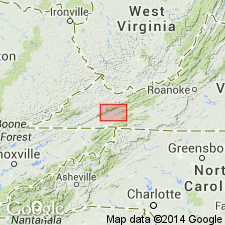
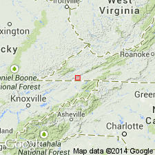
Pg. 233, 234. Maccrady formation. Underlies Newman limestone and overlies Price sandstone. Replaces "Pulaski shale," preoccupied. Thickness 1,025 feet. Consists of (descending): (1) earthy limestone and shale, abundantly fossiliferous, dark-gray, weathering lighter and crumbly, 470+/- feet; (2) gray sandstone, mostly calcareous and crumbly, and shaly argillaceous or earthy limestone, fossils at top, 240 feet; (3) soft rocks, including shaly limestone and probably earthy sandstone and red shale, 225 feet; (4) upper part red shale and shaly sandstone with some gray shaly sandstone; lower part light-buff shale with thin black carbonaceous shale and coal seamlets, 90 feet. Best section measured at Maccrady [Smyth County], southwestern Virginia, for which the formation is named. [Age is Early Mississippian (Osagean).]
Source: US geologic names lexicon (USGS Bull. 896, p. 1249).
- Usage in publication:
-
- Maccrady shale*
- Modifications:
-
- Revised
- AAPG geologic province:
-
- Appalachian basin
Summary:
Maccrady shale. It is doubtful if typical "Pulaski shale" includes any representative of limestone of Warsaw age, as does typical Maccrady. In author's opinion Maccrady should be restricted to the red beds of pre-Warsaw age, and the beds of Warsaw age should be called Warsaw limestone. [This restricted definition of Maccrady shale was adopted by the USGS in Dec. 1931. Age is Early Mississippian (Osage).]
Source: US geologic names lexicon (USGS Bull. 896, p. 1249).
- Usage in publication:
-
- Maccrady shale
- Modifications:
-
- Revised
- Redescribed
- Dominant lithology:
-
- Shale
- Sandstone
- Salt
- Gypsum
- AAPG geologic province:
-
- Appalachian basin
Summary:
Pg. 37-38. Maccrady shale. In his original definition Stose included in the Maccrady the overlying limestone of Warsaw age, here separated as a distinct formation. Maccrady shale as here restricted is a red shale or mudrock with less red argillaceous sandstone. Stose believes that the salt and gypsum at Saltville are in the Maccrady. In Greendale syncline the Maccrady is 50 to 60 feet thick, where its top is defined by overlying limestone of Warsaw age, and as much as 500 feet thick in Pulaski-Blacksburg region, where even with this thickness is not known to be all present, owing to overthrust faulting. [Age is Early Mississippian (Osagean).]
Source: US geologic names lexicon (USGS Bull. 896, p. 1249).
- Usage in publication:
-
- Maccrady series
- Modifications:
-
- Areal extent
- AAPG geologic province:
-
- Appalachian basin
Summary:
Pg. 280-282, measured sections. Maccrady series, comprising beds between Greenbrier series and Pocono series, is distinct and well-defined stratigraphic division in area of this report (Greenbrier County, western West Virginia). Consists of deep-red shale and weakly bedded sandstone. Thickest in southeast part of outcrop and thinnest in north and northwest. Estimated thickness 250 feet in Caldwell section; about 60 feet near Pocahontas County line. [Age is Mississippian.]
Source: US geologic names lexicon (USGS Bull. 1200, p. 2293-2294).
- Usage in publication:
-
- Maccrady shale
- Modifications:
-
- Revised
- AAPG geologic province:
-
- Appalachian basin
Summary:
Pg. 350-354. Maccrady shale was named ·by Stose (1913) from village of Maccrady, 2 miles northeast of Saltville. This shale was also named Pulaski by Campbell (1894). Name Pulaski was preoccupied and was abandoned. Main body of rocks included in Maccrady of Stose is of Warsaw age and cannot be included with the red shale (Maccrady restricted) at its base which is of Osage age and closely related to Price formation. Hence, Maccrady is restricted to red beds at base of Maccrady as defined by Stose. In section published by Stose, the lower bed, 90 feet thick, seems to be based on an exposure at Broadford and includes all red rock of the Maccrady (restricted) and perhaps some of upper Price. The Maccrady directly overlies the Price. In Greendale syncline, including type locality, and in Big Stone area, the overlying formation is of Warsaw age. Near Duffield, Scott County, the Maccrady is 40 feet thick and underlies St. Louis limestone. [Age is Early Mississippian (Osage).]
Source: US geologic names lexicon (USGS Bull. 1200, p. 2293-2294).
- Usage in publication:
-
- Maccrady Shale Member*
- Modifications:
-
- Revised
- AAPG geologic province:
-
- Appalachian basin
Summary:
The Maccrady is revised as a member of the Grainger Formation in east central KY. Consists of siltstone and claystone that in the upper part is grayish red with minor greenish-gray mottling and streaks; the grayish-red color decreases downward and the lower portion is entirely greenish-gray. On the stratigraphic column, the Maccrady Shale Member is combined with the Price Member and is 120 to 170 feet thick. The Maccrady overlies the Price Member of the Grainger Formation and underlies the Newman Limestone.
Source: GNU records (USGS DDS-6; Reston GNULEX).

- Usage in publication:
-
- Maccrady Shale
- Modifications:
-
- Areal extent
- AAPG geologic province:
-
- Appalachian basin
Summary:
In report area Maccrady Shale crops out from Cumberland Gap northeastward to Little Stone Gap where it curves around the nose of the Powell Valley anticline. Unit underlies most of the Appalachian Plateaus. Reaches a maximum thickness of 120 ft in the Harman quad, but is generally less than 100 ft thick. Consists of grayish-red to greenish-gray shale, siltstone, and interbedded thin- to medium-bedded, dark gray to greenish-gray, very fine grained sandstone. Gradationally overlies the Price Formation and disconformably underlies the Greenbrier Limestone. According to author this same formation was called the Pulaski shale by Campbell (1894) in Pulaski Co. Age is Late Mississippian (Meramecian).
Source: GNU records (USGS DDS-6; Reston GNULEX).
For more information, please contact Nancy Stamm, Geologic Names Committee Secretary.
Asterisk (*) indicates published by U.S. Geological Survey authors.
"No current usage" (†) implies that a name has been abandoned or has fallen into disuse. Former usage and, if known, replacement name given in parentheses ( ).
Slash (/) indicates name conflicts with nomenclatural guidelines (CSN, 1933; ACSN, 1961, 1970; NACSN, 1983, 2005, 2021). May be explained within brackets ([ ]).