- Usage in publication:
-
- Lytle Limestone [Member]
- Modifications:
-
- Areal extent
- AAPG geologic province:
-
- Permian basin
- Bend arch
Summary:
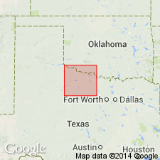
Area of report is north-central TX, approximately between the Brazos and Red Rivers; in this area the Choza, Vale, and Arroyo Formations of Clear Fork Group of the Colorado River Valley of TX are not distinguishable. [Author maps Clear Fork Group undivided, except for "Merkel Dolomite" and "Bullwagon Dolomite", some sandstone beds, and "Lytle Limestone". Listed in descending order: Merkel is topmost member of Choza Formation, Bullwagon is topmost member of Vale Formation, and Lytle is a middle member of Arroyo Formation, all of Clear Fork Group of the Colorado River Valley.] Lytle is described as: "gray to light brown, fine to medium grained, locally contains sparse malachite and azurite vugs, thin bedded, fossiliferous, intraclastic, locally burrowed at base; at northernmost outcrop, comprises single unit of ripple-marked, desiccation-cracked, argillaceous limestone interbedded with fossiliferous, calcareous sandstone; forms low bench; thickness 1 to 3 feet." It is mapped in Haskell Co, Permian basin, and Throckmorton Co, Bend arch. Is of Leonardian (Early Permian) age. Geologic map.
Source: GNU records (USGS DDS-6; Denver GNULEX).
For more information, please contact Nancy Stamm, Geologic Names Committee Secretary.
Asterisk (*) indicates published by U.S. Geological Survey authors.
"No current usage" (†) implies that a name has been abandoned or has fallen into disuse. Former usage and, if known, replacement name given in parentheses ( ).
Slash (/) indicates name conflicts with nomenclatural guidelines (CSN, 1933; ACSN, 1961, 1970; NACSN, 1983, 2005, 2021). May be explained within brackets ([ ]).

