The National Geologic Map Database is migrating to a new infrastructure. We apologize for any service disruptions during this process.
|
|---|


- Usage in publication:
-
- Lyre formation*
- Modifications:
-
- Named
- Biostratigraphic dating
- Dominant lithology:
-
- Conglomerate
- Sandstone
- AAPG geologic province:
-
- Olympic Mountains province
Summary:
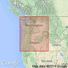
Named for exposure in Lyre River canyon, site of type section, Clallam Co, WA. Comprises [lower member] more than 500 ft thick (at type, 750 ft thick) consisting of firmly cemented, massive, medium- to coarse-grained conglomerate and [upper member] 4120 ft thick (at type, 1450 ft thick) composed of interstratified hard, gray to grayish-brown, coarse-grained, massive sandstone with pebbly conglomerate layers and subordinate thin-bedded sandy shale. Extends for more than 100 mi along northern border of Olympic Peninsula but thins toward Cape Flattery. Conformably overlies Boundary shale "which forms the uppermost portion of ..." Crescent formation (as shown on measured section and geologic sketch map). Conformably underlies Lincoln formation (as shown on geologic sketch map). Poorly preserved mollusks from upper part of unit suggests age is early Eocene.
Source: GNU records (USGS DDS-6; Menlo GNULEX).
- Usage in publication:
-
- Lyre formation*
- Modifications:
-
- Age modified
- Revised
- Areal extent
- AAPG geologic province:
-
- Olympic Mountains province
Summary:
Is restricted to lower member of Weaver's (1937) Lyre formation (750 ft of conglomerate and sandstone). Type locality redefined as extending along Lyre River from point 2850 ft south, 3600 ft west, NE corner sec.10 T30N R9W, to point 950 ft south, 3690 ft west of same corner. Mapped, as restricted, in two area: (1) belt that extends eastward from headwaters of West Twin River 22 mi to about a mi east of Elwha River and (2) smaller belt 2 mi long southeast of main belt. May extend tens of mi both eastward and westward of area studied. Is 1270 ft thick at type and is divided into 2 parts: upper conglomerate (890 ft thick) and lower sandstone (380 ft thick minimum). Unconformably underlies siltstone unit. Lower contact not exposed, but interbedded olive siltstone in lowermost exposures suggest transition into underlying unit. Reference section (5.5 mi west of type, 3.2 mi south of WA HWY 9A bridge, across East Twin River, to point 3.85 mi south of that bridge) is 3283 ft thick. Foraminifera from overlying and underlying units and stratigraphic position, indicate early late Eocene age.
Source: GNU records (USGS DDS-6; Menlo GNULEX).
For more information, please contact Nancy Stamm, Geologic Names Committee Secretary.
Asterisk (*) indicates published by U.S. Geological Survey authors.
"No current usage" (†) implies that a name has been abandoned or has fallen into disuse. Former usage and, if known, replacement name given in parentheses ( ).
Slash (/) indicates name conflicts with nomenclatural guidelines (CSN, 1933; ACSN, 1961, 1970; NACSN, 1983, 2005, 2021). May be explained within brackets ([ ]).