- Usage in publication:
-
- Lowellville limestone
- Modifications:
-
- Named
- Dominant lithology:
-
- Limestone
- AAPG geologic province:
-
- Appalachian basin
Summary:
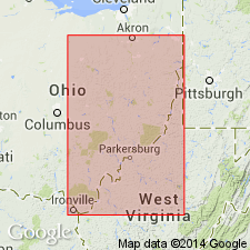
Lowellville limestone named. Lies just below horizon of Quakertown coal in Stark and Mahoning Cos., northeastern OH.
Source: GNU records (USGS DDS-6; Reston GNULEX).

- Usage in publication:
-
- Lowellville limestone
- Modifications:
-
- Overview
- AAPG geologic province:
-
- Appalachian basin
Summary:
Lowellville limestone is informal unit in Pottsville Group exposed along Grindstone Run south of Lowellville. Occurs between Quakertown and Sharon coals. Equivalent to Poverty Run limestone (Slucher and Rice, this volume).
Source: GNU records (USGS DDS-6; Reston GNULEX).
For more information, please contact Nancy Stamm, Geologic Names Committee Secretary.
Asterisk (*) indicates published by U.S. Geological Survey authors.
"No current usage" (†) implies that a name has been abandoned or has fallen into disuse. Former usage and, if known, replacement name given in parentheses ( ).
Slash (/) indicates name conflicts with nomenclatural guidelines (CSN, 1933; ACSN, 1961, 1970; NACSN, 1983, 2005, 2021). May be explained within brackets ([ ]).

