

- Usage in publication:
-
- Loudon [Loudoun] shales*
- Modifications:
-
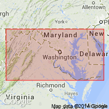
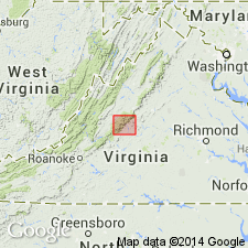
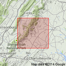
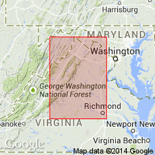
- Areal extent
- Dominant lithology:
-
- Shale
- AAPG geologic province:
-
- Piedmont-Blue Ridge province
Summary:
(As reported by G.H. Williams and W.B. Clark, in Maryland, its resources, industries, and institutions, chap. 3, p. 68. The formation was described, but not named, by Keith in Amer. Geol., v. 10, p. 365, 1892.) Loudon [Loudoun] shales. Gray and black slaty shales, 400 feet thick, underlying Weaverton [Weverton] sandstone. [Age is Early Cambrian.]
Source: US geologic names lexicon (USGS Bull. 896, p. 1222); supplemental information from GNU records (USGS DDS-6; Reston GNULEX).
- Usage in publication:
-
- Loudoun formation*
- Modifications:
-
- Principal reference
- Dominant lithology:
-
- Slate
- Shale
- Sandstone
- Conglomerate
- Marble
- AAPG geologic province:
-
- Piedmont-Blue Ridge province
Summary:
Loudoun formation. Argillaceous slate, sandy shale, gray sandstone, quartz conglomerate, blue limestone, and white marble, 0 to 800 feet thick. Underlies Weverton sandstone and unconformably overlies Catoctin schist (Algonkian). [Age is Early Cambrian.]
Named for fact all of its varieties are well developed in Loudoun Co., northern VA. [Extends in WV, MD, and southern PA.]
Source: US geologic names lexicon (USGS Bull. 896, p. 1222).
- Usage in publication:
-
- Loudoun formation*
- Modifications:
-
- Revised
- AAPG geologic province:
-
- Piedmont-Blue Ridge province
Summary:
The Loudoun formation occurs only in the western part of Frederick Co., MD where it crops out on the slopes and in places on top of Catoctin and South Mountains [a thorough description of the Loudoun's outcrop belts is included in this publication]. The formation is largely a soft arkosic quartzite with beds of purer harder quartzite, quartzose conglomerate (poorly sorted), and phyllite or slate. Some basal beds are red and green slate with scattered grains and pebbles of quartz and feldspar. On the west slope of Catoctin Mountain, the basal beds contain bluish-gray and green tuffaceous slate which is overlain by a thin quartzite and coarse arkosic quartzite. At Pine Knob on South Mountain the arkosic quartzite contains rounded pebbles of quartz and red jasper ranging from 2 to 4 inches in diameter. The upper beds of the Loudoun are a white to gray thin-bedded quartzite and purple banded arkosic quartzite, which shows current bedding in places. The top of the formation is placed below the first prominent bed of purer vitreous quartzite of the Weverton; the lower contact with Catoctin metabasalt is not exposed. Thickness on South Mountain is about 200 feet and on Catoctin Mountain it is about 310 feet thick [measured sections for each included in report]. It is possible that lower blue tuff may be part of Catoctin. Unit considered of Early Cambrian age.
Source: GNU records (USGS DDS-6; Reston GNULEX).
- Usage in publication:
-
- Loudoun formation
- Modifications:
-
- Revised
- AAPG geologic province:
-
- Piedmont-Blue Ridge province
Summary:
Suggests that the term Loudoun be restricted for sediments immediately above the greenstone [Catoctin] rocks in eastern Blue Ridge, but not be used in western Blue Ridge where it has historically been misused for sediments older than Catoctin greenstone, or confused with the Weverton above the Catoctin. Because the term Loudoun has been used for unit between the Catoctin and Weverton, the author uses term Loudoun-Weverton for sedimentary rock units between the Catoctin greenstone and the Harpers formation in the western Blue Ridge belt. The basal part of this unit contains conglomerate and other clastics with far more rhyolitic than true basaltic material, which suggests that the basal Loudoun-Weverton was derived from erosion of ground covered with rhyolitic flows rather than from land on which basaltic rock was exposed. The thickness of this combined unit is estimated to be 1000 to 1400 feet.
Source: GNU records (USGS DDS-6; Reston GNULEX).
- Usage in publication:
-
- Loudoun formation
- Modifications:
-
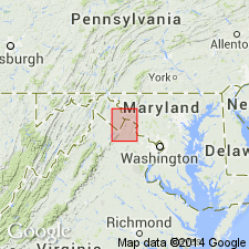
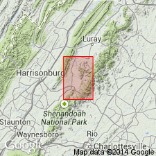
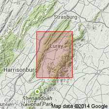
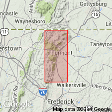
- Areal extent
- AAPG geologic province:
-
- Piedmont-Blue Ridge province
Summary:
The Unicoi formation of southwestern Virginia is approximately equivalent to the combined Loudoun and Weverton of northern Virginia. Author recognizes that the "type locality" discussed by Keith (1894) for the Loudoun near Aldie, VA is actually a unit beneath the Catoctin and is not at the stratigraphic interval that has been established for the Loudoun since then. It is proposed that the "type locality" be discarded and the Loudoun should be recognized in northern Virginia at its stratigraphic position above the Catoctin and below the Weverton. The rock unit at the "type locality" and stratigraphically below the Catoctin is the Lynchburg formation.
Source: GNU records (USGS DDS-6; Reston GNULEX).
- Usage in publication:
-
- Loudoun formation*
- Modifications:
-
- Areal extent
- AAPG geologic province:
-
- Piedmont-Blue Ridge province
Summary:
This report includes a paragraph stating that doubt exists as to whether the Loudoun formation is a valid unit. The original definition by Keith was ambiguous and was applied to beds in more than one stratigraphic position. Stose and Stose's (1946) definition of the Loudoun between the Catoctin and Weverton is also in question due to the fact that the interval they studied on the Potomac River is overturned and actually consists of post-Weverton beds (Harpers formation). These conclusions were made after the preparation of the Elkton report, therefore, the author describes the Loudoun formation. The unit lies between the underlying Catoctin and other Precambrian units and the overlying Lower Cambrian formations. This unit is not continuous in its strike belt. It is generally 100 ft thick but does rich 200 ft in places. The thinning and disappearance of the unit suggests that it was deposited irregularly on the unconformity surface at its base. The Loudoun consists of spotted purple or gray slates, probably representing altered volcanic tuffs, and lava flows in a few places. It is the lowest formation in the Chilhowee group and is considered of Early Cambrian age.
Source: GNU records (USGS DDS-6; Reston GNULEX).
- Usage in publication:
-
- Loudoun formation
- Modifications:
-
- Revised
- AAPG geologic province:
-
- Piedmont-Blue Ridge province
Summary:
Author believes that the original description of the Loudoun by Keith (1893, 1894) and the revised description by Stose and Stose (1946) are invalid because more than one stratigraphic horizon was incorporated, and structural complications on Catoctin Mountain were misinterpreted. The Loudoun is here revised to contain a basal phyllite member and an upper conglomerate member. The phyllite member is a pale-purple phyllite that occurs intermittently and is not well exposed; it is as much as 100 feet thick but thins and disappears in places. The phyllite has prominent cleavage and contains angular fragments of quartz and orthoclase in a groundmass of sericite and chlorite. The conglomerate is composed of rounded quartz, feldspar, and granitic pebbles 1/2 cm to 10 cm in size with a matrix similar to the phyllite. The contact between the two members is gradational. The conglomerate member is continuous on Catoctin Mountain where it is up to 100 feet thick, but thins southward where it disappears approximately 1 mile south of the Potomac River. Unconformably overlies the Catoctin formation and underlies the Weverton quartzite. Stratigraphic relationships to units above suggest that the Loudoun is of Early Cambrian age.
Source: GNU records (USGS DDS-6; Reston GNULEX).
- Usage in publication:
-
- Loudoun Formation
- Modifications:
-
- Revised
- AAPG geologic province:
-
- Piedmont-Blue Ridge province
Summary:
Revised Loudoun Formation to include upper part of the underlying Catoctin Formation and all of the overlying Weverton Quartzite. This increases the thickness to over 3200 feet. This unit in Albemarle Co., VA is equivalent to the Unicoi Formation of southwestern VA. The lower part of the Loudoun is 745 feet thick and consists of three Catoctin type lava flows separated by coarse arkosic quartzitic sandstones, with a 10 foot conglomerate at base and a 175 foot acid lava flow at top. The middle part of the unit is 1425 feet thick and consists of coarse and fine grained micaceous sandstones, shaly sandstones, glassy ferruginous sandstones, and several beds of siliceous hematite. The upper part is 1050 feet thick and consists of sandstones, shaly sandstones, sandy shales, and sericitic shale beds repeated many times overlying yellow and pink paper bedded shales. The stratigraphic table included in this report shows the Loudoun to range from 3220 to 7000 feet thick.
Source: GNU records (USGS DDS-6; Reston GNULEX).
- Usage in publication:
-
- Loudoun formation
- Modifications:
-
- Revised
- AAPG geologic province:
-
- Piedmont-Blue Ridge province
Summary:
Revised the Loudoun formation by only recognizing the purple and red slate and shale (phyllite); a conglomeratic unit immediately above is placed in the Weverton formation. The Loudoun consists of purple or reddish soft slate, containing many oval or round light-green spots. Cleavage is well developed. Small breccia fragments are common in bedding layers and light-gray to green, soft, sericitic slates and schists are intercalated with the purple, green-spotted slates. In Greene Co., VA the thickness of the Loudoun is less than 100 feet.
Source: GNU records (USGS DDS-6; Reston GNULEX).
- Usage in publication:
-
- Loudoun Formation
- Modifications:
-
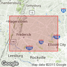
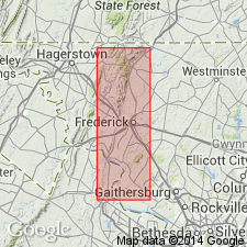
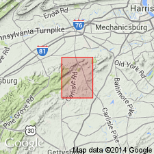
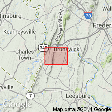
- Areal extent
- AAPG geologic province:
-
- Piedmont-Blue Ridge province
Summary:
Loudoun Formation in Page Co., VA is a purple or reddish soft slate or phyllite, containing many oval or round light-green spots. Light-gray to green, soft, sericitic slates and phyllites are intercalated with the purple, green-spotted slates. Cleavage is generally well developed and bedding is commonly evident on cleavage surfaces. Unit is approximately 100 feet thick but is not present in places. The Loudoun is exposed in a nearly continuous narrow belt lying between the Catoctin and Weverton Formations.
Source: GNU records (USGS DDS-6; Reston GNULEX).
- Usage in publication:
-
- Loudoun Formation
- Modifications:
-
- Areal extent
- AAPG geologic province:
-
- Piedmont-Blue Ridge province
Summary:
Muscovitic quartzite and muscovitic phyllite that lie on top of the volcanic rocks and underlie the Chilhowee Group or Lower Cambrian clastics are mapped as Loudoun Formation in Adams and Cumberland Cos., PA. Only the lower member [phyllite] is mapped as Loudoun; the upper member as designated by Stose is discontinuous and therefore not mappable, and is included as the base of the Weverton where it is present.
Source: GNU records (USGS DDS-6; Reston GNULEX).
- Usage in publication:
-
- Loudoun Formation
- Modifications:
-
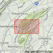
- Areal extent
- AAPG geologic province:
-
- Piedmont-Blue Ridge province
Summary:
Recognized two members of the Loudoun Formation on South Mountain, PA, a basal phyllite and an upper conglomerate. Phyllites are pale red purple to grayish red purple, medium gray, or grayish blue. The contact between the phyllite and the underlying Catoctin Formation is not exposed; it is drawn on the basis of the first occurrence of phyllite float above the highest observed volcanic fragments. The upper member is a polymictic conglomerate with rounded 1-2 inch pebbles of gray and pink quartz, dusky-blue to red-purple phyllite, and grayish-blue to purplish rhyolite. No basalt or granitic pebbles were recognized. The matrix is grayish-blue to light-greenish-gray graywacke exhibiting cleavage in which the phyllite fragments are elongated. Interbeds of quartz phyllite occur sporadically. The upper conglomerate member is lens-shaped and not always present. The contact with the overlying Weverton Quartzite is gradational over 50 feet with a decrease in coarseness, thickness, and frequency of conglomeratic beds. Where conglomerate is absent, contact is interbedded phyllite with Weverton lithologies. Basal phyllite is 150-250 feet thick and conglomerate is 0-200 feet thick.
Source: GNU records (USGS DDS-6; Reston GNULEX).
- Usage in publication:
-
- Loudoun Formation
- Modifications:
-
- Areal extent
- AAPG geologic province:
-
- Piedmont-Blue Ridge province
Summary:
Author believes that the long-standing misinterpretation of the Loudoun Formation makes it undesirable to continue its usage. He states that the last remaining portion of the "old Loudoun Formation" is exposed on the western Blue Ridge where it unconformably overlies the Precambrian complex and Blue Ridge [Catoctin] greenstone volcanic rocks.
Source: GNU records (USGS DDS-6; Reston GNULEX).
- Usage in publication:
-
- Loudoun Formation
- Modifications:
-
- Age modified
- AAPG geologic province:
-
- Piedmont-Blue Ridge province
Summary:
Recognizes two lithologic subdivisions within the Loudoun Formation on Catoctin Mountain, Maryland, a lower phyllite member and an upper conglomerate member. The two units are not readily distinguishable and were not separately mapped. The phyllite member is a discontinuous grayish blue, dusky blue, medium dark gray, and very dusky red purple phyllite that contains oval to elongate light colored blebs. The conglomerate member is a medium to thick bedded conglomerate with oval clasts of quartz, quartzite, and granite(?) up to 4 cm in diameter, plus elongated flattened fragments of dark colored phyllite (15-30 cm). The matrix is composed of light greenish-gray, grayish purple, medium to coarse-grained graywacke. The conglomerate beds are intercalated with cross-bedded, thin and medium-bedded, medium to coarse-grained pebbly graywacke and sometimes intercalated with thin, light to dark gray phyllite. The estimated maximum thickness of the unit is 95-125 feet. It unconformably overlies the Catoctin Formation and underlies the Weverton Quartzite. Age is considered Late Proterozoic.
Source: GNU records (USGS DDS-6; Reston GNULEX).
- Usage in publication:
-
- Loudoun Formation
- Modifications:
-
- Not used
- AAPG geologic province:
-
- Piedmont-Blue Ridge province
Summary:
Loudoun Formation is not used on this map. Author feels that the discontinuous nature and the lack of a lower contact for the Loudoun Formation makes the mapping of this unit suspect. The lithologies that are usually associated with the Loudoun Formation are included in the Catoctin Formation and Weverton Quartzite. The purple phyllite is considered the top of the Catoctin Formation and makes for a sharp contact with the overlying conglomerate which is included as the base of the Weverton Quartzite. Both of these lithologies are discontinuous on the Blue Ridge.
Source: GNU records (USGS DDS-6; Reston GNULEX).
- Usage in publication:
-
- Loudoun Formation*
- Modifications:
-
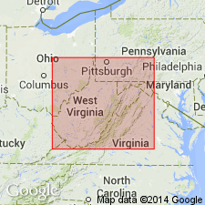
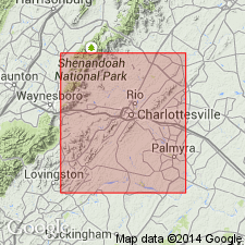
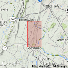
- Areal extent
- AAPG geologic province:
-
- Piedmont-Blue Ridge province
Summary:
Keith (1894) and Jonas and Stose (1938) recognized Loudoun Formation, but also incorrectly mapped some metasedimentary rocks in Catoctin, Fauquier, and Swift Run Formations as infolds of Loudoun Formation. Whittaker (1955) correctly mapped Loudoun between Catoctin Formation and Weverton Quartzite and found it pinching out south of Potomac River. Nunan (1979, unpub Ph.D dissert.) concluded that Loudoun was not a mappable unit and included the metasediments within basal Weverton. This report agree with Whittaker (1955); the Loudoun is mappable and does pinch out just south of Waterford-Point of Rocks quad boundary, about 3 km (2 mi) north of where Whittaker (1955) terminated it. Here locally considered base of Chilhowee Group. Best exposed on east-facing slope of Catoctin Mountain west of US Rte 15 and just south of Point of Rocks bridge. Loudoun is extremely variegated and consists of phyllite, phyllitic metaconglomerate, pebbly metasandstone, and minor vitreous quartzite. Cannot corroborate Whittaker's (1955) subdivision into upper conglomeratic member and lower phyllitic member. Age is Early Cambrian based on stratigraphic position and age of Chilhowee Group. Report includes geologic map, cross sections, and correlation chart.
Source: GNU records (USGS DDS-6; Reston GNULEX).
For more information, please contact Nancy Stamm, Geologic Names Committee Secretary.
Asterisk (*) indicates published by U.S. Geological Survey authors.
"No current usage" (†) implies that a name has been abandoned or has fallen into disuse. Former usage and, if known, replacement name given in parentheses ( ).
Slash (/) indicates name conflicts with nomenclatural guidelines (CSN, 1933; ACSN, 1961, 1970; NACSN, 1983, 2005, 2021). May be explained within brackets ([ ]).