- Usage in publication:
-
- Lost Canyon Member
- Modifications:
-
- Named
- Dominant lithology:
-
- Dolostone
- AAPG geologic province:
-
- Great Basin province
Summary:
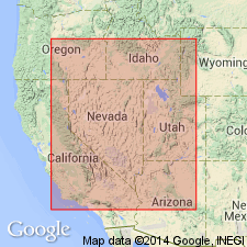
Named as member (third from base of four members) of Ely Springs Dolostone (redescribed). Type section is north of Lost Canyon [for which unit probably named] in Silver Island Mountains, NE1/4 of unsurveyed sec 30, T3N, R17W, northwestern Tooele Co, UT, Great Basin province. Additional exposures occur in southwestern UT at Barn Hills and at southern Egan Range, Delamar Mountains, Cherry Creek Range and Pancake Range in eastern NV. Consists of interbedded light-gray and dark-gray, microcrystalline to finely crystalline dolostone; thin to very thick bedded; laminated in part. Thickness at type is 217 ft; averages about 220 ft. Overlies Barn Hills Member (new) of Ely Springs; underlies Floride Member of Ely Springs. Measured sections. Fossil corals indicate a late Late Ordovician age.
Source: GNU records (USGS DDS-6; Denver GNULEX).
For more information, please contact Nancy Stamm, Geologic Names Committee Secretary.
Asterisk (*) indicates published by U.S. Geological Survey authors.
"No current usage" (†) implies that a name has been abandoned or has fallen into disuse. Former usage and, if known, replacement name given in parentheses ( ).
Slash (/) indicates name conflicts with nomenclatural guidelines (CSN, 1933; ACSN, 1961, 1970; NACSN, 1983, 2005, 2021). May be explained within brackets ([ ]).

