- Usage in publication:
-
- Lookout Mountain Conglomerate Member
- Modifications:
-
- Named
- Dominant lithology:
-
- Conglomerate
- AAPG geologic province:
-
- Green River basin
- Yellowstone province
Summary:
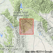
Named as an upper member of the Wasatch Formation. Is well exposed along south fork of Hoback River and at Lookout Mountain [source of name] in Sublette Co, WY in the Greater Green River basin. No type locality designated. Geologic map. Fence diagram. Mapped in discontinuous exposures from Cow Creek, Teton Co, WY in the Yellowstone province, south to the Hoback River. Consists of angular to poorly rounded sandstone and limestone clasts as much as 40 cm in diameter in a sandstone matrix. Clast sizes decrease eastward. Interbeds of sandstone become thicker and more abundant. Some siltstone interbeds. Is at least 600 m thick. Formerly assigned to Pass Peak, but new unit has different gross lithology and mineral composition than Pass Peak. In contact with Mesozoic rocks (mostly Jurassic) along east flank of Hoback Range. Shown as intertonguing with Pass Peak and with the older Chappo Member of Wasatch. Is not overlain by younger sediments. Fragmental mammal fossils. Probably deposited in earliest Eocene (Lysitean and possibly early Lostcabinian) time.
Source: GNU records (USGS DDS-6; Denver GNULEX).
For more information, please contact Nancy Stamm, Geologic Names Committee Secretary.
Asterisk (*) indicates published by U.S. Geological Survey authors.
"No current usage" (†) implies that a name has been abandoned or has fallen into disuse. Former usage and, if known, replacement name given in parentheses ( ).
Slash (/) indicates name conflicts with nomenclatural guidelines (CSN, 1933; ACSN, 1961, 1970; NACSN, 1983, 2005, 2021). May be explained within brackets ([ ]).

