- Usage in publication:
-
- Longfellow limestone*
- Modifications:
-
- Named
- Biostratigraphic dating
- Dominant lithology:
-
- Limestone
- Shale
- Sandstone
- AAPG geologic province:
-
- Basin-and-Range province
Summary:
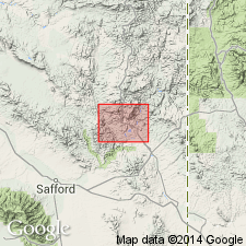
Named. Source of name and type locality not stated. Longfellow mine is north of Morenci, Greenlee Co, AZ, Basin-and-Range province. Consists of limestones usually more or less dolomitic, cherty, sandy, and shaly, and gradually growing more siliceous near their lower limit. Extensively developed in central part of geologic map. Best section 1/4 mi south of Madre Peak measured; composed at that locality of (ascending): sandy and shaly limestone; coarse gray sandstone; shaly limestone; buff-brownish-gray cherty limestone; quartzitic sandstone; and buff limestone--totals 380 ft thick. Two other sections measured. Petrologic analyses. Maximum thickness about 400 ft. Conformably overlies Coronado quartzite and overlain by Morenci shale (both new) in the Basin-and-Range province. Is of Ordovician age. Fossils (gastropods, trilobites) scarce.
Source: GNU records (USGS DDS-6; Denver GNULEX).

- Usage in publication:
-
- Longfellow limestone
- Modifications:
-
- Revised
- AAPG geologic province:
-
- Basin-and-Range province
Summary:
A fossil collection from uppermost 5 ft of the "Longfellow limestone" near Clifton, AZ in the Basin-and-Range province is clearly of either Middle or Upper Ordovician age. These beds at top of "Longfellow" are actually Upham dolomite of the Montoya group and quite distinct from the true Longfellow limestone.
Source: GNU records (USGS DDS-6; Denver GNULEX).

- Usage in publication:
-
- Longfellow limestone*
- Modifications:
-
- Areal extent
- AAPG geologic province:
-
- Pedregosa basin
- Basin-and-Range province
Summary:
Shown on generalized stratigraphic column for southern AZ as overlying Abrigo limestone and overlain by Martin limestone. In the Basin-and-Range province and Pedregosa basin [Although approved for the column by GNC there is probably no implication that such relations exist at any specific locality]. Is of Late Cambrian and Early Ordovician age.
Source: GNU records (USGS DDS-6; Denver GNULEX).

- Usage in publication:
-
- Longfellow Limestone*†
- Modifications:
-
- Abandoned
Summary:
A name that has been applied only near the Longfellow mine, Morenci district, Graham Co., AZ in the Basin-and-Range province. Rocks formerly assigned to Longfellow are part of a carbonate sequence assigned to the El Paso Limestone.
Source: GNU records (USGS DDS-6; Denver GNULEX).
For more information, please contact Nancy Stamm, Geologic Names Committee Secretary.
Asterisk (*) indicates published by U.S. Geological Survey authors.
"No current usage" (†) implies that a name has been abandoned or has fallen into disuse. Former usage and, if known, replacement name given in parentheses ( ).
Slash (/) indicates name conflicts with nomenclatural guidelines (CSN, 1933; ACSN, 1961, 1970; NACSN, 1983, 2005, 2021). May be explained within brackets ([ ]).

