

- Usage in publication:
-
- Long Canyon Sandstone Bed
- Modifications:
-
- Named
- Dominant lithology:
-
- Sandstone
- AAPG geologic province:
-
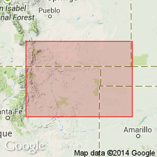
- Palo Duro basin
- Sierra Grande uplift
Summary:
Name applied to the basal sandstone of Glencairn Formation (rank raised; term Purgatoire Formation not used). Named for Long Canyon where type section designated and measured in SW1/4 SE1/4 SW1/4 sec 35, T32N, R29E, Union Co, NM on the Sierra Grande uplift. Disconformably overlies Lytle Sandstone, a pale-orange, very fine grained quartzose sandstone. Underlies upper part of Glencairn Formation. Upper contact of Long Canyon at type is with a gray, very fine grained, quartzose sandstone. Consists of 3 m of massive, bioturbated, yellowish-brown to dark-yellowish-orange, quartzose, medium- to coarse-grained sandstone. Has abundant casts of fossil shells. Has been correlated with Plainview Sandstone Member of South Platte Formation in north-central CO. Correlation chart. Other measured sections. Is 0.6 m thick at Travesser Park, sec 12, T31N, R32E, Union Co, and 2.7 m thick in sec 18, T5N, R2E, and 1.6 m thick in sec 20, T5N, R2E, Cimarron Co, OK in the Palo Duro basin. Same rocks were assigned as the basal sandstone of Glencairn Shale Member of Purgatoire Formation in earlier reports. Contains abundant TEXIGRYPHAEA shells. Age assignment of late Albian given to the entire Glencairn. Deposited along western shore of Cretaceous seaway.
Source: GNU records (USGS DDS-6; Denver GNULEX).
For more information, please contact Nancy Stamm, Geologic Names Committee Secretary.
Asterisk (*) indicates published by U.S. Geological Survey authors.
"No current usage" (†) implies that a name has been abandoned or has fallen into disuse. Former usage and, if known, replacement name given in parentheses ( ).
Slash (/) indicates name conflicts with nomenclatural guidelines (CSN, 1933; ACSN, 1961, 1970; NACSN, 1983, 2005, 2021). May be explained within brackets ([ ]).